Filter Your Results
- Sleeping Bear Dunes National Lakeshore (20)
- Golden Gate National Recreation Area (13)
- Arches National Park (11)
- Point Reyes National Seashore (9)
- Saguaro National Park (9)
- Big Bend National Park (8)
- Death Valley National Park (8)
- Capitol Reef National Park (7)
- Petrified Forest National Park (7)
- Show More ...
- National Heritage Areas Program (2)
- Commercial Services Program (1)
- Fire and Aviation Management (1)
- Geologic Resources Division (1)
- Historic Preservation Training Center (1)
- Inventory and Monitoring Division (1)
- National Center for Preservation Technology and Training (1)
- National Register of Historic Places Program (1)
- Northern Colorado Plateau Inventory & Monitoring Network (1)
- Show More ...
Showing 220 results for wash ...
George Washington Memorial Parkway
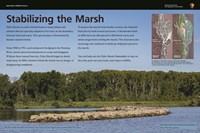
Information Panel: Stabilizing the Marsh
- Type: Place
Capitol Reef National Park
Waterpocket District
- Type: Place

The Waterpocket District of Capitol Reef is rugged and remote. Road conditions vary, a high clearance vehicle is usually needed. Check at the visitor center, or call 435-425-3791 for road conditions.
Capitol Reef National Park
Lesley Morrell Line Cabin
- Type: Place

The Lesley Morrell Line Cabin provides a glimpse into the ranching past of Capitol Reef National Park. Access requires a high clearance vehicle. Check road conditions and weather before attempting.
Bent's Old Fort National Historic Site
St. Vrain's Quarters
- Type: Place

This second level room can be accessed from the first-floor dining room or the plaza promenade on the second floor. The room was used by Bent, St. Vrain, & Company partner Ceran St. Vrain when he was present or otherwise used as a temporary guest quarters.
Manassas National Battlefield Park
Information Panel: The Tide Crests
- Type: Place

Robert Milroy's Union brigade occupied the washed-out bed of Sudley Road before you. Behind them, artillery occupied the crest of Henry Hill, in position to fire safely over the infantry.
Valley Forge National Historical Park
Knox Covered Bridge
- Type: Place

The Knox Covered Bridge is a scenic feature for many visitors to Valley Forge National Historical Park. The first covered bridge across Valley Creek was built in 1851; it was rebuilt in 1865 after being washed away in a flood. Measuring 10 feet wide and 65 feet long, the bridge connects Yellow Spring Road and Route 252. This picturesque bridge is owned and maintained by the Commonwealth of Pennsylvania Department of Transportation (PennDOT).
San Francisco Maritime National Historical Park
Kaiulani Logbooks Discovered
- Type: Article

The Kaiulani logbooks offer a glimpse into the daily lives of sailors on their voyage from Aberdeen, WA to Durban, South Africa to Hobart, Tasmania. The logbooks date from 1941-42, and this was the last American crew to sail around Cape Horn in a commercial square-rigged sailing vessel.
- Type: Person
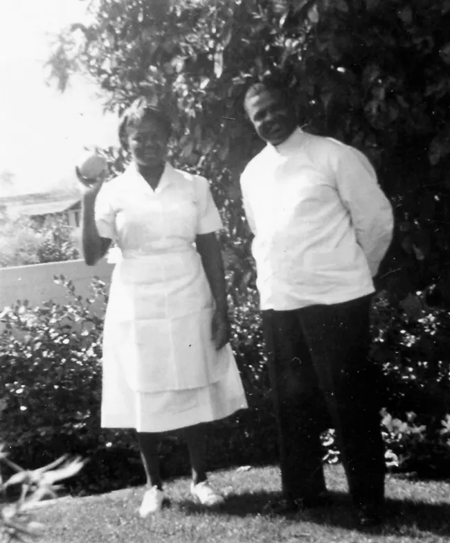
John and Delores Moaney played an indispensable role in the lives of Dwight and Mamie Eisenhower. Explore the story of how the Moaney family became intertwined with the Eisenhowers here.
Tule Springs Fossil Beds National Monument
Aliante Parkway Kiosk
- Type: Place

This interpretive kiosk is located at N. Aliante Pkwy & W. Moonlight Falls Ave. The kiosk describes the history of scientific research at Tule Springs, safety tips, park regulations, and a map of the monument. This area features relatively flat terrain, creosote desert scrub habitat, and views of the Las Vegas and Sheep ranges.
Fort Necessity National Battlefield
Mount Washington Tavern Interior
- Type: Place

Washington's Influence
Petrified Forest National Park
Rainbow Forest
- Type: Place

Petrified Forest National Park
Hamilili Point
- Type: Place

Badland, grassland, and mesa view from South No Name Point, the access point for the south unit of the Petrified Forest National Wilderness Area.
Sleeping Bear Dunes National Lakeshore
Old Indian Trail
- Type: Place

A beautiful loop trail that promises a quieter experience than most trails of Sleeping Bear Dunes, the Old Indian Trail follows a portion of a pathway early Indians established along the coastline and between sites and shorelines where they fished and camped. **Pets are NOT allowed on trail from December 1 to March 31**
Boston National Historical Park
Barbara Tuttle Green
- Type: Person

As a welder at the Charlestown Navy Yard, Barbara Tuttle Green worked under demanding conditions, facing health risks and physical exhaustion to support the war effort.
Arches National Park
Tower Arch Trail
- Type: Place

This trail climbs up a rock wall, cuts across a valley, and then meanders through sandstone fins and sand dunes. Reaching this trailhead requires driving 8 mi (14 km) on unpaved roads, which wash out quickly in rainstorms. Roundtrip Distance: 2.6 mi (4.2 km) Time: 2-3 hours Elevation Change: 290 ft (89 m)
Point Reyes National Seashore
Pierce Ranch Picnic Area
- Type: Place

Four picnic tables are located adjacent to the milking barn at the historic Pierce Ranch within Point Reyes National Seashore. The Pierce Ranch is approximately 35 minutes by car from the Bear Valley Visitor Center.
Death Valley National Park
Golden Canyon
- Type: Place

Death Valley's most popular short hike.
Mount Rainier National Park
Carbon River
- Type: Place
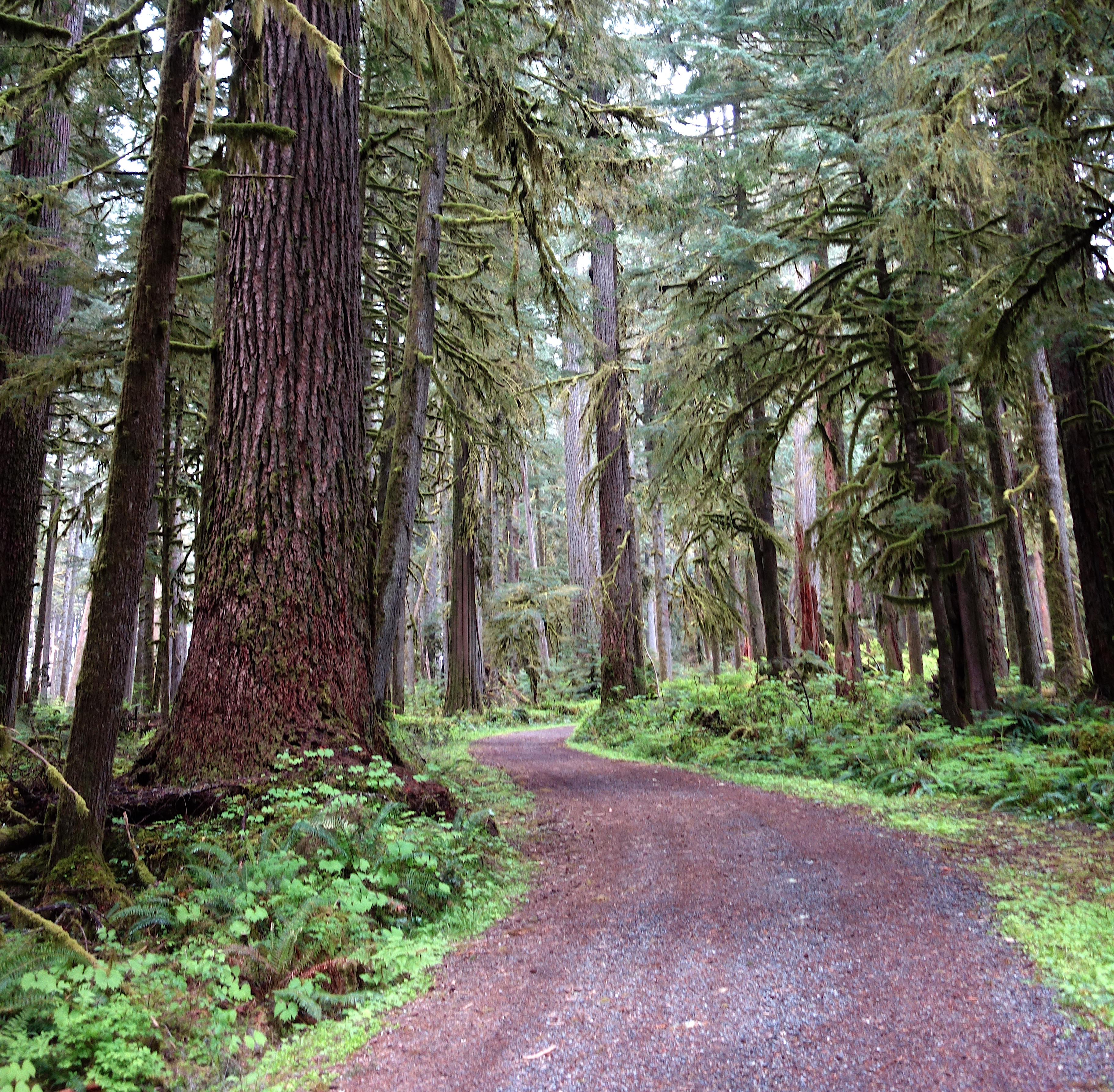
Located in the remote northwest corner of the park, Carbon River is home to temperate rainforest, Mount Rainier's lowest elevation glacier, and a dynamic river system. Hiking, bicycling, and camping opportunities abound.
Colorado National Monument
Devils Kitchen Trail (Colorado National Monument)
- Type: Place

Devils Kitchen Trail begins just inside the East (Grand Junction) Entrance. Less than a mile hike leads to a grotto of sandstone towers and boulders.
Death Valley National Park
Artists Palette
- Type: Place

This scenic vista offers a stunning glimpse into Death Valley’s colorful volcanic past.