Filter Your Results
- Santa Fe National Historic Trail (211)
- Yellowstone National Park (188)
- Lewis & Clark National Historic Trail (177)
- Santa Monica Mountains National Recreation Area (91)
- Mount Rainier National Park (84)
- Grand Canyon National Park (78)
- Golden Gate National Recreation Area (60)
- National Mall and Memorial Parks (54)
- Acadia National Park (52)
- Show More ...
- Harpers Ferry Center (39)
- Geologic Resources Division (35)
- National Trails Office - Regions 6, 7, 8 (19)
- Youth Programs (17)
- National Register of Historic Places Program (15)
- Inventory and Monitoring Division (14)
- San Francisco Bay Area Inventory & Monitoring Network (14)
- Wildland Fire Program (14)
- Archeology Program (13)
- Show More ...
Showing 3,337 results for Female ranger ...
Mammoth Cave National Park
The Church
- Type: Place

Church services once held in the cave led to the name for this cave room.
Grand Teton National Park
Jenny Lake Climbing Exhibit
- Type: Place

Summit the Teton mountain peaks at this climbing exhibit. Learn about women alpinists, touch multiple elevation benchmarks, and scope out the different peaks.
Grand Teton National Park
Jenny Lake Plaza
- Type: Place

Dive deeper into the history of Grand Teton National Park. Interpretive signs introduce topics like the Greater Yellowstone Ecosystem, grizzly bear research, geologic forces and features, glaciers, and the Hayden Survey. A large bronze tactile relief map will help orient you in relation to where you are in the park. Different peaks, canyons, lakes, falls, and other park features are labeled throughout the map.
Grand Teton National Park
Jenny Lake & Park Orientation
- Type: Place

Plan your Jenny Lake and park experience by reading these informational signs.
Grand Teton National Park
Jenny Lake Pathway Hub
- Type: Place

The Jenny Lake Pathway Hub is the most northern point of the multi-use pathway. Read our informational sign about biking and use the bike rack to store your bike while you explore the Jenny Lake area.
- Type: Article

Bill was inspired to help the NPS and learn something new along the way. He discovered that his family history coincides with the history of these parks.
- Type: Article

Volunteer Charles and maintenance team member Bud work together each week to keep the parks’ engines humming, to ensure the historic landscapes are beautiful and inviting to visitors, and habitats preserved for the animals that call its meadows and trees home.
- Type: Article

Interview with retired park ranger and volunteer Paul Plamann.
Denali National Park & Preserve
Inclusive Conservation in the Denali Region of Alaska: Scenario planning with local communities
- Type: Article

Public land management requires reflexive engagement, negotiation, and compromise among people who differ in how and why they value nature. The process of balancing visitor and resident interests while sustaining ecosystems is increasingly complicated by global environmental change and the range of relationships that people have with nature. This model of public engagement uses scenario planning throughout the decision-making process. Alaska Park Science, 2025
Boston African American National Historic Site
Edmund Jackson
- Type: Person
Boston merchant and abolitionist Edmund Jackson served on the 1850 Boston Vigilance Committee.
Bryce Canyon National Park
RV Dump Station
- Type: Place

This RV Dump Station is typically open spring - fall, closing for the season when overnight temperatures fall below freezing. The dump station is located at the south end of North Campground and can be used by any visitor for a $5 use fee. No use fee applies for those with a campground reservation in the park. Potable water is available.
Lowell National Historical Park
Patrick J Mogan Cultural Center
- Type: Place
Cedar Creek & Belle Grove National Historical Park
Signal Knob
- Type: Place
Rising 1,500 feet above the Valley floor and marking the northern end of Massanutten Mountain is Signal Knob.
Trail Of Tears National Historic Trail
Port Royal State Historic Park
- Type: Place

“...the people…are moving not from choice to an unknown region not desired by them.” Elijah Hicks wrote these words to Chief John Ross while camped at Port Royal, Tennessee in October 1838. Port Royal was the last place over 10,000 Cherokees slept in Tennessee before crossing into Kentucky. They were travelling along the Great Western Road, part of the Northern Route, which ran from Nashville, Tennessee to Missouri. Visitors can walk about a 1/4 mile of that historic roadbed.
Mary McLeod Bethune Council House National Historic Site
Unita Zelma Blackwell (1933-2019)
- Type: Person

Born to sharecroppers in the Mississippi Delta, Blackwell rose from humble beginnings to become one of many unsung Black female heroines of the modern Civil Rights Movement. Blackwell was an outspoken critic of racial and economic inequality and the first Black female mayor elected in the state of Mississippi. We honor her as an ancestor for reminding us of the power to change the circumstances we were born into.
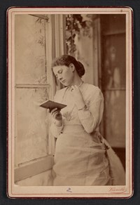
- Type: Person
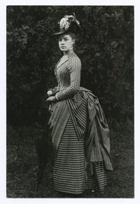
Alice Austen was a photographer who documented the lively activities of her female social circle at the turn of the century in New York City.
Grand Canyon National Park
South Kaibab Trail
- Type: Place

This well-maintained dirt trail offering wonderful expansive views. This is a great trail for short day hiking trips into the canyon of half a day or less. During winter months foot traction and hiking poles are advised when trail surfaces are icy. There is no public parking at the South Kaibab Trailhead. Please park at the Visitor Center, then take the Kaibab (Orange) Route shuttle bus to the trailhead. It is a 9-minute ride from the Visitor Center to the Trailhead.
Grand Canyon National Park
Bright Angel Trail
- Type: Place

Bright Angel Trail lets hikers walk in the footsteps of the canyon's Indigenous Peoples, miners, and early tourists, as they descend into the canyon's depths. Offering big views, morning and afternoon shade, resthouses, vault toilets, and water stations during the summer. The water is OFF at 1.5- and 3-mile resthouses. Portions of Bright Angel Trail are closed for waterline construction, Visit the link for a list of trail closures.
Grand Canyon National Park
Bright Angel Trailhead
- Type: Place
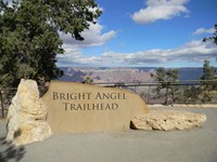
Bright Angel Trailhead is located just west of Bright Angel Lodge, Lookout Studio, and Kolb Studio. At 6,840 feet (2,085 m), it provides access for hikers and mules to many inner canyon destinations. From the Hermit Road Interchange shuttle bus stops, it is a short walk to the east, and up a hill, on a paved footpath to the trailhead. This winter, a number of trail closures (on parts of Bright Angel Trail) are in effect. Click on the link for details.
Saint-Gaudens National Historical Park
Maria Oakey Dewing
- Type: Person
When playwright Oscar Wilde asked, “Why don’t you go into decoration & wipe them all out?”, she responded by saying, “Because I must paint pictures or die”.