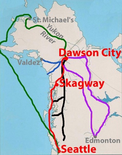
NPS image No gold was ever found in the Skagway Valley. The gold fields were located approximately 600 miles to the north, near the junction of the Klondike and Yukon Rivers at today's Dawson City. Skagway became internationally known solely as a gateway to the Klondike gold fields.
Promoters advertised many routes to the Klondike:
FORMATION OF GOLD
Gold forms inside of other rocks. Another way of saying this is that gold is hosted inside of other rocks. But what types of rocks usually host deposits of gold? And how does the gold get into these rocks? Nature is a mad scientist, and there is more than one answer to these questions.
Geologists have studied gold deposits for decades and know of different processes that form gold deposits. Klondike gold formed by one of these processes. The gold in the Klondike is known as orogenic gold. The word “orogenic” refers to a mountain-building event. Orogenic gold is gold that formed during a mountain-building event. Mountain-building events generate large amounts of heat and pressure, so oftentimes metamorphism will accompany this process. Years of geologic research have shown that orogenic gold is usually hosted in metamorphic rocks. This does not mean that all metamorphic rocks have orogenic gold, or that every mountain-building event leads to gold deposits. It just means that the orogenic gold that has been found was found in metamorphic rocks. But how does the gold get into the metamorphic rocks? During metamorphism, minerals get squeezed and heated to the point where they release really hot fluids. These fluids flow upwards through the crust towards the surface of the Earth. As they flow upwards, they dissolve other minerals that they pass by and carry those dissolved chemical elements with them. Gold is included in very small amounts in some minerals, so if the fluid dissolves a mineral with a little bit of gold, the fluid will also contain a little bit of gold. These fluids seek weaknesses in the rocks, such as faults, as a pathway to flow along. Eventually, the fluid will encounter different environmental conditions that cause it to deposit the gold and other elements it was carrying as a solid. Orogenic gold deposits often occur in veins, which are long and skinny sheets of gold and other minerals, such as quartz, within a rock. Sometimes veins will trace fault lines or other weaknesses because these are the easiest paths for the gold-bearing fluid to follow. 
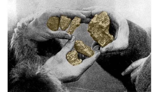
There are gold-rich veins beneath present-day Dawson City. Millions of years of uplift eventually exposed this gold to the surface where ice and rain could erode it. Millennia of weathering broke up the vein gold into smaller pieces: nuggets and flakes of gold dust known as placer gold. The placer gold washed into the streams and creeks that feed the Klondike River. Many times heavier than sand and dirt, the gold sank to the bottoms of the creek beds. It collected there until 1896 when the first nuggets of Klondike gold were found, leading to one of the world's great gold rushes.
There is still gold in the Dawson City area, but individual stampeders were replaced by large corporations that still mine the Klondike District for gold.
Geology, Glaciers, and Gold sections
Photographs and figures were provided by National Park Service rangers B. Aulick, P. Cooper, M. Hachtmann, S. Hinderman, and S.Millard; the National Archives, This Dynamic Earth by Jacqueline Kious and Robert Tilling, Earth's Interior and Plate Tectonics by Calvin and Rosanna Hamilton, the Alaska State Library Alaska Purchase Centennial Collection, Melanie Moreno and the United States Geological Survey. |
Last updated: July 21, 2025
