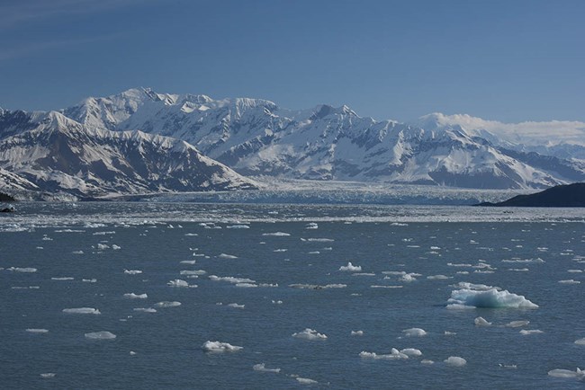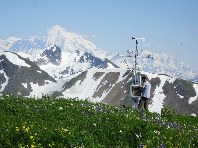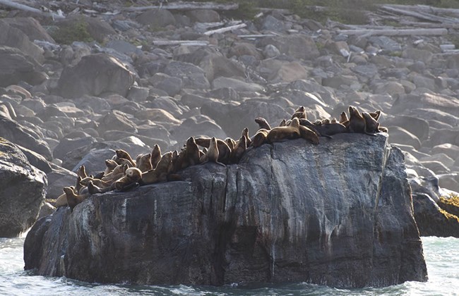

The remote outer coastal region of Wrangell-St. Elias National Park and Preserve and Glacier Bay National Park and Preserve in and adjacent to the eastern Gulf of Alaska spans over 500 km of shoreline, 12,100 square km of coastal lands, and 607 square km of marine jurisdiction, placing it among the most significant coastal areas under National Park Service jurisdiction.
Part of a UNESCO Biosphere Reserve and World Heritage Site, the region includes an impressive array of globally significant physical, geological, terrestrial, and marine resources, including some of North America’s largest tidewater glacier (Hubbard Glacier) and piedmont glacier (Malaspina Glacier), a major transboundary wilderness river (Alsek River), recently deglaciated fjords, and large seasonal aggregations of forage fish, seabirds, and marine mammals. Collectively, these features provide highly sought viewing opportunities for visitors as well as opportunities for subsistence, recreational, and commercial harvest of fish and wildlife. The region is considered one of the most pristine coastal and fjord areas of the world.
The relatively pristine Outer Coast is undergoing rapid change. Multiple stressors, including projected increases in air and ocean temperatures, increased rates of ocean acidification, changes in glacier mass balance and volume, isostatic rebound, and growth in vessel traffic and visitation have the potential to impact local ecosystems and landscape dynamics through both direct and indirect pathways. Given expected future changes to the region, establishment of an integrated multidisciplinary long-term monitoring program to better understand ecosystem processes and inform park management is essential.

The Outer Coast monitoring program expansion area is defined as inner continental shelf marine waters to ~19 km (10 NM) offshore plus associated coastal lands from the Copper River Delta to Point Carolus at the mouth of Glacier Bay in the eastern Gulf of Alaska (see map above). It encompasses nearshore coastal areas of Glacier Bay and Wrangell-St. Elias national parks and preserves, including the fjords and glaciers in and adjacent to Lituya, Yakutat, Disenchantment, and Icy Bays. The expansion area’s terrestrial scope is not strictly defined, but focuses on landscape components like rivers and glaciers that interact directly with coastal waters. Along the Outer Coast, many of the larger rivers (e.g., the Copper and Alsek Rivers) and glaciers (e.g., the Bering, Yahtse, Malaspina, Hubbard, and Grand Plateau) reach far inland and are only partially within NPS (or even United States) jurisdictional boundaries. These features and the lands that surround them are therefore pertinent to the monitoring program in a manner comparable to the importance of oceanographic conditions outside NPS boundaries.


Weather and Climate
A fundamental driver of ecosystem processes, climate is a critical component of the long-term monitoring pilot study. Observed air temperature, atmospheric moisture content, precipitation, and wind are shaped by local factors (e.g., orography and land cover) and global-scale climate patterns and teleconnections. The local climate directly impacts glaciers when warm temperatures melt ice or snowfall adds mass. Atmospheric conditions control marine conditions and hydrographic structure via surface wind stress as well as ocean-atmosphere heat and moisture fluxes. On land and in the ocean, climate influences the speed of chemical, physical, and biological activity.

Glacier Dynamics
One long-term monitoring component will examine whether continued warming will lead to continued mass loss in Alaska, where land-terminating glacier loss as a steady function of climatic trends is expected, but tidewater glacier dynamics reflect a more complex suite of processes. All glacier changes have direct and indirect impacts on regional hydrology, geomorphology, biogeochemical fluxes and cycling, biodiversity, aquatic and marine food webs, ecosystem services, and natural hazards. Among these many effects, glacier monitoring in the expansion area will focus on delivery of freshwater, icebergs, and nutrients to the marine environment.

Landform and Landcover
Climate-driven changes in temperature and precipitation affect landscape dynamics such as seasonal phenology, lake size, and slope movements (e.g., landslides). All are important drivers of small-to-regional scale terrestrial shifts and influence the ocean ecosystem through sediment and freshwater input. Large outburst flood events can drastically change lake conditions with implications for glaciers and nearby marine environments.

Oceanography
Oceanographic conditions, including current patterns and mixing, structure of salinity, temperature and stratification, sedimentation rates, and light penetration exhibit spatial and temporal structure and can mask or obscure causes of top-down and/or anthropogenic change in populations and community structure. Ocean acidification occurs when absorbed atmospheric CO2 lowers seawater pH. Saturation states of calcium carbonate minerals decrease, driving dissolution of the shells and skeletons of calcifying marine organisms and destruction of marine habitat (e.g., coral) and important benthic prey (e.g., crabs, mussels).

Pelagic Food Web
Nearshore Gulf of Alaska pelagic communities are comprised of phytoplankton, zooplankton, small forage fish, larger predatory fish, and a diverse array of marine birds and mammals. Diatoms and dinoflagellates make up the majority of phytoplankton biomass, serving as the food web base. Zooplankton production is tightly coupled to environmental parameters such as seawater chemistry and water column structure. Forage fish, benthic invertebrates, and larger predatory fish are also recognized as important to the regional marine food web, though little is known about their community structure, nutritional value, or spatially explicit abundance in the expansion area.

Environmental Contaminants
Organic and inorganic pollutants pose ecological and human health risks, potentially driving loss of habitat quality and biodiversity, biomagnification, and illness from consumption of contaminated subsistence resources. Southeast Alaska’s coastal ecosystems are continually exposed to long-distance non-point source threats, including airborne pollutants and drifting marine debris. Marine shorelines are susceptible to local emissions of combustion products that affect air quality, and catastrophic pollution events such as oil spills given the volume of regional vessel traffic.
Learn more about the Outer Coast
Last updated: October 19, 2022
