Mileage Chart
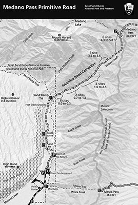
Set your odometer to zero at the southern entrance of the primitive road to follow along with this guide.
0.0 End of Paved Road: start of Medano Pass Primitive Road.
0.2 Garden Creek: flows until mid-summer
0.5 Buck Creek: intermittent stream
1.0 Sawmill Creek: flows until mid-summer.
1.1 Point of No Return: 4WD vehicles ONLY past this point. Sand Ramp Trail access.
1.4 Ponderosa Point Picnic Area: view of Mt. Herard (13,297’) and dunes.
1.8 Sand Pit: DEEP SAND! Reduce tire pressure to about 20 pounds if sand is soft
2.6 Castle Creek Picnic Area: picnic tables, vault toilet. Park only in designated areas.
3.3 Horse Canyon: views of eastern dunes and foothills.
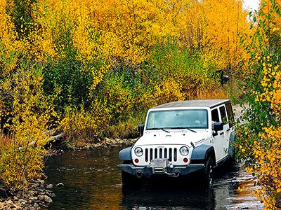
4.5 1st Crossing of Medano Creek: spring runoff can be very deep! Use caution.
4.6 Old Fire Road: closed to vehicles. 1/2 mile walk to ridge with good views.
5.0 Sand Ramp Trail: trail crosses road. Overnight backpacking permit required.
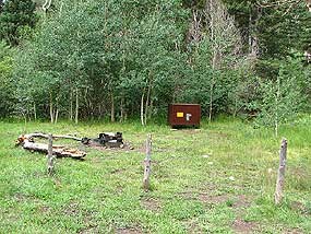
5.2 Park/Preserve Boundary: roadside campsites begin, numbered by mileage from
boundary. 8 campsites over next 0.3 mile.
5.6 2nd Crossing of Medano Creek
5.9 More Campsites: 2 campsites over next 0.5 mile.
6.1 3rd Crossing of Medano Creek: look for bighorn sheep in meadows and cliffs.
6.2 Herard family’s 1870s homestead site (only foundation remains).
6.4 4th Crossing of Medano Creek
6.8 5th crossing of Medano Creek: 4 campsites over next 0.9 mile.
6.9 Tight squeeze: narrow roadway, boulders on roadsides. Use caution!
7.2 6th crossing of Medano Creek
7.7 Crossing of a Tributary Creek
7.8 Two alternatives: left side usually best.
7.9 7th Crossing of Medano Creek: road steeper ahead.
8.4 More campsites: 1 campsite within next 0.3 mile.
8.6 Creek Crossing of a Tributary Creek.
8.8 Beaver Dams: long meadows, marsh, and beaver dams.
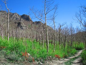
9.0 Three Cabins: burned in 2010 wildfire.
9.5 More Campsites: 6 campsites over next 1.5 miles.
9.6 8th Crossing of Medano Creek
10.6 Creek crossing of a Tributary Creek.
10.7 Medano Lake Trailhead: trailhead at end of short spur road.
11.0 Irrigation ditch: steep section ahead.
11.2 Medano Pass: elevation 10,040’ above sea level.


