Canyon Sketches Vol 18 - March 2010

NPS Archeology "Blitz Trip" Visits Archeological Sites along the Colorado River Corridor

by Allyson Mathis

 
Participants monitoring an archeology site on the blitz trip, February 2010.
Monitoring a site near the river.
In February 2010, archeologists from Grand Canyon National Park’s Division of Science and Resource Management and the Museum of Northern Arizona (MNA) visited 107 archeological sites in the Colorado River to assess their condition.

Monitoring archeological sites is necessary to determine if the sites have been impacted by erosion due to sediment depletion in the Colorado River system from the operation of Glen Canyon Dam and by visitation by river runners and hikers. Most of the sites were in good condition having only minor impacts from erosion and/or visitation. The crew also monitored sites that were excavated by MNA and the NPS in a joint project between 2007 and 2009, assessed erosion control features such as check dams at sites that have been impacted by significant erosion, and improved documentation of a number of sites.
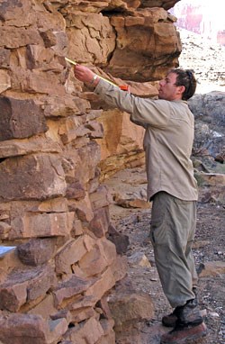
 
measuring Beamer's cabin wall.
Monitoring Beamer's Cabin.
The National Park Service has monitored archeological sites along the Colorado River corridor since the early 1970s, and more intensely following the 1990 comprehensive survey of archeological sites exposed at the surface in the river corridor.

Since the implementation of the Colorado River Management Plan (CRMP) in 2006, many of the 600 sites in the CRMP project area have been visited by park archeologists during the integrated resource monitoring trips.

The purpose of the “archeology blitz” monitoring trip in February was to allow crews to focus on archeological site assessments and to complete some more intensive projects than CRMP monitoring protocols allow. For example, crews were able to examine a number of archeological sites in side canyons that may have an increase in recreational use during the winter months with more winter launches under the CRMP.
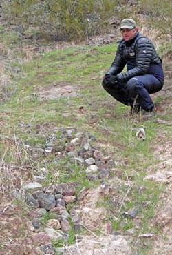
 
Examining a check dam built in the 1990's.
Examining a check dam from the 1990's.
Approximately 30 of the sites visited during the archeology trip have been significantly impacted by erosion.

The National Park Service and the Zuni Conservation Team built rock and brush check dams to control erosion at these sites in the 1990s. Check dams limit erosion by reducing water velocity in washes and arroyos and trapping sediment. River corridor archeologist Jen Dierker explained, “Regular maintenance of check dams is an integral part of erosion control work at archeological sites along the Colorado River. Watch check dam video clip.

On the trip, we were joined by Utah State University geomorphologist Christopher Tressler. Almost all the check dams we evaluated were in good shape. We had to repair only three check dams and construct one new one. It seems like check dams are the most appropriate erosion control method for use along the river, and that other more aggressive methods don’t work as well in this environment.”
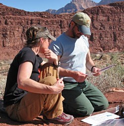
 
2 archeologists working at the Unkar Delta Site.
Collecting data at Unkar Delta.
The crew spent two full days at Unkar Delta, the largest complex of archeological sites along the Colorado River, documenting the sites using current protocols and collecting GIS data to improve geographic information. These tools will aid park archeologists in managing visitor use of the area and protecting the resources.

Unkar Delta was a thriving ancestral Puebloan farming community between 800 and 1000 years ago. Some sites at Unkar Delta were excavated in the late 1960s by the School of American Research. Today, visiting Unkar Delta is a highlight for many river trip passengers as they travel through Grand Canyon. River runners can view the foundations of many structures and see artifacts such as pot sherds at the site.
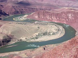
 
Colorado River bowing around the Unkar Delta.
View upriver of the Unkar Delta
Dierker said, “Our work at Unkar Delta was an amazing accomplishment. We designated 22 separate site areas at Unkar Delta that will enable us to effectively manage visitation and erosional impacts in the area. It was very difficult for the park’s Cultural Resource Program to manage Unkar Delta as a single site. These site designations will allow us to specifically manage each one given their visitation level and other impacts. The park’s CRMP program will be doing extensive work at Unkar Delta over the next few years, improving the interpretive trail, and mitigating impacts at archeological sites.”
 
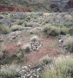
doughnut-shaped roasting pit.
A doughnut-shaped roasting pit

Another accomplishment during the trip was locating two archeological sites in Surprise Valley that had only been documented by helicopter survey in the 1960s. Dierker said, “The only documentation we had of these sites were photographs taken from a helicopter hovering above them and a short description of each one.
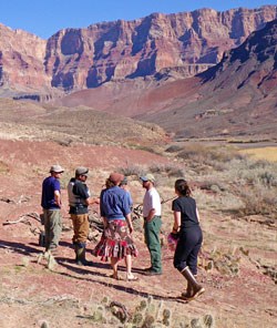
Both sites are large ‘donut-shaped’ roasting pits that were used to cook plant and animal foods. This type of site would be easy to identify from the air as the donut-shaped ring of stone around the earthen oven would be very visible from above. We had to cover a lot of ground to find these sites, and it was great to be able to locate them again and document them according to current standards for archeological sites in the park.”

 
group touring a backfilled area.
Touring a backfilled site.

As a follow up to the excavation of nine archeological sites by MNA and the NPS between 2007 and 2009, the crew visited the sites to assess the effectiveness of stabilization measures taken at the conclusion of each dig.
Each site was backfilled with dirt that had been excavated to protect them from the elements and further erosion, and planted with native vegetation. All but one site appeared very stable with annual vegetation re-establishing itself, meaning that the post-excavation stabilization measures have been successful to date.

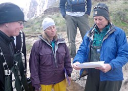
The archeology blitz river trip allowed Grand Canyon’s cultural resource managers a unique opportunity to complete more comprehensive projects such as the site documentation at Unkar Delta. Dierker said, “We got a great deal of work accomplished on this trip. It was also a rare opportunity for the entire Grand Canyon archeology staff to work together–usually we are working on separate projects. Bringing the entire crew together and working with MNA archeologists allowed us to complete critical monitoring and assessment work in the river corridor that we would not have otherwise been able to accomplish.”

 
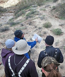
Crew looking at a sitemap.

Jane Rodgers, Deputy Chief, Socio-Cultural Resources, added, “I am really proud of our staff’s capability and creativity to bring together partnership trips such as this. We brought together specialists in both archeology and river running to carry out the blitz.

"The end result was a great trip where stewardship, science and resource management coalesced. Trips like these are invaluable for us in preserving the cultural heritage of the canyon and sharing the information with the public.”


Last updated: February 24, 2015

Park footer

Contact Info

Mailing Address:

PO Box 129
Grand Canyon, AZ 86023

Phone:

928-638-7779

Contact Us