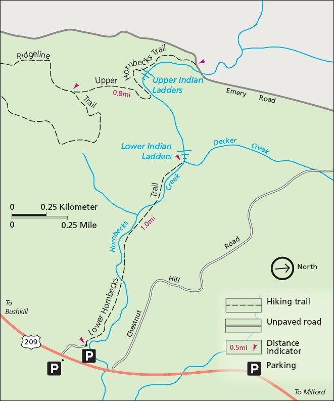
Length: 1 mile, one-way One of the hidden treasures of Delaware Water Gap National Recreation Area is undoubtedly the Hornbecks Creek Trail, known to some locals as Indian Ladders. The trail follows an old roadbed that meanders along Hornbecks Creek to a lovely waterfall. While the waterfall is a relatively short drop, the symmetrical cliffs and round plunge pool provide a beautiful frame for the falls. The trail used to continue to a second waterfall. However, the trail was precariously set along a steep hill and numerous storms over the last couple of years have caused the hillside to slough, making the trail dangerous. Because recent stabilization attempts did not have a lasting effect, the section of trail between the two waterfalls is closed. The second waterfall may be accessed from the Upper Hornbecks Creek Trail at the Pocono Environmental Education Center.

NPS Map |
Last updated: March 28, 2022
