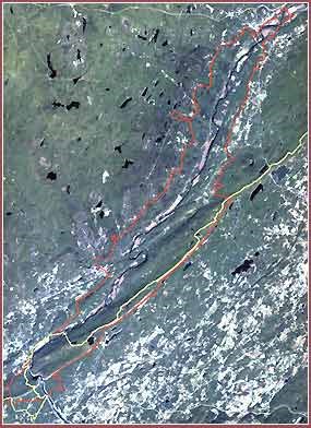
NPS Photo Over 70,000 acres of floodplains, hardwood forest, and mountain ridges on both sides of the Delaware River in the states of New Jersey and Pennsylvania make up the Delaware Water Gap National Recreation Area. Ecosystems include hemlock ravines with massive rhodendrons, ridgetops with native prickly pear cactus, and bountiful blueberry patches that are a favorite food of the local wildlife. Among the more abundant species of animals in the park are black bears, timber rattlesnakes, and bald eagles. While not abundant, we even have endangered peregrine falcons. Boasting numerous trout streams, lakes, ponds, and some of the highest waterfalls, the park offers some of the most beautiful views found in either state. Over 20 miles of Appalachian Trail and 40 miles of the Middle Delaware National Scenic and Recreational River rest in the recreation area. The Delaware River provides water to millions of families along the east coast, including in New York and Philadelphia. The river's path through the mountains includes the S-curve of Walpack Bend and, the namesake of the recreation area, the Delaware Water Gap. Resource Monitoring in the ParkERM Inventory & Monitoring Network |
Last updated: December 16, 2022
