
NPS photo The NeustonThe largest and most equipped of the two vessels used for research on Crater Lake is the Neuston. This boat is all-weather capable, and can withstand 5-foot waves that are common on the lake.The Neuston is housed in the Wizard Island boathouse over winter.

NPS photo The OuzelThe Ouzel is a 19 foot, aluminum SAFE boat, circa 1997 with a rigid foam collar for extra floatation. It has a 175 h.p. outboard engine, manual boom arm and winch for water sampling. The Ouzel is most often used for research nearshore.
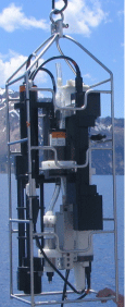
NPS Conductivity-temperature-depth profiler (CTD)The CTD measures water temperature, depth, salinity, particle density, and chlorophyll concentration. It is deployed from the research boat Neuston to the lake bottom at 580 meters. This profiler takes readings twice per second during its desent, then stores the data which is downloaded afterwards on the boat. Ice-Tethered Profiler (ITP)Weather conditions make it extremely difficult to access the lake in fall, winter, and spring. In July 2013, year-round monitoring of the water column began using an Ice-Tethered Profiler (ITP), initially designed for studying ocean conditions under the floating Arctic ice-pack. In Crater Lake, the instrument crawls up and down a wire mooring once a day. It is anchored to the bottom of the lake and kept upright with floats near the surface. The ITP collects daily data which is retrieved once a year in summer, on chlorophyll concentration, particle density (i.e., water clarity), dissolved oxygen, dissolved organic matter, temperature, and salinity.
NPS Secchi DiskThe Secchi disk has been used to measure water clarity in lakes and oceans around the world since the 1860’s. The depth at which the 8 in (20 cm) disk disappears is known as the Secchi disk depth. At Crater Lake, this depth is calculated as the average of three descending depths where the observer loses site of the disk as it is lowered into the water and three ascending depths, where the observer regains site of the disk as it is raised. Measurements are only taken between 10 AM and 2 PM, and only when the lake surface is calm. There can be high year-to-year variability, but Secchi clarity has not declined. If anything, readings have become slightly deeper in depth. Crater Lake is known to be one of the clearest lakes in the world with an average Secchi disk reading of 102 ft (31 m) and a record depth reading of 143 ft (44 m). 
NPS Weather BuoyAn automated weather station is attached to a buoy near the deepest part of Crater Lake. It reports hourly data to a publicly available website operated by the University of Utah - Department of Atmospheric Sciences. The data obtained from this weather station assists the park in understanding climate change, the effects of air and water temperature on lake currents, and other significant lake developments. The following data is collected: air temperature
dew point wet bulb temperature relative humidity wind speed wind gusts water temperature - The sensor for tracking surface water temperature is located approximately 3 ft (1m) under the buoy. 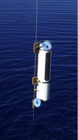
NPS Van DornVan Dorn water samplers are attached to a cable that is lowered into the lake. By the time the cable reaches the bottom of the lake there are 11 Van Dorn samplers on the line at different depths. A weight is dropped at the top of the cable, which then travels down the line and trips, and closes, the ends of each Van Dorn sampler. The cable is then pulled back into the boat and the water in the Van Dorn bottles is collected for water quality testing. Click here to watch a video and see photos of the process. 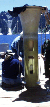
NPS Other devices and equipment that have assisted with past research include:Although nearshore oxygen sensors were installed to measure the productivity of floating algae (phytoplankton), In 2020 it becvame evident that the nearshore sensors primarily record the growth of algae growing on the rocky shoreline. |
Last updated: July 30, 2023