|
Fort Christiansvaern at Christiansted National Historic Site serves as the point of information for the three national park units on St. Croix, including Buck Island. Visit the fee booth at the fort for brochures and guides.
To Christiansted National Historic Site from Henry E. Rohlsen Airport: Drive east on Route 64 to Melvin Edwards Highway (Route 66). Turn right and continue for 4.8 miles (7.2 kilometers). Continue straight onto Old Centerline Road (Queen Mary Highway), and continue straight onto the Christiansted Bypass 3.7 miles (5.9 km). Turn left onto Hospital Street. The parking lot for Christiansted National Historic Site will be on your right.
Buck Island Reef National Monument is accessible only by vessel, either private or concessionaire. It is a 5.5 mile (8.8 km) sail from Christiansted on St. Croix. Concession boats are available at Christiansted Wharf or Green Cay Marina.
Private vessels must obtain an anchoring permit from the National Park Service headquarters in Christiansted or by emailing CHRI_Permits@nps.gov prior to anchoring at West Beach or in the lagoon in order to moor at the Underwater Trail or Scuba locations. Currently, our concessionaires are: Big Beard's Adventure Tours 44A Queen Cross St. 340.773.4482 www.BigBeards.com info@bigbeards.com Caribbean Sea Adventures 59 King's Wharf 340.773.2628 www.caribbeanseaadventures.com info@caribbeanseaadventures.com Jolly Roger Charters Christiansted Harbor 340.513.2508 http://www.jollyrogervi.com/ captainmike90@hotmail.com Llewellyn's Charters St. Croix Yacht Club 340.773.9027 llewellynwesterman.com kmcottonvalley@hotmail.com Teroro II, Inc. and Dragonfly Green Cay Marina 340.718.3161 http://www.gotostcroix.com/buck-island/heinz/ teroro@msn.com
Average high temperatures range between 84°Fahrenheit (F) and 89°F, and lows between 73°F and 80°F (23°C to 27°C). Low temperatures in the winter rarely dip below 73°F (23°C). Between April and June there is typically little rainfall. Hurricane season is officially June 1 through November 30, with peak months for storms between August and October.
The strong Easterlies can sometimes bring clouds of African dust from the Sahara; millions of tons of dust can be transported each year, affecting air quality, and potentially affecting marine life, including coral reefs. Click here for the current weather conditions on St. Croix from the National Weather Service.
There is no entrance fee to Buck Island.
There is no visitor center on Buck Island, and no visitor services on the island. Fort Christiansvaern at Christiansted National Historic Site serves as the point of information for the three national park units on St. Croix. Visit the fee booth at the fort for brochures, pamphlets, and guides. And be sure to check out our exhibits.

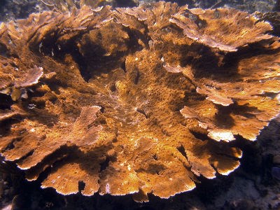
NPS photo Welcome to Buck Island!Located 1½ miles from the island of St. Croix, Buck Island Reef National Monument includes over 19,00 acres of both submerged and dry lands. On land, trails will take you through our tropical dry forests, manchineel beach forest, pristine sand beaches, and rocky shores. In 2001, our park was made the first Marine Protected Area, providing protection for all park resources from the island's highest peak to 5,000 feet below the water. Our beaches are home to several endangered and threatened species, such as hawksbill, green, leatherback, and loggerhead sea turtles, and the St. Croix Ground Lizard. Every summer, least terns arrive to nest, followed by pelicans in the fall. Elkhorn coral, the first listed marine invertebrate, surrounds two-thirds of the island. Elkhorn coral patch reefs rise up nearly 40 feet to the surface. Prehistoric peoples canoed from the "mainland" of St. Croix and camped on the beach, where they fished and gathered sea turtle eggs, bird eggs, and conch. In the 1700s and 1800s, the Danish government established a signal station on the island’s highest peak, at 328 feet (100 meters). A signal keeper, his family, and enslaved workers lived nearby. |
Last updated: May 10, 2022
