")
NPS photo
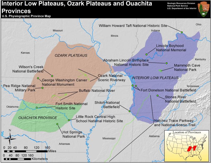
The Interior Low Plateaus exist at the southeastern extent of the Central Lowlands, the boundary occurring where the maximum extent of Pleistocene glaciers reached. The Interior Low Plateaus are almost completely horizontal beds of Paleozoic sandstone, shale, and limestone. The entire province is divided northeast-southwest by a fold axis known as the Cincinnati Arch. The area is also home to two structural domes that have been eroded to form basins lined with inward-facing cuestas.
The limestone of the province is marked by well-developed karst topography, including Mammoth Cave National Park. Mapping of Mammoth Cave is ongoing, but currently 480 km (300 mi) of caverns are mapped, making it the longest on earth. The caves are well decorated including remarkable gypsum crystals and travertines, and include great rooms and a large underground river.
The Interior Low Plateaus are home to widespread but small-scale coal, petroleum, and natural gas mineral resources. In addition, fluorite (used in steel production) and phosphate are mined extensively in the region.
Educational Resources
Mammoth Cave Curriculum Materials
- Mammoth Cave National Park's complete Environmental Education Curriculum Guides area availalble online. Grades K-12.
Interior Low Plateaus Parks
- Abraham Lincoln Birthplace National Historical Park, Kentucky—[Geodiversity Atlas] [Park Home]
- Fort Donelson National Battlefield, Tennessee—[Geodiversity Atlas] [Park Home]
- Lincoln Boyhood National Memorial, Indiana—[Geodiversity Atlas] [Park Home]
- Mammoth Cave National Park, Kentucky—[Geodiversity Atlas] [Park Home]
- Natchez Trace Parkway, Alabama, Mississippi, & Tennessee—[Geodiversity Atlas] [Park Home]
- Stones River National Battlefield, Tennessee—[Geodiversity Atlas] [Park Home]
Part of a series of articles titled Physiographic Provinces.
Previous: Great Plains Province
Next: New England Province
Last updated: April 30, 2018