|
Geography gives us a sense of place, providing the framework—the lines of latitude and longitude, a unique position on the Earth's surface—to study and relate park resources. Knowing the two- or three-dimensional locations of features (such as plants or buildings) or events (such as fires or wildlife sitings) allows experts to examine and analyze relationships amongst data. A GIS (Geographic Information System) is used by Yosemite National Park scientists to document the locations of many different types of features.

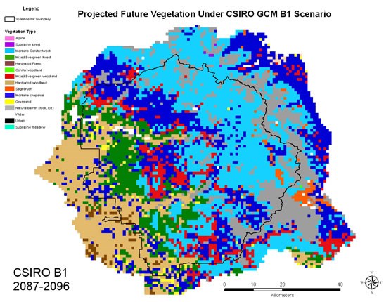
The GIS allows park staff to create, edit, display, and analyze locations of point-, line- or polygon-type features. The GIS also allows scientists to associate data or information with those features, such as species names, dates, and elevations. All information associated with a particular feature, such as a lake’s water quality, can be analyzed for relationships with other physical or biological information like visitation or the presence or absence or fish. A GIS can also be used to model or to predict events or states based on current and potential future scenarios. Using existing data, a GIS can create a model of likely locations for American Indian village sites, for example. A GIS also can be used to predict the likely locations of rare or endangered populations of plants or how the park’s vegetation might shift under potential future climate changes. By understanding where populations of invasive plants take root or where rockfalls occur most frequently, scientists assess management needs. Projections of climate change effects, for instance, can reveal why wildlife and plants are moving higher in elevation to follow suitable habitat. Recently, a vegetation map produced with the assistance of GIS—the first vegetation map of Yosemite since the 1930s—combined interpretation of 1,500 aerial photographs and data from hundreds of field plot surveys to produce floristic classifications of more than 100 vegetation types. This detailed data provides an in-depth look at plant communities as they relate to elevation, geology, topography, and soils. This GIS-related project, begun in 1997 and finished 10 years later, delineated and assigned vegetation types to approximately 85,000 polygons covering more than 1.4 million acres. A vegetation map is critical information for any scientist or land manager to incorporate when deciding fire management, wildlife management, vista management, rare plant location modeling, and archeological site prediction, for example. 
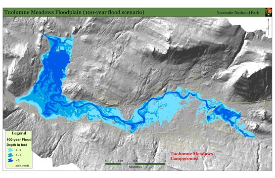
At Yosemite, GIS has been instrumental in assessing the potential impact of rare flood events on infrastructure in the Tuolumne Meadows area. Using recently acquired LIDAR data, a GIS was used by park hydrologists to map areas within the meadows that would be impacted by flooding. The GIS could relate building, trail, and interpretive locations to flood water depths, therefore, providing critical information for present and future management of infrastructure and human safety. The study of geographic concepts is key to park managers for planning and making decisions that have long-term outcomes. GIS continues to be used extensively to monitor and manage the physical, biological, and human resources of Yosemite’s 750,000 acres. Learn More:
|
Last updated: August 22, 2023

