Calumet Dunes Trail

Calumet Dunes Trail Banner


Getting There
Need to Know
Trail Map
Featured Hikes
Nearby Hikes
Photos

This short paved trail features the Calumet Dunes ridge, which was the shoreline of Lake Michigan over 12,000 years ago. The lake has slowly receded over time, forming three major parallel dune ridges: Glenwood (640' above sea level), Calumet (620' above sea level) and Tolleston (605' above sea level). The current lake level is approximately 580' above sea level. U.S. Highway 12 follows the high ground of the Tolleston Dunes ridge in this area, just north of the Calumet Dunes Trail.

Trail Features: Fall Colors, Wildlife


Getting There

Trailhead Parking Lot
1596 North Kemil Road (300E), Chesterton, IN 46304 (Intersection of Kemil Road and U.S. Highway 12)

Note: Kemil Road is called East State Park Road north of U.S. Highway 12.
Note: This is the location of the old visitor center for the park. The building is now USGS Lake Michigan Ecological Research Station.


Trailhead GPS Coordinates
41.661836, -87.010109 (Decimal Degrees)


Need to Know
Hours & Information

  • Hours – Open daily from 6:00 am to 11:00 pm.
  • Passes are required.
  • Hike Length – 0.5 miles.
  • Hike Time – 20 minutes.
  • Difficulty – Easy with some elevation change.
  • Trail Surface – Paved.
  • Facilities – Year-round restrooms and potable water.
  • Pets – Permitted on a leash (6' or shorter). Pets are prohibited on the equestrian portion of the Glenwood Dunes Trail.
  • Prohibited Littering, hunting, and removing plants.
  • Prohibited Bicycles and motorized vehicles.
  • The parking lot is paved.
  • In the winter, this trail is popular with cross-country skiers.
  • The Calumet Dunes Trail is interconnected with the large Glenwood Dunes Trail system and the Dunewood Trace Campground Trail. Click here for information on the Glenwood Dunes Trail system.

Safety

  • Please stay on the trail and respect closed area signs. Going off trail damages fragile habitat.
  • Ticks are present year-round. Take precautionary measures to prevent bites.
  • Poison ivy can be present on the edges of the trail.
  • Mosquitoes and flies can be bad in summer months.
  • Be prepared for changing weather conditions.
  • In case of an emergency or to report a crime, call 1-800-PARK-TIP.

Accessibility

  • Trail is paved but slopes exceed ADA limits. Trail is wheelchair accessible with proper support. Restrooms are accessible.
 

Trail Map

Click here for a list of all hiking trail maps of the Indiana Dunes National Park.
Download a national parks interactive trail guide phone app. Apple or Android.
Paper trail maps are available at the trailhead kiosk and the Indiana Dunes Visitor Center.
 
Calumet Dunes Trail Map
 

Featured Hikes
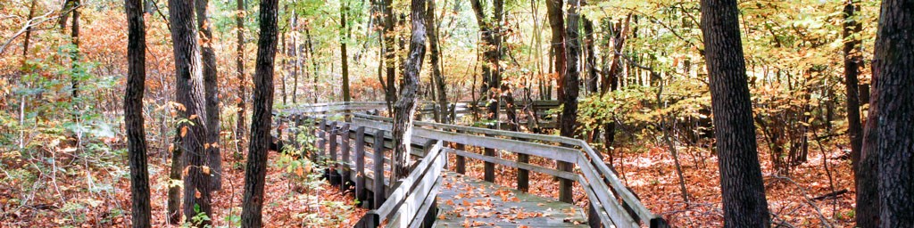
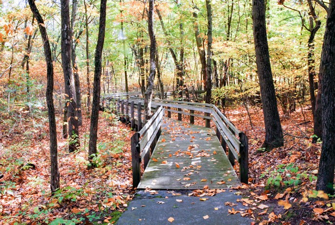
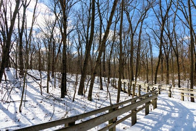
Calumet Dunes Paved Trail
0.5 miles, 32 feet of elevation gain, 2% average grade, 5% maximum grade
Hike time: 20 minutes


This featured hike is a loop trail and is wheelchair accessible. Starting at the parking lot trailhead, hike the trail loop in a counter-clockwise direction. The path is easy to follow. Please be aware of trail junctions. Stick to the left at each junction. The first two junctions are the north and south entrances to the Glenwood Dunes Trail system. Note that no pets are allowed on this portion of the Glenwood Dunes Trail. The last trail junction is with the Dunewood Trace Campground Trail. Again, stay left. The trail ends on the opposite side of the building from where you started. Walk around the front of the building.

History and Background
The building at the parking lot has an interesting history. The ground breaking ceremony for the building took place in 1959 and opened on November 13, 1960 as the Presbyterian Church of the Dunes [An interesting side note is that the church had owned and held services in the Old North Church building in Beverly Shores (from the 1933 Chicago World's Fair) from 1938 until 1960]. The last service in the building was held on August 30, 1970 and the National Park Service purchased the land and building shortly afterwards. The building became the park's headquarters and visitor center in 1971. The headquarters moved out of the building to the abondoned Nike missle base on Mineral Springs Road in 1977. The visitor center stayed in the building until November 15, 2006, when the current Indiana Dunes Visitor Center on State Road 49 was opened. The building is currently serving as the United States Geological Survey's (USGS) Lake Michigan Ecological Research Station.


Nearby Hikes
Great Marsh
Dune Ridge
Glenwood Dunes

Click here for a list of all hiking trails in the Indiana Dunes National Park.
 

Photos
 
Calumet Dunes trail in the fall.
Calumet Dunes Trail in the fall
 
Calumet Dunes Trail in the Winter
Calumet Dunes Trail in the winter
 
Calumet Dunes Trail in the winter

Last updated: February 9, 2023

Park footer

Contact Info

Mailing Address:

1100 North Mineral Springs Road
Porter, IN 46304

Phone:

219 395-1882
Indiana Dunes Visitor Center phone number.

Contact Us