Otis Pike Fire Island High Dune Wilderness

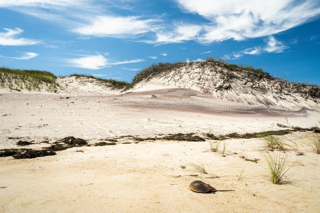
A high root-topped dune with white and purple-colored sand. In the foreground is a wrack line and a horseshoe crab carapace. Blue sky and streaky white clouds fill the background.
Visitors will find striking landscapes, abundant wildlife, and plenty of solitude in the Otis Pike Fire Island High Dune Wilderness.

NPS Photo

 
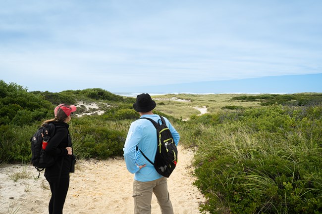
Two hikers look out on an expanse of dunes and the ocean.
Hikers look out on a sandy trail in the Otis Pike Wilderness.

NPS Photo

A Wilderness in Your Backyard

The Otis Pike Fire Island High Dune Wilderness is the only federally designated wilderness in the State of New York and it is just a short drive or train ride from New York City.
The wilderness extends from the Wilderness Visitor Center, adjacent to Smith Point County Park, to Watch Hill. Though it is the smallest wilderness area managed by the National Park Service, the Fire Island wilderness offers big adventures.


The Wilderness Visitor Center is open year-round and is accessible by car. Please be sure to look for park ranger programs and check hours of operation or call ahead at 631-281-3010.

 
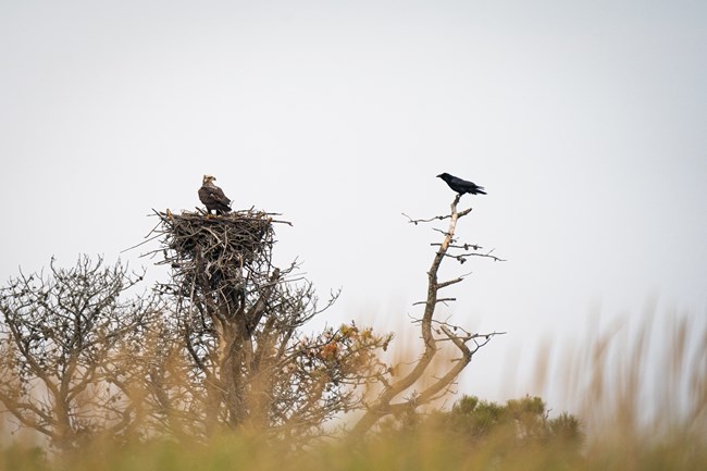
A bald eagle sits on a nest of sticks as a raven looks on from a separate branch.
Wildlife viewing is a popular activity in the The Otis Pike Wilderness.

NPS Photo

The Magic of Wilderness

Close your eyes for a moment and imagine wilderness. You may envision an icy crag reaching skyward, a lush green mountain meadow, or a deep, dark forest. The magic of wilderness is that each of us conjures a different landscape, and a different experience.

The Otis Pike Fire Island High Dune Wilderness offers a wilderness experience like no other. In this seven mile stretch of undeveloped barrier island, you will find excellent hiking along the trace of the old Burma Road and backcountry camping opportunities (via Watch Hill and points west). Anglers enjoy casting for bluefish, striped bass, winter flounder, and other saltwater species along the shore. And scenic views and abundant wildlife attract bird watchers, wildlife viewers, and nature lovers, alike.

 
Wooden beams and large spikes protude from a sandy beach with sand dunes in the background.
Remnants of shipwrecks are reminders of Fire Island's maritime history and can occasionally be seen on the beach adjacent to the wilderness area. Pictured above is the hull of the Bessie A. White, a coal schooner that wrecked in 1922 near Long Cove in what is now the Otis Pike Wilderness.

NPS Photo

Wilderness and Human History


All national seashores like Fire Island, and the wilderness areas within, are the homelands of indigenous peoples since time immemorial. Historically, members of Long Island indigenous groups such as the Unkechaug, Secatogue, Shinnecock and Montaukett travelled to the barrier island to harvest food and other resources. These seasonal activities included whaling, fishing, harvesting shellfish, and hunting waterfowl and seals. After colonization, European Americans began whaling (using techniques learned from indigenous whalers), with operations leaving from and returning to the Fire Island beach.

By the 19th century, the US Life Saving Service had set up several stations across Fire Island to aid ocean-going vessels and their passengers in distress. This included posts at Smith Point and Bellport Beach which are to today within the wilderness area. Hikers may find concrete pads and partially submerged wooden structures on the bay shore that are remnants from the US Life Saving stations (later US Coast Guard stations). Remains of wrecked ships can also seen from time to time protruding from the sand on the ocean beach adjacent to the wilderness.

By the 20th century, small communities and modest vacation cottages were established within what is today wilderness at Long Cove, Skunk Hollow and Whalehouse Point. With little documentation that proved ownership of the land and the establishment of the national seashore in 1964, many of these part-time residents were forced to leave to establish an 8-mile natural zone between the Davis Park community and Smith Point. The dwellings between Watch Hill and Smith Point were demolished or removed by the National Park Service prior to the wilderness designation in 1980, though some construction remnants can still be seen from the Burma Trail.
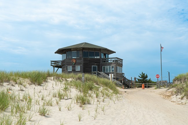
 
A wooden, octagonal building with dune grass in front.
The Wilderness Visitor Center is open daily and accessible by car via Smith Point County Park.

NPS Photo

Plan Your Visit


You can drive to the east end of wilderness and enjoy park ranger programs all year. Be sure to check visitor center hours of operation and the calendar of events.

Plan your visit so you can make the most of your wilderness experience. You're likely to encounter dense thickets of catbriar and poison ivy. In warmer weather, vast numbers of salt marsh mosquitoes and ticks. Wear light-colored clothing and a wide-brimmed hat to help you detect ticks and protect against the sun. In winter, bring plenty of warm layers. Always be aware of changing weather conditions, tide and ocean conditions and rip currents. For your safety, never swim alone.

From March 15 through Labor Day, pets are not permitted on the ocean beach in front of the wilderness to ensure that threatened and endangered beach-nesting shorebirds are protected.
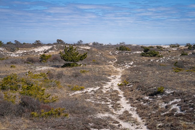
 
A view of dunes, beach vegetation and a narrow trail.
View of the Otis Pike Wilderness swale environment from the Burma Trail.

NPS Photo

Wilderness Designation

The Wilderness Act was signed into law on September 3, 1964. In 1975, what became known as the "Eastern Wilderness Areas Act" provided for the addition of areas that had been severely modified, including the authority to condemn and remove structures, to create designated wilderness in the East.

The Otis Pike Fire Island High Dune Wilderness Act, signed on December 23, 1980, designated approximately 1,363 acres as wilderness in Fire Island National Seashore, and identified 18 more acres as potential wilderness.

In October, 1999, a Federal Register notice announced that 17 acres of potential wilderness by that time fully complied with wilderness standards, and were officially designated as wilderness.

In 2015, the NPS added the last acre of the 18 acres of potential wilderness identified in 1980. Hurricane Sandy destroyed structures on the land, making it eligible for designation and addition to the Seashore’s wilderness area.

Explore Wilderness
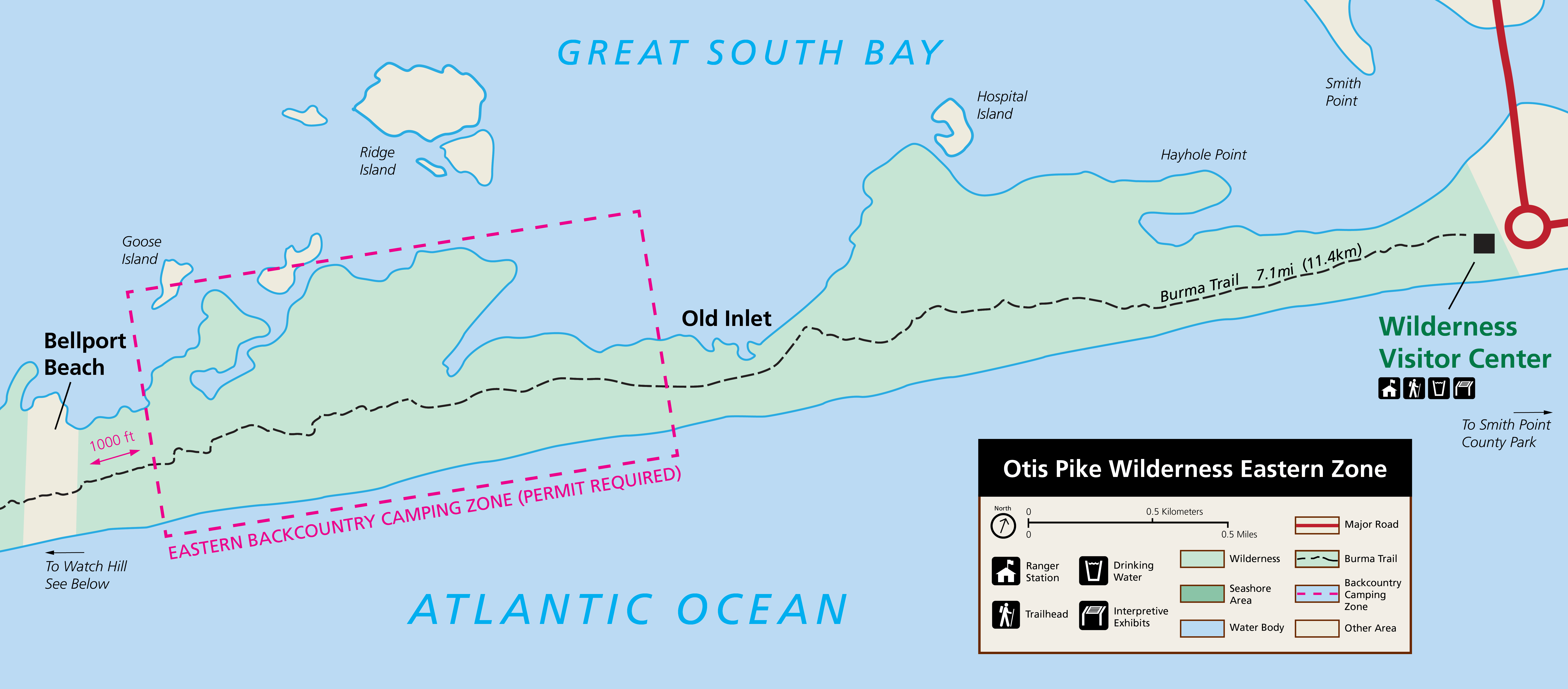


A color map of the eastern wilderness zone with the Wilderness Visitor Center in the east and Bellport Beach in the west. A dashed line runs the length of the map showing the Burma Trail. A magenta-colored dashed box shows the backcountry camping zone.
Map of the Otis Pike Wilderness Eastern Zone showing the Burma Trail and eastern backcountry camping zone.
 
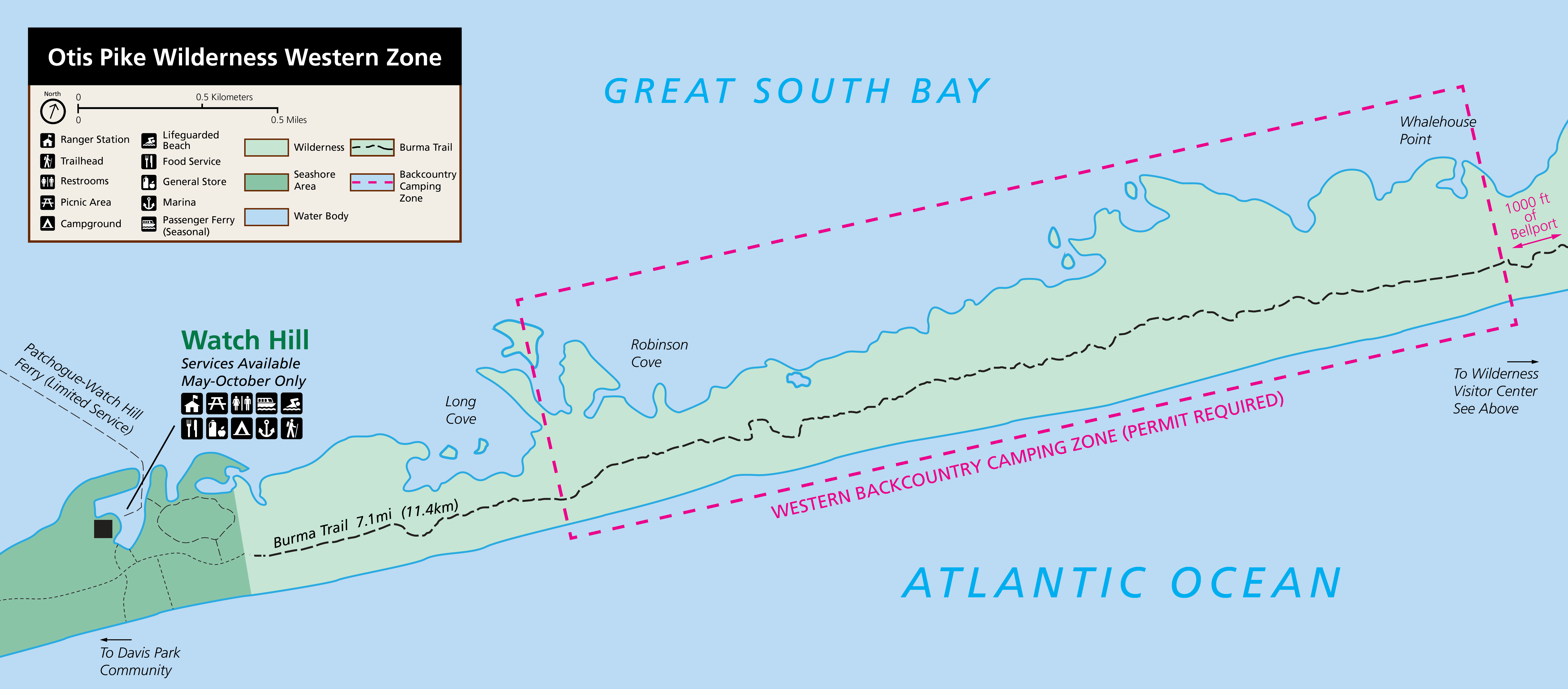
A color map of the western wilderness zone with the area west of Bellport Beach in the east and Watch Hill in the west. A dashed line runs the length of the map showing the Burma Trail. A magenta-colored dashed box shows the backcountry camping zone.
Map of the Otis Pike Wilderness Western Zone showing the Burma Trail and western backcountry camping zone.
 
A hiker in winter jacket, gloves and wearing a frame pack hikes through the grassy swale on a winter beach.
A backpacker hikes the Burma Trail in winter. Cooler seasons can be the most comfortable time to hike the trail due to a lack of mosquitoes.

NPS Photo

Hiking the Burma Trail

Download a trail map (PDF - 1.74 MB)

The Burma Trail follows part of the trace of the old Burma Road, an off-road vehicle route used before the area's wilderness designation in 1980. Most of the road has disappeared under dunes or vegetation, but in some places it remains clear. Hikers may also find traces of human development, such as concrete pads used by the US Life Saving Service and Coast Guard, bricks used for summer bungalows, or the remnants of shipwrecks along the shore. While these reminders of the human past may seem to run counter to the idea of wilderness, you might think of the area as reclaimed by nature, rather than “untouched” or “pristine.”

The Burma Trail allows access to wilderness for hikers, photographers, birders, campers, anglers, hunters, and others. Whether your visit is for a short stroll, a full-day outing, or an overnight trip, visitors should take care to keep this area wild and minimize their impact on the landscape and wildlife.

Hikers typically access the trail at the Wilderness Visitor Center or Watch Hill. Those interested in hiking during cooler months from the western end can take a ferry and walk an additional mile from Davis Park (ferry service is limited between October and May – check the latest schedule).

Interested in camping overnight? Learn more about backcountry camping in the Otis Pike Wilderness.

Hike Smart

  • Hike the trail in cooler months. Mosquitoes are prevalent north of the primary dune from late spring until late fall. The trail is best enjoyed during cooler seasons when adult mosquitoes are not present. Hiking on the ocean beach can be a more comfortable option in warmer months.
  • Stay on paths. Protect vegetation and dunes by staying on trail or on deer paths. Walking on paths also helps avoid ticks and poison ivy.
  • Trail conditions. Storms can cause flooding and overwashing of sand on the trail. Be prepared to wade flooded areas and navigate through altered sections of trail. Parts of the trail may become overgrown with brush. If the trail is impassable, walk to the ocean side through a low point in the dunes and walk the beach.
  • Backcountry camping in the east or west zones requires a permit purchased on recreation.gov. Campers can select a campsite in established zones north of the primary dune year-round or on the beach between March 15 and Labor Day. Learn more about backcountry camping.
  • Check the weather and tides before your hike. Storms and seasonal tides can present dangerous conditions with ocean water pushing to the dune line and causing overwashes in low-lying areas. This creates river-like washes that can sweep away tents and cause hazardous conditions if wading across. Avoid setting up camp where sandy washes are observed--these areas are especially prone to flooding.
  • Bring plenty of water. No drinking water is available between the Wilderness Visitor Center and Watch Hill.
  • Protect yourself from the sun. Wear a hat, cover legs and arms, and wear sunscreen. There is little shade on the trail. Learn more about sun protection.
  • Avoid pests. Mosquitoes are present in warm months. Ticks are common--inspect yourself after a hike. Avoid poison ivy.
  • Duck hunters may be encountered in season. Duck hunting is permitted in the wilderness area and Great South Bay during the fall and winter north of Burma Trail.
 
Visit our keyboard shortcuts docs for details
Duration:
7 minutes

Join three teen poets from New York City on their first adventure to the wilderness of Fire Island National Seashore. And it's only a train ride away! As the poets explore this coastal wilderness with spoken word poetry, each begins to form a deeper understanding of their personal relationship with the natural world.

Last updated: September 17, 2024

Park footer

Contact Info

Mailing Address:

120 Laurel Street
Patchogue, NY 11772

Phone:

631-569-2100

Contact Us