Trailing Ancient Hunters in Wild Alaska

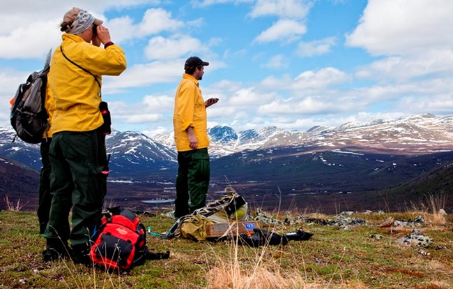
Archaeologists surveying in the mountains

NPS/Greg Kinman

In early June, I was stationed out of the Yukon-Charley Rivers National Preserve headquarters in Eagle, Alaska. I did many things during that short time, and photographed many more, but by far the highlight of the trip was the three-day stint I spent with the preserve's archaeology crew.

The crew was in the middle of their annual two-week helicopter survey. For fifteen days straight, they flew out each day, landing on unimproved sites that are only accessible (in a timely fashion) by helicopter, such as flat ridges and gentle slopes vegetated primarily with dry, mossy tundra. While at these sites, they slowly walked around the tundra, keeping an eye out for stone tools and flakes that would have been used by ancient Alaska Native caribou hunters. The main goal was to learn more about the migration patterns and lifestyles of the natives in an effort to learn more about what Interior Alaska was like before Western contact.

Learn more about the archaeologists' work in the preserve

 
Panoramic photo of mountains with patches of snow

NPS/Greg Kinman

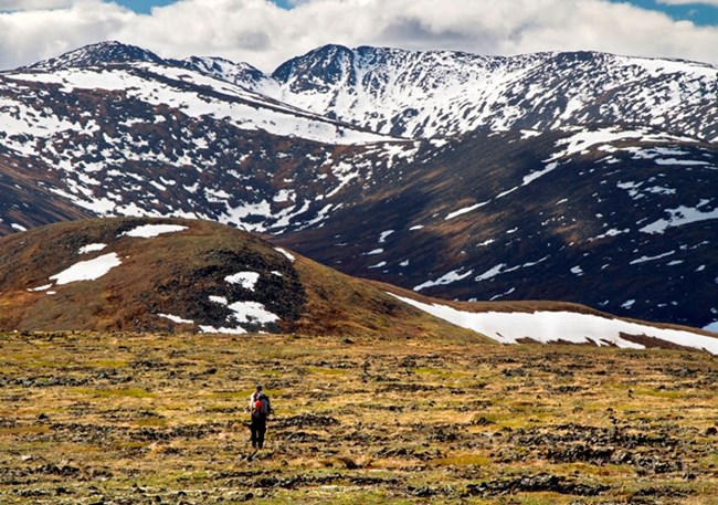
On the second, and arguably most exciting, day that I was part of the group, we landed on a gorgeous alpine ridge. Moss, grassy vegetation, and rock coated the terrain; it was a hiker's dream. The sun blazed, helping with the upland chill; the wind howled, keeping the mosquitoes at bay; and sweeping views abounded. I did some of the best hiking I've ever done on that day. When we landed, the archaeologists broke out their GPS device and planned out the day's route. It's important for them to search in areas near where they've found artifacts before in order to increase the likelihood of finding something - but not so close that they're encroaching on or just re-encountering their previous findings. They rely heavily on accurate GPS technology in their fieldwork.
 
An archaeologist hikes a ridge with mountain peaks in background

NPS/Greg Kinman

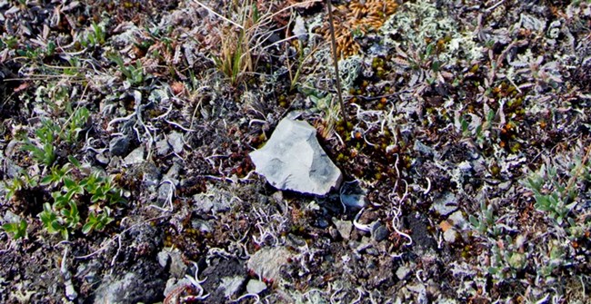
We hiked all morning with no luck. But, no one complained, probably because of the beautiful location. I can't imagine a better-looking workplace than the upper drainages in the mountainous areas of Yukon-Charley Rivers. We stopped to eat our sandwiches while still near the landing site, but, after lunch, we proceeded downhill. We were pretty spread out while hiking down the hill; I was in the back so I could focus on shooting the scenery, because there wasn't really anything interesting to shoot while the archaeologists were just hiking. The lead hiker was about half a mile ahead of me, and when he reached a rocky bench about midway down the hill, he gave a loud shout. He had found an enormous cluster of tool remnants lying on the top layer of the tundra. The other surveyors and I hurried down the hill and immediately hopped to work.
 
A chipped off fragment of rock sits on top of the tundra

NPS/Greg Kinman

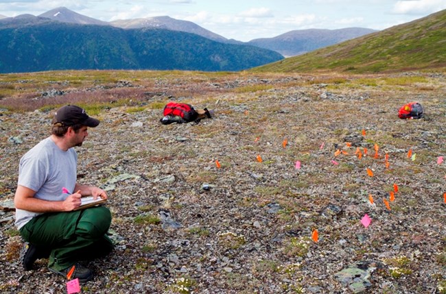
The surveyors picked out stone tool remnants like M&M's on white carpet, planting flags by each artifact they found, making waypoint markers on the GPS, and taking notes about the site. It was extremely interesting to watch them do their survey, and I knew I was doing an important job by documenting their oft-overlooked work.
 
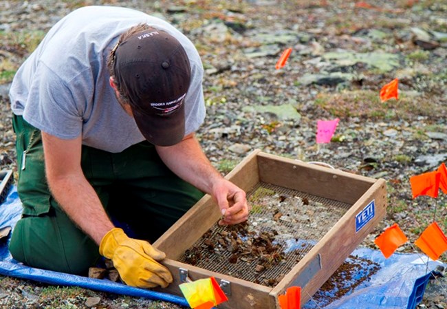
Archaeologist examining dirt from a shovel test in a screen-filter box

NPS/Greg Kinman

After the crew thought they had given the site a thorough visual scouring, they performed what they call a "shovel test:" they dug about eight inches down in about two inch increments, stopping at each increment to sift through the dirt to see if any artifacts might have been covered over by soil. They explained that the shovel test is a type of test that is generally more effective and necessary in rainier areas of the lower 48; in the Alaskan tundra, it was more of a formality, since most artifacts lying on dry tundra will not be disturbed by weather, even over thousands of years.
 
Archaeologist taking notes at an archaeological site with flags marking findings on the tundra

NPS/Greg Kinman

Most of the artifacts found at that site in particular were flint rock that had obviously been "napped," or chipped and shaped into a blade useful for cutting. It seems that areas like the one we found on that day were popular sites for the ancient Athabaskan Alaska Natives to watch for caribou during a hunt or to process their meat after a successful kill. The evidence of these actions is literally lying out in the open on the upland tundra, waiting for archaeology crews (or hikers and hunters) to find it and to tell the stories of the ancient dwellers of the mountains.

I had a wonderful and enlightening three days with the crew; I learned a great deal about the rich cultural and archaeological history in the preserve, and the new knowledge further inspired me to accurately and artfully portray the preserve through my photographs in such a way that would inspire others to conserve it.

Last updated: April 14, 2015

Park footer

Contact Info

Mailing Address:

101 Dunkel St
Suite 110

Fairbanks, AK 99701

Phone:

907-459-3730

Contact Us