Geology Down the Yukon Guide - Page 2

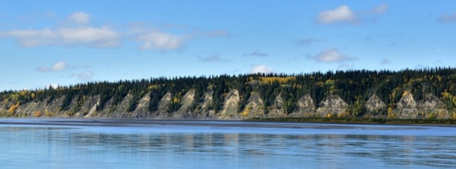
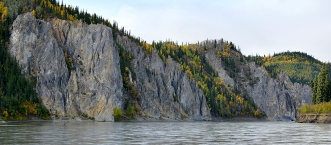
The tall Tahkandit Limestone bluffs near Nation River
West side (river left)

NPS Photo by Josh Spice
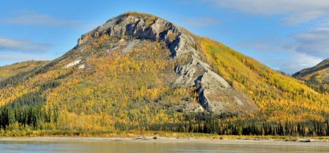
 
The tall Tahkandit Limestone bluffs near Nation River
East side (river right)

NPS Photo by Josh Spice

Graceful arches of Tahkandit Limestone flank the Yukon River on both banks just upriver of the mouth of the Nation River. These beige to very pale orange ridges form the north flank of the Michigan Creek Anticline. The Tahkandit Limestone, which tends to form massive cliffs, overlies the less resistant mudstone of the Nation River Formation.
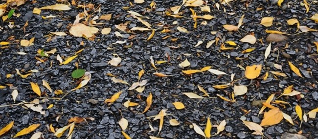
 
The Glenn Shale on Glenn Creek

NPS Photo by Josh Spice

Glenn Shale (Triassic - Cretaceous) is exposed along the Yukon near Glenn Creek, for which it is named. Glenn Shale is predominantly grayish-black carbonaceous shale.
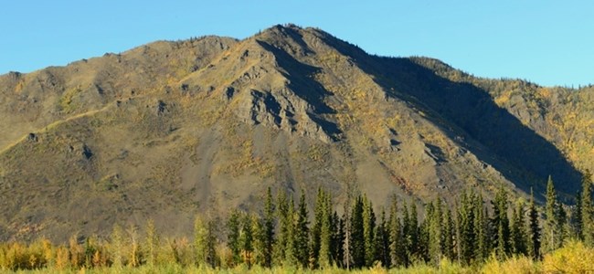
 
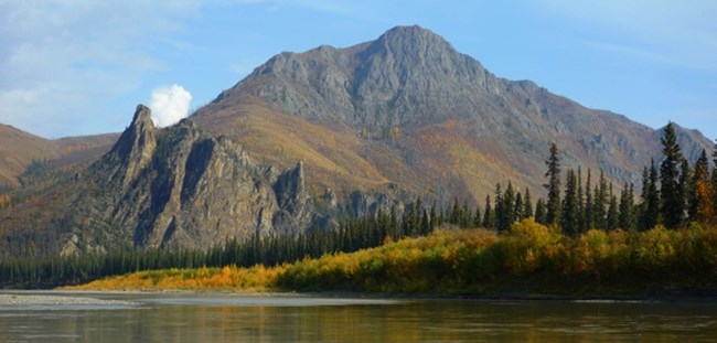
Kathul Mountain

NPS Photo by Josh Spice

Directly across from Washington Creek rises Kathul Mountain. Blocky outcrops between grassy slopes and the crest of the mountain are chiefly conglomerate and sandstone. Kathul Graywacke forms prominent ridges and extends continuously from Kathul Mountain to the middle and upper reaches of the Kandik River. Fossils indicate marine origin for the Kathul Graywacke (Cretaceous).
 
Biederman Bluff panorama

NPS Photo by Josh Spice

Four miles downriver from the mouth of the Kandik River, Biederman Bluff rises 1,000 feet. The bluff is composed of Biederman Argillite (Cretaceous), which exhibits rhythmic bedding of argillite, siltstone, and sandstone. The dark gray and black layers are a few inches to many feet thick.
 
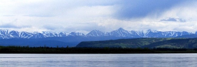
Mountains of the Upper Charley rise above the Yukon River

NPS Photo by Josh Spice

Downstream from Biederman Bluff, the granitic mountains of the upper Charley River grace the southern horizon.
 
The terraced look of Chester Bluff

NPS Photo by Josh Spice

Chester Bluff is composed of finely layered Biederman Argillite, which is overlain by deposits of a river terrace. These sedimentary deposits are composed of light brown sand and silt and were deposited by the Yukon River when the floodplain was at a higher level. The Yukon subsequently cut down through these deposits and established a floodplain at the present level.
 
Devil's Thumb on the Yukon River

NPS Photo by Josh Spice

Much of the lower section of the Yukon River within the preserve is divided among several volcanic rock sequences providing a considerable array of rock types and features. McGregor Bluff introduces the traveler to the Woodchopper Volcanics. This formation produces prominent bluffs along the river for the next 20 miles.
 
The spires of Takoma Bluff

NPS Photo by Josh Spice

The needle-like spires of Takoma Bluff (Precambrian) suggest a medieval castle rising along the Yukon River. Swirling eddies allow the river traveler to examine the thinly layered limestone and dolomite. The needle-like features have developed through dissolution. During this process, water penetrates into vertical fractures and slowly dissolves the bedrock.

Last updated: April 10, 2023

Park footer

Contact Info

Mailing Address:

101 Dunkel St
Suite 110

Fairbanks, AK 99701

Phone:

907-459-3730

Contact Us