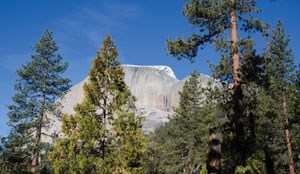
Little Yosemite ValleyHighlights: Waterfalls, Valley Views Distance: 9.6 miles (15.5 km) round trip Elevation Gain: 2,150 feet (655 m) Permit Demand: Very High Trailhead: Happy Isles The trail to Little Yosemite Valley starts at Happy Isles. It travels near steep granite cliffs and past both Vernal and Nevada Falls. The shortest and steepest route up is the Mist Trail, while the John Muir Trail takes a longer and lower angle path. 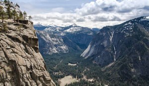
Yosemite FallsHighlights: Waterfalls, Valley Views Distance:7.4 miles (11.9 km) round trip Elevation Gain: 2,700 feet (820 m) Permit Demand: Medium Trailhead: Yosemite Falls The Yosemite Falls Trail starts behind Camp 4 and ascends to the top of Upper Yosemite Fall. It offers views of Yosemite Valley and provides access to the northern rim of the Valley. Hikers can also access Eagle Peak, El Capitan, Yosemite Point, and North Dome. 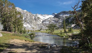
John Muir Trail to TuolumneHighlights: Waterfalls, Valley Views, Distance: 22 miles (35.4 km) one way Elevation Gain: 5,900 feet (1,800 m) Permit Demand: Very High Trailhead: Happy Isles This hike follows the John Muir Trail from its beginning at Happy Isles to Tuolumne Meadows. Along the way, the trail passes Vernal and Nevada Falls, then below the south face of Half Dome, through Sunrise Meadow, and beside Cathedral Peak before descending to Tuolumne Meadows. 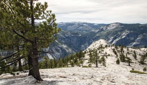
Full North RimHighlights: Waterfalls, Valley Views Distance: 29.1 miles (46.8 km) one way Elevation Gain: 6,200 feet (1,890 m) Permit Demand: Low Trailhead: Old Big Oak Flat Road or Snow Creek Starting at Old Big Oak Flat Road (from along new Big Oak Flat Road), this strenuous hike follows the entire North Rim of Yosemite Valley. The trail crosses over streams and waterfalls and passes through vast forests. Hikers can stand atop El Capitan, Yosemite Falls, Yosemite Point, and North Dome. The hike returns to Yosemite Valley via the Snow Creek Trail and Mirror Lake. 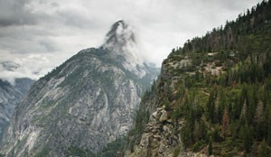
Glacier Point to Yosemite ValleyHighlights: Valley Views Distance: 11.5 miles (18.5 km) one way Elevation Gain: 1,100 feet (335 m) Permit Demand: High Trailhead: Glacier Point Starting at Glacier Point, hikers can either descend into the Illilouette Creek Basin to camp or go to the Little Yosemite Valley backpackers campground. The hike then continues down the John Muir Trail to Yosemite Valley, passing Nevada and Vernal Falls. 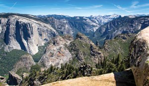
Pohono Trail (east to west)Highlights: Valley Views Distance: 13.7 miles (22.0 km) one way Elevation Gain: 1,100 feet (335 m) Permit Demand: Medium Trailhead: Glacier Point Beginning with the sweeping vista of Glacier Point, venture along the south rim of Yosemite Valley and enjoy the evolving views from points like Taft, Dewey, and Stanford as you gradually descend to the end of the trail at the iconic Tunnel View. (Public transportation is not availble between trailheads.) 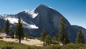
Snow CreekHighlights: Valley Views Distance: 7.1 miles (11.4 km) round trip Elevation Gain: 2,750 feet (840 m) Permit Demand: Low Trailhead: Snow Creek This trail begins in Yosemite Valley at Mirror Lake, near the base of Half Dome. This exposed, sunny trail is the steepest way out of Yosemite Valley and gain access to the North Rim with impressive views of Half Dome. 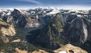
Eagle PeakHighlights: Valley Views, Peaks Distance: 12.6 miles (20.2 km) round trip Elevation Gain: 3,770 feet (1150 m) Permit Demand: Medium Trailhead: Yosemite Falls After ascending the Yosemite Falls Trail, hikers continue on to Eagle Peak in the direction of El Capitan. Eagle Peak offers expansive view of Yosemite Valley and the high country. 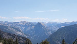
El Capitan (from Yosemite Valley)Highlights: Valley Views, Peaks Distance: 15.4 mile (24.8 km) round trip Elevation Gain: 3,800 feet (1,160 m) Permit Demand: Medium Trailhead: Yosemite Falls On the north rim of Yosemite Valley is one of the landmarks of Yosemite: El Capitan. The trail passes near Yosemite Falls and through oak and pine forests. From the summit, there are views of Yosemite Valley and the high country. Along the way, hikers can detour to the summit of Eagle Peak. 
Pohono Trail (west to east)Highlights: Valley Views Distance: 13.7 miles (22 km) one way Elevation Gain: 4,150 feet (1,260 m) Permit Demand: Medium Trailhead: Wawona Tunnel The Pohono Trail traverses the southern rim of Yosemite Valley, beginning at Tunnel View and ending at Glacier Point. This steep trail alternates through dense forest and prominent vista points where you can see El Capitan, Yosemite Falls, North Dome, Half Dome, and the high country. 
Pohono + Four-Mile TrailsHighlights: Valley Views Distance: 18.3 miles (29.5 km) one way Elevation Gain: 4,150 feet (1,260 m) Permit Demand: Medium Trailhead: Wawona Tunnel For backpackers who want to hike the Pohono Trail and hike back to Yosemite Valley, this is an option. After camping on the southern rim, backpackers hike to Glacier Point where there are panoramic views of Yosemite National Park. Then hikers descend the Four Mile Trail to Yosemite Valley to finish the trip. 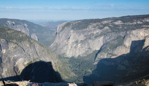
Half Dome via the John Muir Trail (JMT)Highlights: Valley Views, Peaks Distance: 16.2 miles (26 km) round trip Elevation Gain: 4,830 feet (1,470 m) Permit Demand: Very High Trailhead: Happy Isles The hike to the summit of Half Dome is one of the most popular in Yosemite. This hike follows the John Muir Trail past Vernal and Nevada Falls. Then, the trail passes under Liberty Cap and through Little Yosemite Valley. The final leg to reach the summit involves ascending steep stairs and granite slabs up subdome and then climbing up the steel cables that lead to the summit. 
Eastern North RimHighlights: Waterfalls, Valley Views Distance: 18.1 miles (29.1 km) one way Elevation Gain: 5,200 feet (1,585 m) Permit Demand: Low Trailhead: Yosemite Falls or Snow Creek This strenuous hike out of Yosemite Valley passes near waterfalls and through forests and glades. Along the way, there are views of Yosemite Valley and Half Dome from the top of Yosemite Falls, Yosemite Point, and North Dome. Hikers can also detour to Indian Rock, a natural rock arch. 
John Muir TrailHighlights: Waterfalls, Valley Views, High Country Distance: 210.4 miles (338.6 km) one way Elevation Gain: 47,000 feet (14,000 m) Permit Demand: Very High Trailhead: Happy Isles The long-distance John Muir Trail travels through the high country of the Sierra Nevada, including Yosemite, Sequoia, and Kings Canyon National Parks, as well as Inyo National Forest. The trail starts at Happy Isles in Yosemite Valley and ends at the summit of Mount Whitney. The trail passes through vast regions of alpine wilderness and lies almost entirely above 8,000 feet (2,400 m) in elevation. |
Last updated: November 13, 2019
