|
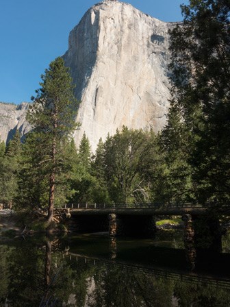
Enjoy some solitude in western Yosemite Valley. Hike through meadows, forests, and beside the Merced River. Along the way, enjoy striking views of Sentinel Rock, Cathedral Rocks, Bridalveil Fall, El Capitan, Three Brothers, Yosemite Falls, and more.

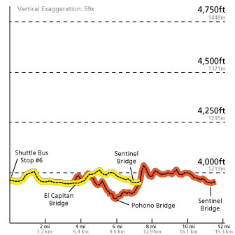
Trail OverviewDistance: 11.5 mi (18.5 km) full loop; 7.2 mi (11.6 km) half loop This trail follows many of the Valley's first east-west trails and wagon roads. It offers a rare opportunity in Yosemite Valley: to hike on a fairly level trail with some solitude. While some of the trail passes near roads, much of it takes you through meadows, talus slopes at the base of the granite cliffs, and near the Merced River. You can access the trail from many places throughout the Valley; however, the mileage and description used here starts at the Lower Yosemite Fall area (follow signs for Valley Loop Trail). Route-finding can be difficult in places, so it is best to bring a map with you (even a simple day hiking brochure from the visitor center) as it will orient you with the various landforms in the Valley, which are often listed on the trail/directional signs. From the Lower Yosemite Fall area, head west along the base of the Three Brothers rock formation, past Camp 4, eventually working your way through Yosemite Valley to El Capitan. If you are planning to hike the half loop, cross the Merced River at El Capitan Bridge and continue by heading east back toward Yosemite Village. If you are planning to hike the full loop, continue west past El Capitan toward Bridalveil Fall. While most of the trail is flat, there are some hilly sections throughout the hike. Additionally, you will find mixed trail surfaces: dirt, rocks, sand, and old pavement. SeasonalityThe Valley Loop Trail is open year-round. During spring, you may find localized flooding on the trail near creeks. During winter, the trail is often snowy and icy in places, particularly along the south side of Yosemite Valley. In these areas, use extreme caution as it may be hard to get traction on ice and route-finding may be difficult in snowy areas (the trail may be completely obscured by just a few inches of snow). 
Stay Safe
WaterDrinking water is not available along the trail. A drinking fountain is available at the start of the trail near the Lower Yosemite Fall Trailhead. RestroomsRestrooms are available at the trailhead near the start of the Lower Yosemite Fall Trail and at Bridalveil Fall. Vault toilets are also available at picnic areas along or near the trail. ParkingParking is not available at the trailhead; the trail begins at the Lower Yosemite Fall Trailhead (near shuttle stop #6). Primary parking is available at the Yosemite Village and Yosemite Falls parking areas. You can also access the trail from various roadside parking areas throughout Yosemite Valley. TransportationThe Valleywide Shuttle serves this trailhead (stop #6). You can also walk from the Yosemite Village area along the bicycle path to get to the trailhead (this adds approximately 0.5 mile (0.8 km) to your hike).Other stops further west in the Valley, at the El Capitan Meadow (stop #9) and the Four Mile Trailhead (stop #11), should you need alternate transportation back. Trail EtiquettePets, bicycles, and strollers are prohibited. Keep your food within arm's reach at all times and do not feed the wildlife. Carry out all trash and food waste (fruit peels, shells, etc.). 
Other Moderate and Strenuous Hikes in Yosemite Valley<< Back to Yosemite Valley Day Hikes |
Last updated: July 10, 2024
