|
The landscape of Yosemite National Park is a product of its unique geology, resulting from glacial erosion of the underlying granite. Iconic landforms such as Yosemite Valley, Yosemite Falls, Bridalveil Fall, El Capitan, Half Dome, and Cathedral Peak are known throughout the world. Besides their natural beauty, these icons are also important sites for studying and understanding the geological history of the Sierra Nevada mountain range. Yosemite preserves a fascinating geologic story hundreds of millions of years in the making. Many forces, including water, ice, and even daily temperature changes, have worked to sculpt—sometimes gradually, sometimes catastrophically—the granite bedrock of Yosemite to form the stunning features that we see today. 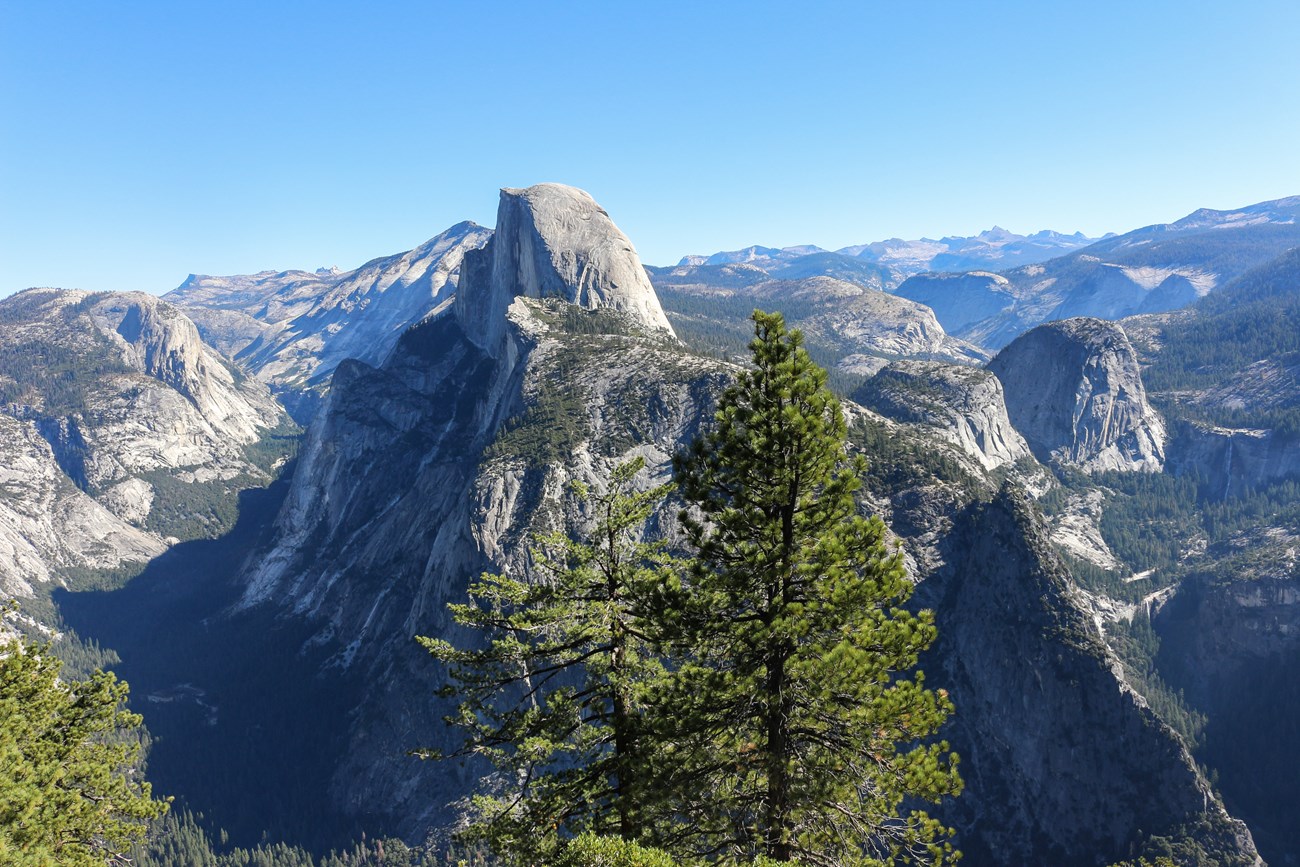
The Making of the LandscapeYosemite National Park is located within the heart of the Sierra Nevada, the largest fault-block mountain range in the United States. Trending northwest–southeast for more than 300 miles, the Sierra Nevada traverses half the length of California, with the Central Valley to the west and the Basin and Range Province to the east. It is an asymmetric mountain range with a long, gentle western slope and a short, steep eastern escarpment. It is 50 to 80 miles wide and extends in elevation from near sea level along its western edge to more than 13,000 feet along the crest in the Yosemite area, and more than 14,000 feet along the crest in Sequoia and Kings Canyon National Parks. The highest peak in the Sierra Nevada, and in the continental United States, is 14,505-foot-tall Mount Whitney in Sequoia National Park. Mount Lyell, the highest peak in Yosemite National Park, rises 13,114 feet above sea level. Geologically, the Sierra Nevada is a huge block of the Earth's crust that is bounded on its east side by a fault system, along which the Sierra has been uplifted and tilted westward. This combination of uplift and tilt, which is the underlying geologic process that created the present range, is still occurring today. 
The geologic story of Yosemite National Park can be considered in two parts. First was emplacement of granitic rocks in a subduction zone and metamorphism of older sedimentary rocks. Later came uplift, erosion, and glaciation of the rocks to form today's mountainous landscape. Subduction and Granite FormationThe Sierra Nevada is mainly composed of granite, a salt-and-pepper appearing rock composed primarily of quartz, plagioclase, potassium feldspar, biotite, and hornblende. Granite, granodiorite, diorite, and tonalite are all forms of plutonic rock that occur in Yosemite, and are loosely referred to as granitic rocks. The many varieties of plutonic rocks in Yosemite and the rest of the Sierra are due to different compositions of magma intruded into Earth’s crust at different times, and separation of intruded magma into crystal-rich and crystal-poor fractions. The differences are visible in color, grain size, texture, structure, and mineralogy, and in response to weathering and erosion of the rocks. The granites of Yosemite are part of the Sierra Nevada Batholith, a large amalgamation of plutons. Plutons are bodies of molten rock material (magma) that froze within the Earth rather than erupting to form volcanic rocks. The batholith formed due to subduction, where tectonic plates converge and one dives under the other. Around 220 million years ago, the ancestors of the Pacific Plate began to subduct beneath the North American Plate and the west coast of California was similar to today's Andes of South America. The majority of granites in Yosemite National Park formed during the Cretaceous period, between 105 and 85 million years old. They were eventually exposed on the surface by gradual erosion of the overlying rocks over millions of years. The huge amount of eroded sediment was transported westward by river systems into California’s Central Valley. 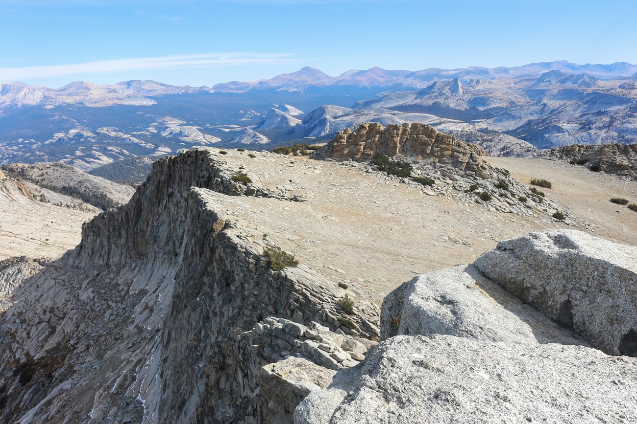
The sheer cliffs of Yosemite Valley, the spire-like peaks of the high country, and the many rounded domes all result from the fact that granite is very strong: it is an unlayered rock that due to its massiveness and durability can sustain bold forms. Large interlocking crystals form as magma very slowly cools to create granite, which is why it is one of the strongest types of rock. The vertical face of El Capitan, rising 3,000 feet above the floor of Yosemite Valley, testifies to the great strength and relative lack of fractures in the El Capitan Granite. It's a remarkable example of a granitic landform, composed of contrasting compositions and colors of plutonic rocks. 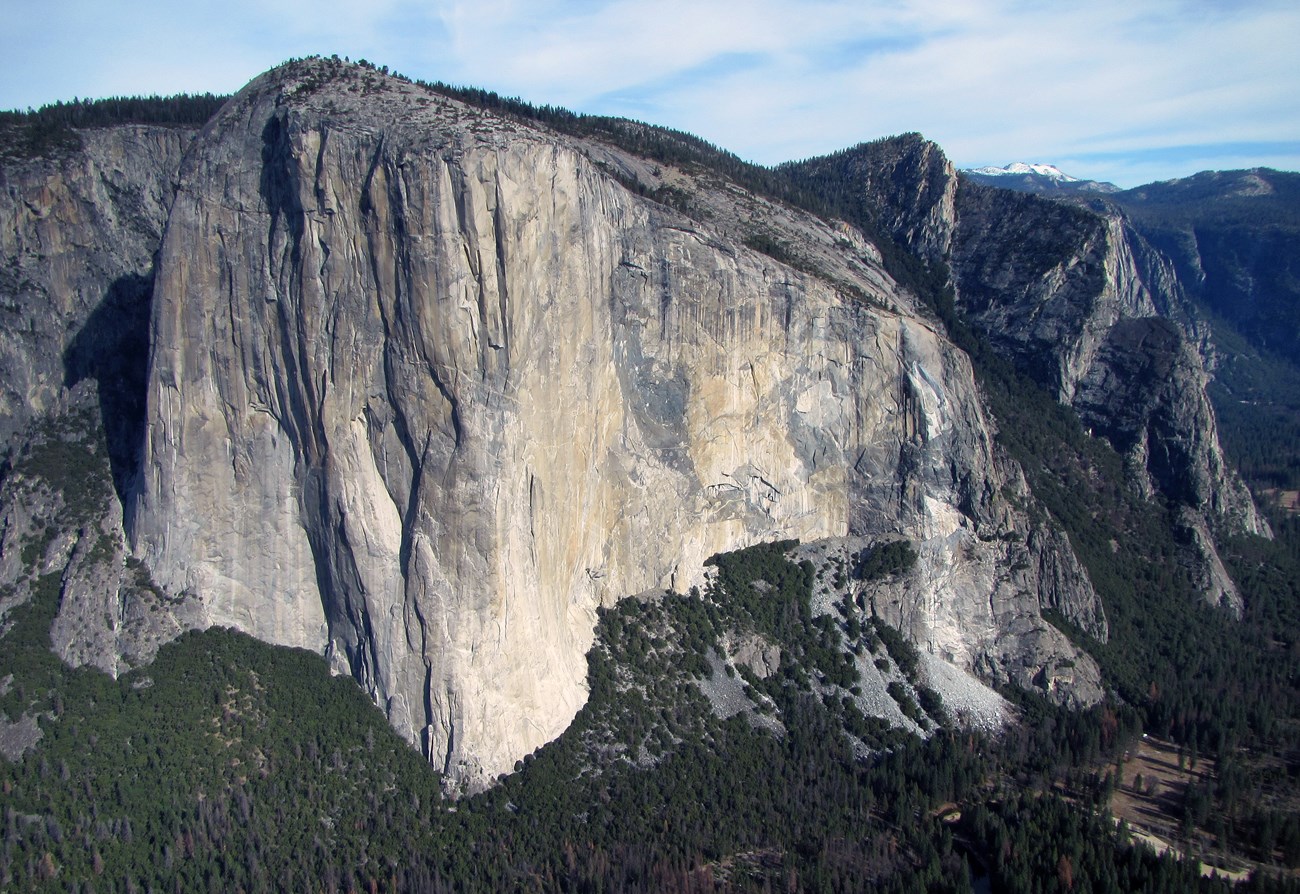
More than 90% of the park’s landscape is composed of Cretaceous granitic rocks, but some remnants of Yosemite’s older and younger geological history are preserved in metamorphic and volcanic rocks within the park and on its borders. The oldest rocks in Yosemite are metamorphic, meaning that they have been altered by high temperature, pressure, and stress caused by tectonic processes. There are two northwest-trending belts of metamorphic rocks in Yosemite, one on each side of the plutonic rocks that make up the core of the range. They are mostly remnants of ancient marine sedimentary rocks, like sandstone and limestone, deposited around 400–500 million years ago and later deformed and metamorphosed to quartzite and marble. The youngest rocks in the park are volcanic. Volcanic rocks form when magma erupts as lava flows or blows apart and spreads over the countryside as tuff. There are small outcrops of volcanic rocks within Yosemite, such as Little Devils Postpile near Tuolumne Meadows, and larger lava flows north and east of the park. The volcanic rocks inside the park include basalt and andesite flows and dacite flows and tuffs. The Mono Craters east and southeast of the park are rhyolite volcanoes that erupted stubby flows and tuffs from about 30,000 to 650 years ago. 
Uplift and Landscape EvolutionEvolution of the landscape is as much a part of the geologic story as the rocks themselves, and Yosemite is a place where the dynamism of geologic processes is well displayed. By the end of Cretaceous time, about 65 million years ago, subduction and granite production ended. At that time the Sierra Nevada was a substantial mountain range. For tens of millions of years, gradual erosion stripped away the overlying volcanic and metamorphic rocks, exposing the granites that once formed at depth. Within the past 20 million years or so, the region began to uplift and tilt toward the southwest, a process that would eventually lead to the present Sierra Nevada. Faulting on the eastern part of the range steepened the western slops and rivers, causing them to carve valleys more quickly. As the rate and degree of southwest tilt increased, the gradients of streams flowing southwestward to California's Central Valley also increased, and the faster-flowing streams cut deeper and deeper canyons into the mountain block. Glaciers Enter the PictureAs the world started to cool about 3 million years ago, glaciers began to advance and retreat repeatedly from the range crest. During cold periods, glacial ice covered much of the higher Yosemite area and sent glaciers down most of the valleys. Glaciers deepened and widened previously stream-cut valleys that were later partially filled with sediment. Most of the glacial features in the park reflect the most recent major episode of glaciation, referred to locally as the Tioga Glaciation, which began about 26,000 years ago and reached its maximum extent about 18,000 years ago. During the Tioga Glaciation, glaciers covered most areas in and around Yosemite National Park above 8,900 feet (2,700 m) in elevation. 
Yosemite's landscape would not be the same without the imprint of glaciers. Landforms that are the result of glaciation include glacially polished granite, U-shaped canyons, jagged peaks, rounded domes, waterfalls, moraines, erratics, and glacial lakes. Glaciers tend to smooth those landforms that are completely buried in ice (such as Lembert Dome) and sharpen those that project above it (such as Cathedral Peak). As glaciers scrape over bedrock, sediment embedded in the ice polishes the granite and leaves behind linear scratches called glacial striations. Many features deposited by glaciers can be seen in the park, such as moraines and erratics, which are solitary boulders transported by glaciers, often long distances, and left behind as the ice melted. The joints (fractures) in the park’s granitic bedrock significantly influenced glacial erosion patterns in this otherwise homogeneous, erosion-resistant landscape. 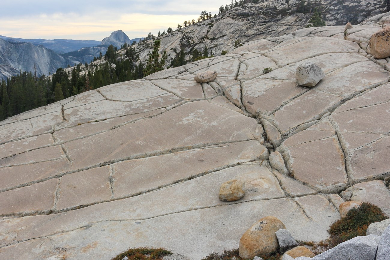
Glaciers convert narrow, V-shaped, river-carved canyons into broader U-shaped valleys with steep walls and relatively flat floor, due to the erosional power of the moving ice that is extended far up the valley walls. Lyell Canyon and Yosemite Valley are examples of U-shaped valleys. Glaciers carving the main valleys were thicker and had more erosive power than those in tributary valleys. When glaciers retreat, the tributary valleys are left hanging high above the floor of the main valleys, and their streams pitch into the main valleys as waterfalls. Bridailveil, Yosemite, Sentinel, and Ribbon falls are hanging waterfalls. Virtually all the natural lakes in the park are the result of glacial scouring. But even these lakes are transitory, fated to fill with sediment and become meadows. Mirror Lake is an example of a former lake that is now nearly filled with sediment. 

The modern glaciers in the Sierra Nevada are not remnants of last Pleistocene glaciation, but are the product of more recent climate fluctuations. Warming temperatures at the end of the Pleistocene and beginning of the Holocene (11,000 years ago) reached a maximum about 5,000 years ago, when it is thought that glaciers in the Sierra Nevada had melted away entirely. Currently, two directly adjacent glaciers, the Lyell and Maclure glaciers, remain in the highest peaks of the park. They are among the longest-studied glaciers in North America and are important to local ecosystems, providing a year-round supply of cold water to the Lyell Fork of the Tuolumne River. Yosemite’s modern glaciers may have been near their maximum extent in 1872, when John Muir made the first measurements of their movement. Since that time, the glaciers have lost more than 90% of their volume, and the Lyell Glacier no longer moves. These glaciers are among the most visible indicators of climate change in Yosemite National Park and will soon disappear. 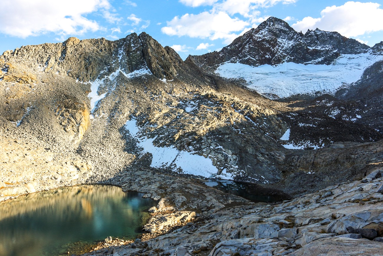
Rockfalls and Other Active Geological ProcessesYosemite National Park records its dynamic geologic history in its rocks and landscape, being a key place to understand the evolution of Sierra Nevada and geological processes, such as granite formation, glacial geomorphology, and tectonics. Today, rockfalls are the most active geological process in the park, triggered by rain, earthquakes, and even solar heating. These dramatic events continue to shape the valley walls but also pose considerable risk to people. More gradually, sediment fills alpine lakes, and the Maclure and Lyell Glaciers, although melting at a rapid rate, continue to scour the bedrock beneath them. From its granitic domes and waterfalls to its sediment-filled valleys, Yosemite National Park exhibits the past processes of plate tectonics and glaciation along with ongoing weathering and erosion that continue to shape one of America’s most impressive landscapes. More Information
Yosemite Observer Dashboard: GeologyVisual, interactive information about current weather, stream flow, fires, and air quality conditions; all on one site! Videos
|
Last updated: November 22, 2024

