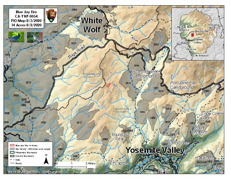
Location: In the wilderness 4 miles south of White Wolf campground and 1 mile west of Lukens Lake trail at approx. 9,000 feet elevation.
Discovery Date: July 24, 2020
Size: 15 acres
Containment: 0%
Strategy: Confine and Contain
Cause: Lightning
The Blue Jay Fire was ignited by lightning on July 24th. Current fire behavior is an active perimeter with creeping and smoldering through ground litter on the forest floor and burning in pockets of accumulated dead and down logs with some isolated single tree torching. Fire is producing moderate light smoke moving to the east. The fire is expected to continue creeping and smoldering as it burns through timber litter with an overstory of lodgepole and red fir.
The strategy for this fire is to confine and contain it to specific area, utilizing natural barriers for the fire to burn into, such as granite and bare ground. This minimizes fire suppression impacts in the wilderness and reduce exposure to firefighters in a remote area of the park where there are no trails or campgrounds. Firefighters are on scene and will continue to monitor fire behavior.
The area the fire is burning in is a fire adapted ecosystem. There are currently no threats to infrastructure or hiking trails. The fire will be visible from Tioga Road, Glacier Point, and from high country viewpoints.
Park Managers are working with the local Air Quality Districts and will be monitoring smoke impacts to the park and local communities.
For the most up-to-date fire information follow the Inciweb link: inciweb.nwcg.gov or search Inciweb, Blue Jay Fire.