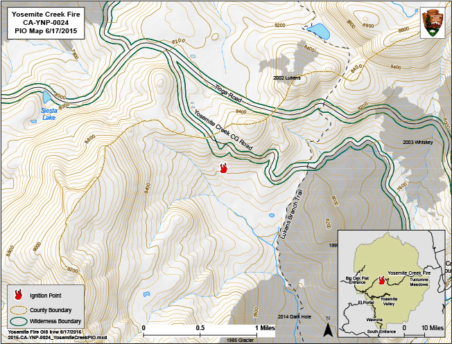
Active fires being managed for multiple objectives: The current fires are due to thunderstorm activity over the Sierra Nevada Mountains and Yosemite since June. The national weather service is predicting continued drier and warm conditions. All the fires are being monitored by Yosemite National Park firefighters.
Other Fires
Boundary (37 45.778 x 119 40.502 – Mariposa Co., 8,000 ft, June 6). This fire is near Boundary Peak and has been inactive over the last week. A single red fir was struck by lightning. It is surrounded by granite and has low potential for growth. The fire will be monitored.
South Fork (37 47.965 x 119 40.5028, - Mariposa Co., 8,100 ft, June 6). This fire is approximately one half mile from Cascade Creek. A single red fir tree was struck but in an area of huckleberry brush and needle litter. This fire is on a northeast aspect and has low to moderate potential for growth. This fire has also been inactive.
Wheel (37 55.430 x 119 27.873 – Tuolumne Co., 7,412 ft, June 8). This fire is remote and near Glen Aulin High Sierra Camp and Waterwheel Falls. It is in a red fire, lodge pole and Jeffrey pine forest. It is on the south side of the Tuolumne River. Brush and ground forest litter was observed to be smoldering. It has low potential for growth. This fire is also inactive with no visible smoke.
Smoke that may be visible in the park today, June 18, is due to current fires outside of the park in the Mariposa and Oakhurst areas. Smoke from these fires may be visible from many locations within the park.
All visitors are urged to use established campgrounds for fires. In all campfires, when departing, please be sure all fires are out.
Our top priority is to keep the public and firefighters safe.

