Last updated: October 29, 2023
Thing to Do
Hike Mount Rose
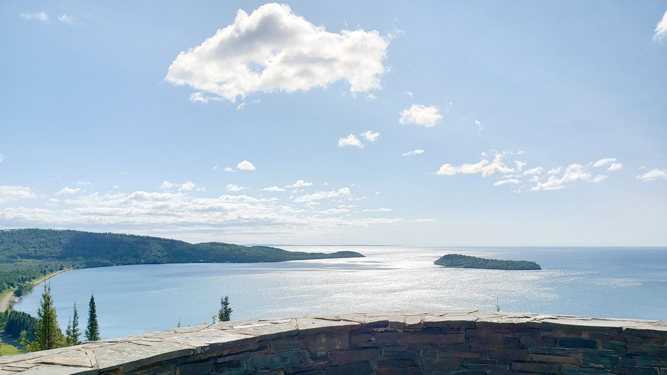
NPS Photo / GM Spoto
Hike to the top of Mount Rose for a spectacular view of Grand Portage Bay and beyond – on a clear day, Isle Royale is visible! From a protective stone wall, get a bird's eye view of the depot or look west to the gap in the land where the voyageurs transported goods along Gichi Onigaming, the Grand Portage Trail. Learn about the ancient geology that created the rugged beauty of the North Shore landscape.
The Mount Rose hike is available year-round – see which animals left their tracks in the snow! In spring, watch the snow recede and the leaves unfurl while many wildflowers emerge. In early summer, bring your binoculars or listen for returning birds. The surrounding forest in fall is loaded with fiery color.
Details
Duration
30-90 Minutes
Activity
Front-Country Hiking
Age(s)
No minimum age. Suggestion is for people who can walk a half mile uphill to the summit, ascending and descending multiple staircases.
Pets Allowed
Yes with Restrictions
Pets are allowed on a leash 6 feet or less.
Activity Fee
No
Entrance fees may apply, see Fees & Passes information.
Location
Mount Rose Summit
Reservations
No
Season
Year Round
In winter the trail can be icy with areas of deep snow. Snowshoes are difficult to use on the stairways so be prepared with sturdy footwear and clothing appropriate to breaking a trail.
Time of Day
Day
Accessibility Information
The Mount Rose Trail is steep and rocky in places with multiple staircases. The trail is less than three feet in width throughout.
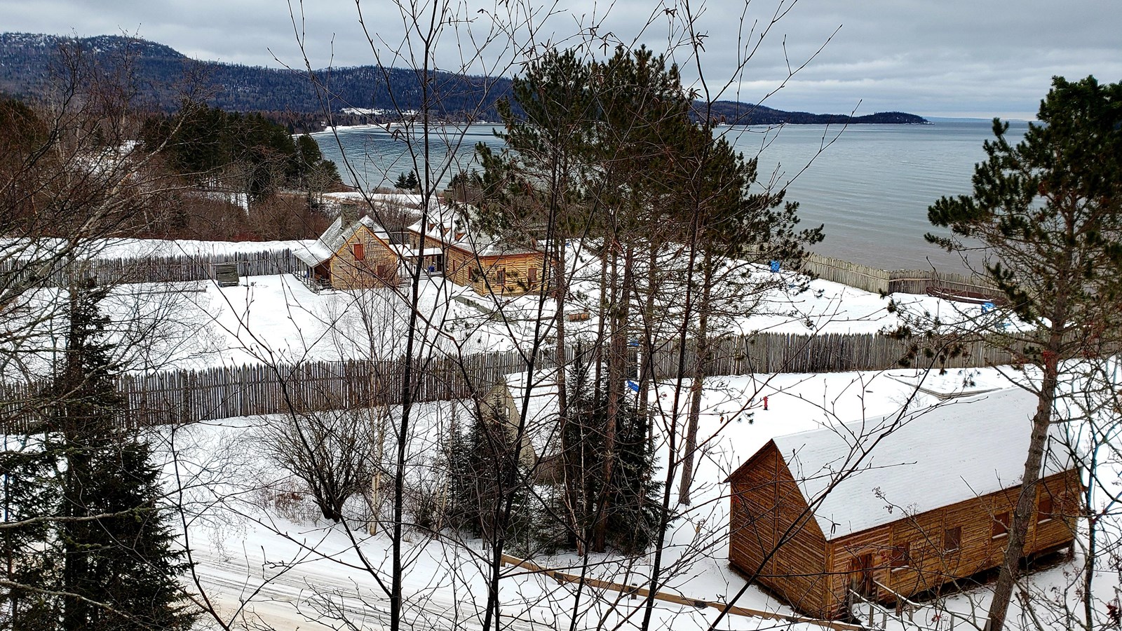
NPS photo / GM Spoto
Quick Facts
Amenities
3 listed
Historical/Interpretive Information/Exhibits, Scenic View/Photo Spot, Trailhead
Mount Rose Trail and Loop
Fires are prohibited on the Mount Rose Trail
Two ways to access the trail:
Mount Rose Loop Trail
- Dirt path between flights of wooden stairs accessed from the Heritage Center parking lot, near the picnic area
- Gradual, steady climb up the gentle spine of Mount Rose, a little less than a mile round trip
Mount Rose Trail
- Asphalt trail with stone steps and guardrails in steepest sections, ~1.5 miles round trip from the trail head across from the Depot.
- The trail switchbacks its way up south wall of Mount Rose.
- Rock walls protect hikers from cliffs and provide impressive views of the historic depot and Grand Portage Bay
Trail Information
- The Mount Rose Loop Trail begins in the picnic area at the west end of the Heritage Center parking lot. The older Mount Rose Trial begins across from the historic depot’s stockade and main gate on Mile Creek Road
- A series of wooden steps climb the side of an ancient rock wall then a dirt path gently rises along the spine of Mount Rose until it connects with the older paved Mount Rose Trail near the overlook, the highest point of Mount Rose (906 ft., 276 m)
- Hikers can descend Mount Rose Trail on a series of sandstone steps and paved trail eventually coming out of the forest near the main gate of the historic depot
- The Mount Rose Trail meets the Grand Portage corridor near the gatehouse and north gate, offering an alternative route to enter the historic depot through the gatehouse on the Grand Portage corridor as the voyageurs did
- Hikers can also see the historic depot first and hike the Mount Rose Trail on the way back to the parking lot
- Wayside exhibits along the trail inform visitors about natural and historical features in Grand Portage