Last updated: January 20, 2021
Thing to Do
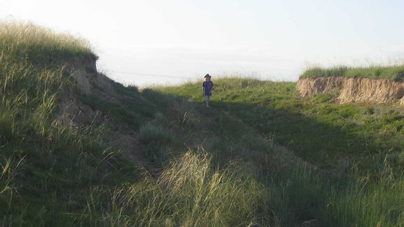
Go See Oregon Trail Ruts
Photo/NPS
The Oregon and California trails provided pathways to the Pacific for fur traders, gold seekers, missionaries, and emigrants. From 1841 to 1861, more than 300,000 emigrants followed this route from the Midwest to fertile Oregon farmlands or California gold fields—trips that took five months to complete.
Over the years, thousands of wagon wheels and hooves churned the earth as they traveled west. Covered wagons struggled up hills in the mud left behind by torrential summer downpours. Emigrants fought to slow oxen down steep hillsides as they dug their hooves in to break. All of this activity left a discernable trail in the hard rock and a wider swale in softer soil. Though the wagon trains didn't all follow the same route, sometimes using cutoffs, the evidence of the tremendous amount of westward travelers can still be seen today.
Their traces are often referred to as wagon ruts and they can appear a variety of ways depending on the type of soil and the continued effects of water erosion. In some places, the ruts might look like a very obvious ditch, and in others they might be a wider, shallower, drainage.
One of the best ways to experience the Oregon Trail is by taking a step back in time while visiting a trail rut. Luckily, there are still places where you can have that experience today. Take a look at the the list below and plan your visit to the mid-1800s today!
These trail sites are working hard to protect these important historical resources. Please remember to treat these special trail resources carefully and with respect when you visit.
National Frontier Trails Museum
The historic trails passed through this area in the field that is directly across from the National Frontier Trails Museum. Evidence of the trails can still be seen in the field in the form of swales, which marks the exact route used by emigrants as they traveled westward.
Santa Fe Park
Santa Fe Park preserves approximately one-quarter mile of Oregon, California, and Santa Fe trail ruts in the heart of the city of Independence, Missouri. These ruts align with trail ruts found a half mile north on the Bingham-Waggoner estate, a 19.5 acre museum and park, that is open to the public.
Wieduwilt Swales (85th and Manchester)
Wieduwilt Swales are the grassed-over evidence of three historic trails that passed through the area, the Santa Fe, California, and Oregon. Thousands of wagons, carts, livestock, and people traveled on these trails, which created ruts and left deep depressions in the earth. After the traffic stopped, vegetation slowly reclaimed the muddy and barren ground of the trails, creating the swales that are still visible today.
Emigrants heading west from Independence encountered their first river crossing at Minor Park, a preview of the many water crossings to be negotiated on their long journey west. Here, wagon trains crossed the Blue River by fording, since the first bridge across the river wasn't constructed until 1859. Numerous emigrants wrote about or mentioned the crossing in their diaries.
Prairie Village Santa Fe Trail Park
Prairie Village Ruts marks the location of the Oregon, California, and Santa Fe Trails in the form of rounded depressions in the ground called swales. These swales were once part of a well-defined path, most equivalent to a modern day dirt road, that was created as thousands of oxen, cattle, and wagons traveled across the land. They eroded and compacted the ground, which created ruts. Over time, the ruts were weathered into the more gently sloping swales visible today.
Lone Elm Campground
Lone Elm Campground is where many Oregon, California, and Santa Fe trail travelers spent their first night west of the Missouri River. For several decades, starting in 1821, this site served as a campground and rendezvous point for people traveling along these trails. The wagon swales created by the travelers can still be seen in the park, where the overland trails crossed a creek.
Alcove Spring Swales
The hilly area around Alcove Springs made travel difficult for emigrants. Heavy wagons being pulled forward by livestock dug into the ground, creating ruts. These ruts were deepened and lengthen by wagons wet from river crossings, which made the ground muddy. The ruts were maintained, and grew, by the thousands of wagons that traveled through this area. They can still be seen today.
O'Fallon's Bluff at Sutherland Rest Area
O'Fallon's Bluff is a section of bluffs about 20 miles long that sits next to the south side of the Platte River. The bluffs close proximity to the river forced the emigrant trails onto a narrow path that went up and over the bluffs. Over time, as thousands of wagons, emigrants, and livestock went up the rise, ruts were carved into the dry bluffs. These ruts are still visible today at Sutherland Rest Area.
California Hill
California Hill reveals the difficult decisions emigrants had to make when choosing their route to Oregon. Near North Platte, Nebraska, the Platte River splits into two major forks. Several crossing sites were used, but the Upper Crossing was the most important because it led to the best approach to the North Platte. However, this meant traveling over California Hill, which necessitated a steep climb of 240 feet in 1½ miles.
Ash Hollow State Park- Windlass Hill Area
Windlass Hill is scarred by deeply eroded ruts cut by thousands of wagons sliding downhill with their wheels locked on the Oregon Trail. Due to the steepness of the grade, the wagons could easily travel at speeds that were not good for them or the livestock pulling the wagons. They were slowed by locking the wheels, which prevented the wheels from turning and increased friction.
Bedlam Ruts
The Bedlam Ruts are a fine stretch of Oregon Trail ruts and swales that visitors can walk. This Trail segment is on 40 acres of undeveloped public lands jointly managed by the Bureau of Land Management and the National Park Service (Ft. Laramie National Historic Site).
Independence Rock State Historic Site
Independence Rock was the most-noted landmark of the wagon trails west of Fort Laramie. The rock derived its name from a party of fur trappers who camped and celebrated Independence Day near the rock on July 4, 1830. Eventually, thousands of emigrants camped at the foot of this 1,900 feet long by 850 feet wide granite outcrop. They carved their names and messages into the granite, using Independence Rock as a bulletin board for Oregon Trail.
South Pass
South Pass , a 20 mile wide, gently sloping gap in the Rocky Mountains, was perhaps the most important landform along the emigrant trails. It opened the West to settlement by providing a route over the Continental Divide that wagons could negotiate. Everyone who followed the Oregon Trail through Wyoming used this sagebrush and grass covered saddle. A wide and deep path was created as thousands of wagon wheels and livestock hooves steadily eroded the ground.
Oregon Trail Ruts State Historic Site
Oregon Trail Ruts State Historic Site , also called the Guernsey Ruts, is located where the geography of the area forced the Oregon Trail to change course. At this point, the Trail was blocked from continuing along the North Platte River by a steep ridge of sandstone rock. It had to go up and over the ridge in order to continue heading west.
Oregon Trail Park and Marina
Oregon Trail Park and Marina contains a short segment of original Oregon Trail wagon swales. The Trail, marked by white carsonite markers, heads up from the park's lake, Alexander Reservoir, and crosses the park's entrance road. Look for the swales in the grass on either side of the entrance road near its junction with U.S. 30.
Massacre Rocks Rest Area- Historical Site
Remnants of the Oregon and California Trails can be found by continuing on the trail at Massacre Rocks Rest Area to the historical site . To reach this site, walk past the Snake River overlook and through the tunnel that goes underneath both lanes of the interstate highway. When you exit the tunnel, follow the trail to right. It will take you first to a series of interpretive wayside exhibits on Oregon Trail history.
Milner Historic Recreation Area Swales
The Oregon Trail ruts at Milner Historic Recreation Area cut across the loop road here in a couple of places. The shallow trough-like swale can be seen extending on both sides of the road through the grassy landscape dotted with sagebrush. Small white posts labeled "Oregon Trail" mark the position
of the swale.
Echo Meadows
The primary route of the Oregon Trail passed through Echo Meadows from 1847-1860. Just four miles from the Umatilla River crossing, emigrants did not stop or camp here, but they left signs of their passing nonetheless. Deep wagon swales were created as the emigrants passed through the meadows, which remain to this day.
The primary route of the Oregon Trail passed through Echo Meadows from 1847-1860. Just four miles from the Umatilla River crossing, emigrants did not stop or camp here, but they left signs of their passing nonetheless. Deep wagon swales were created as the emigrants passed through the meadows, which remain to this day.
National Historic Oregon Trail Center- Trail Ruts
The National Historic Oregon Trail Interpretive Center is located at the top of Flagstaff Hill. The Oregon Trail reached this hill by going through the small valley, known as Virtue Flat, that lies just south of the center. Traveling through this valley was no easy task. Emigrants had to fight their way through shoulder-tall sagebrush just after spending four or five difficult days ascending Burnt River.
Details
Activity
Self-Guided Tours - Auto
Plan a roadtrip to see Oregon Trail wagon ruts along the Oregon Trail. Trail sites are listed by state, so you can find a place near you, or plan a mult-day trip.
Pets Allowed
Yes
Activity Fee
Yes
Entrance fees may apply, see Fees & Passes information.
Reservations
Yes
Accessibility Information
Accessibility Information will vary by site. Please check with the individual site before visiting.