.jpg?maxwidth=650&autorotate=false)
National Park Service. 1.8 miles, 2.9 kilometers To reach Birch Bluff Trail, walk approximately one-third of a mile down the Laurel Loop Trail, which you can access behind the bathrooms in the Pine Grove Picnic Area. The Laurel Loop Trail has yellow blazes on the trees. Once on Birch Bluff, follow the red blazes through the woods until you reach a clearing. South Fork Quantico Creek will be in front of you. 
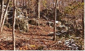
National Park Service The trail follows the creek for about ten minutes with rock outcroppings lining parts of the trail. Also, remnants of beaver activity can be found along the creek-side. Before you meet back up with the Laurel Loop Trail, the creek widens. Here you can see the creek partially frozen over in the cold of January. _1.jpg?maxwidth=650&autorotate=false)
National Park Service Follow the trail around the bend and you will come upon a small cascade surrounded by many downed trees. From here it is only a short walk to the yellow-blazed Laurel Loop Trail. This trail will lead you back to the Pine Grove Picnic Area where your journey began. |
Last updated: September 28, 2017
