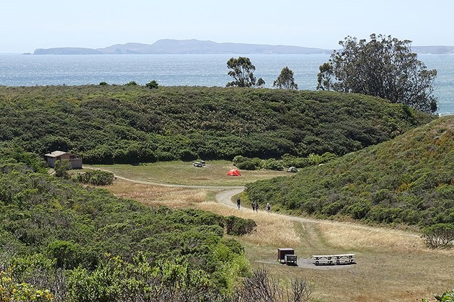
NPS/A. Kopshever Loading...
Basic Information
Amenities Fire/Stove Policy Toilet Types Shower Types Weather Email Address Phone number (Voice) Mailing Address Physical Address Directions Additional Information Cell Phone Additional Information Internet Additional Information Regulations
Image Gallery
Accessibility Information

NPS Photo Site Availability and DirectionsSites available for reservations through Recreation.gov three (3) months to the day in advance: Regular sites #1, #4, #6, #10, #12, & #14 and Group sites #8 & #13 Sites available for reservations through Recreation.gov 14 days in advance: Regular sites #2, #3, #5, #7, #9, & #11
Hiking Routes to Coast CampgroundFor the shortest approach to Coast Campground on solid ground, start at the Laguna Trailhead (geographic coordinates: 38.0434, -122.8585). Drive 9.4 km (5.9 miles) along Limantour Road until you reach the Laguna Road junction, which is signed for Hostel and Education Center (if you are using Google Maps, please be aware that this road is mislabeled as "Limantour Spit Rd"). Turn left and drive 0.8 km (0.5 miles) to the Laguna Trailhead. If the Laguna Trailhead parking lot is full, there is overflow parking on the south side of the access road before you reach the turn to cross a bridge that leads into the Laguna Trailhead parking lot. Please make sure that your vehicle is completely off the pavement of this narrow, one-lane access road to allow passage by emergency vehicles. From the Laguna Trailhead, you can hike to Coast Campground via the Laguna and Firelane Trails climbing over a 120-meter-tall (400-foot-tall) ridge. This route is 2.9 kilometers (1.8 miles) long, but is closed to bicycles and other wheeled devices since it passes through Wilderness. There is also a vernal pool through which the trail passes near the ridgecrest. This vernal pool is frequently filled with water in the winter and spring, so expect to get your feet wet if you are hiking this route during the "rainy season." To keep your feet dry (or at least drier) during the "rainy season," you will want to follow the Coast Trail from the Coast Trailhead (geographic coordinates: 38.0438, -122.8636), which is located on the south side of Laguna Road (if you are using Google Maps, please be aware that this road is mislabeled as "Limantour Spit Rd") just west of Limantour Lodge (formerly called the Point Reyes Hostel). DO NOT park in the lodge's parking lot or anywhere on the north side of Laguna Road; parking is allowed on the south side of Laguna Road. Please make sure that your vehicle is completely off the pavement of this narrow, one-lane access road to allow passage by emergency vehicles. The Coast Trail offers an easy, flat 4.3 km (2.7 miles) route. If you'd prefer to hike on a beach to get to Coast Campground, drive to Limantour Beach, but do not park in the large, gravel day-use-only parking lot; just before you reach the main parking lot, there is a spur road that branches off to the east. Drive 0.6 km (0.4 miles) along this spur road to a small, paved parking lot (geographic coordinates: 38.0262, -122.8769) and park in one of the designated parking spots. Overnight parking is permitted in this lot for those that have current and valid backcountry camping reservations. From here, hike along the path to the beach and turn left to walk east on the beach for 2.2 km (1.4 miles) until you arrive at the beach access path descending down from Coast Campground. Or, if you'd prefer a hike that is closer to 6.4 km (4 miles), park at the Sky Trailhead (geographic coordinates: 38.0549, -122.8381) along Limantour Road and hike to Coast Campground via the Laguna or Fire Lane Trails. Both of these routes descend from an elevation of ~200 meters (~670 feet) near Inverness Ridge's crest. If you are interested in a longer hike, park at the Bear Valley Trailhead (geographic coordinates: 38.0398, -122.7994) to hike up and over Inverness Ridge. Overnight parking is available in the gravel parking lot near the trailhead; do not park in the paved lot near the visitor center. Download the Bear Valley Area Map (427 KB PDF), which shows the location of the trailhead parking lot relative to the Bear Valley Visitor Center. There are a variety of options to hike from Bear Valley to Coast Campground, with the shortest being about 9.6 kilometers (6 miles) long. The highest elevation along: the Mount Wittenberg Trail is ~400 meters (~1300 feet); the Meadow Trail is ~325 meters (1075 feet); and the Horse Trail is ~333 meters (1100 feet). There is only one route to Coast Campground open to bicycles and other non-motorized wheeled devices, like wagons. Follow the Coast Trail from the Coast Trailhead (geographic coordinates: 38.0438, -122.8636), which is located just west of Limantour Lodge (formerly called the Point Reyes Hostel). The Coast Trail offers an easy, flat 4.3 km (2.7 miles) ride on dirt and gravel substrate. Campground MapDownload the aerial photo/map of Coast Campground. (269 KB PDF) |
Last updated: September 18, 2024
