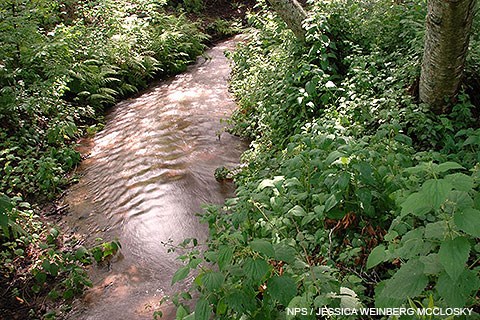
On their way to the ocean, the streams of Point Reyes and Bolinas Ridge flow through the canyons and valleys of coastal mountains, linking forest, chaparral, scrubland, grassland, and marsh. Riparian woodlands develop along stream banks and floodplains, and coastal wetlands and estuaries form where the streams enter the sea. The streams transport nutrients, sediments, and oxygen through the watershed, and support numerous animals, including frogs, salamanders, snakes, muskrats, and river otters. Deciduous trees—such as maples, cottonwoods, alders, and willows—grow along the stream banks, providing shelter and shade for many animals. Leaves fall in the stream and decompose, adding nutrients and organic matter. Algae and mosses proliferate in the water and on rocks, providing food for invertebrates (including insects), fish, and birds. Anadromous fish, such as the federally endangered coho salmon and the federally threatened steelhead trout, migrate from the sea to freshwater to spawn and die and decompose bringing nutrients from the sea upstream. Most of the streams of Point Reyes and Bolinas Ridge are not large and their tributaries are frequently ephemeral. River runoff, the amount of water discharged through surface streams, is determined by a combination of factors, including local geology, topography, drainage area, and rainfall patterns. As streams flow from their headwaters toward the coast, rivers carve steep, narrow canyons through the mountains. As they approach the coast they lose speed, depositing sediment to build broad floodplains with rich, deep soils. Coastal rivers also play a crucial role in replenishing sand lost from beaches. As rainfall and moisture diminish southward along the California coast, runoff decreases and rivers are accordingly smaller in size. The overall condition of these streams reflects impacts of more than a century of intensive agricultural land use, combined with the instability associated with the highly active San Andreas Fault. The effects of past land use practices (logging, agriculture, and grazing) have changed the condition of the watershed, altering its ability to support fish populations at their historic levels. Dam construction, channelization, water diversion projects for agricultural irrigation, and the increased water demands of growing urban areas have dramatically altered the natural hydrologic regime and sediment transport. Dams can also block the path of migrating fish, damage fish spawning gravels, deprive estuaries of needed fresh water, and reduce sediment nourishment of beaches (See the Stressors chapter of the Coastal Watershed Assessment referenced below for more information). Loss of native perennial vegetation, soil compaction and loss, gullying, and incision of swales and meadows have changed the runoff patterns and reduced the capacity of the watershed to attenuate pollutant loading and surface runoff to streams. Although land use activities have been greatly reduced and upgraded to more environmentally sustainable practices, current land use continues to influence water quality within many watersheds. In an arid, Mediterranean climate like that of the San Francisco Bay Area, creeks and streams provide corridors of precious water that can sustain dense stands of trees and wetland plants, and support habitat for birds, fish, amphibians, insects, and aquatic invertebrates. Federally endangered coho salmon and threatened California red-legged frogs are among the many at-risk species that rely on healthy waterways in the Bay Area. While Point Reyes National Seashore doesn't have any large rivers, it does contain many small creeks and streams, including:
The text above is adapted from the Coastal watershed assessment for Golden Gate National Recreation Area and Point Reyes National Seashore. Learn more...Pacific Coast Science and Learning Center: Rivers and Streams Pawley, A. and M. Lay. 2013. Coastal watershed assessment for Golden Gate National Recreation Area and Point Reyes National Seashore. Natural Resource Report NPS/PWR/NRR—2013/641. National Park Service, Fort Collins, Colorado. Available at https://irma.nps.gov/DataStore/Reference/Profile/2194043. (accessed 7 January 2023) Science & Research Project SummariesFrom 2006 to 2018, Point Reyes National Seashore and Pacific Coast Science and Learning Center (PCSLC) staff and communication interns assisted scientists conducting research through the PCSLC and the San Francisco Bay Area Inventory & Monitoring Network to produce a series of Resource Project Summaries, four of which were about creeks and streams at Point Reyes. These two-page summaries provide information about the questions that the researchers hoped to answer, details about the project and methods, and the results of the research projects in a way that is easy to understand.
Top of Page |
Last updated: October 26, 2024
