Last updated: August 22, 2025
Place
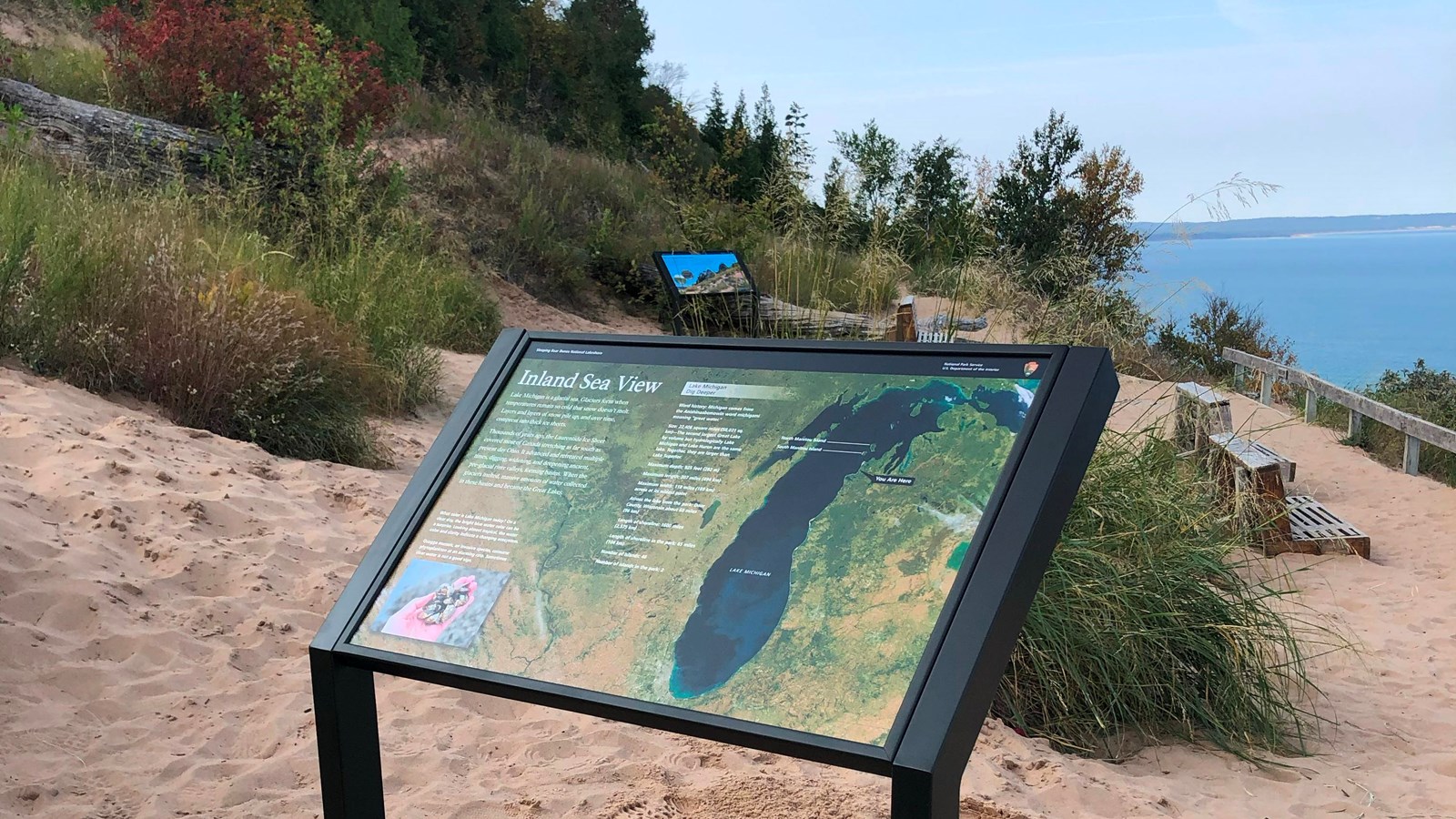
Wayside: Inland Sea View
Quick Facts
Location:
44.8013, -86.0714
Amenities
1 listed
Audio Description
Main Exhibit Text
Lake Michigan is a glacial sea. Glaciers form when temperatures remain so cold that snow doesn’t melt. Layers and layers of snow pile up, and over time, compress into thick ice sheets.
Thousands of years ago, the Laurentide Ice Sheet covered most of Canada stretching as far south as present-day Ohio. It advanced and retreated multiple times, digging, widening, and deepening ancient, pre-glacial river valleys, forming basins. When the glaciers melted, massive amounts of water collected in these basins and became the Great Lakes.
Lake Michigan: Dig Deeper
- Word history: Michigan comes from the Anishinaabemowin word michigami, meaning “great water.”
- Size: 22,406 square miles (58,031 sq. km)—The second largest Great Lake by volume but hydrologically Lake Michigan and Lake Huron are the same lake. Together, they are larger than Lake Superior.
- Maximum depth: 925 feet (282 m)
- Maximum length: 307 miles (494 km)
- Maximum width: 118 miles (189 km) across at its widest point
- Across the lake from the park: Door County, Wisconsin about 60 miles (96 km)
- Length of shoreline: 1600 miles (2,575 km)
- Length of shoreline in the park: 65 miles (104 km)
- Number of islands: 46
- Number of islands in the park: 2
Image Descriptions
Background Image
The background of this exhibit is a satellite image of Lake Michigan and the surrounding area. Visible and labeled in the lake are North Manitou Island and South Manitou Island, as well as a You Are Here marker near the shore of the lake. Also visible in the aerial photograph are wispy clouds and other landscape features such as rivers, vegetation, and cities.
Caption
What color is Lake Michigan today? On a clear day, the bright blue water color can be a surprise. Looking almost tropical, the water color and clarity indicate a changing ecosystem.
Quagga Mussels (bottom left)
In the bottom left corner of the exhibit is a photo of a hand holding many small mussels. The mussels are tan and black with a striped pattern.
Caption
Quagga mussels, an invasive species, consume phytoplankton at an alarming rate. Sometimes clear water is not a good sign.