Last updated: January 2, 2025
Place
Sable Falls Orientation Wayside
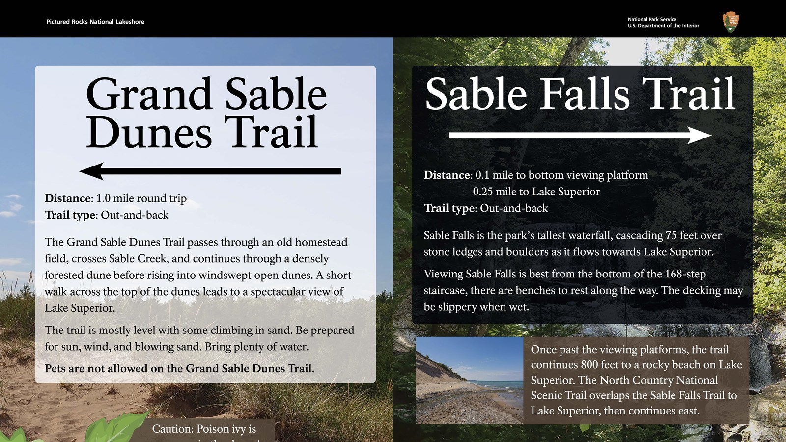
Grand Sable Dunes Trail - to the left:
Distance: 1.0 mile round trip
Trail type: Out-and-back
The Grand Sable Dunes Trail passes through an old homestead field, crosses Sable Creek, and continues through a densely forested dune before rising into windswept open dunes. A short walk across the top of the dunes leads to a spectacular view of Lake Superior.
The trail is mostly level with some climbing in sand. Be prepared for sun, wind, and blowing sand. Bring plenty of water.
Pets are not allowed on the Grand Sable Dunes Trail.
Caution: Poison ivy is common in the dunes!
Sable Falls Trail - to the right:
Distance: 0.1 mile to bottom viewing platform
0.25 mile to Lake Superior
Trail Type: Out-and-back.
Sable Falls is the park's tallest waterfall, cascading 75 feet over stone ledges and boulders as it flows towards Lake Superior. Viewing Sable Falls is best from the bottom of the 168-step staircase, there are benches to rest along the way. The decking may be slippery when wet.
Once past the viewing platforms, the trail continues 800 feet to a rocky beach on Lake Superior. The North Country National Scenic Trail overlaps the Sable Falls Trail to Lake Superior, then continues east.
Map describes the trail system, you are currently at the junction between the Sable Falls Trail and the Dunes Trail. Taking a right will take you to the Sable Falls Trail - which overlaps the North Country National Scenic Trail until it reaches Lake Superior. There are two viewing platforms along the way. Taking a left will take you to the Grand Sable Dunes Trail, which overlaps the North Country National Scenic Trail for about a half mile, before splitting to the right. The North Country Trail continues westward. The Dunes Trail crosses the Sable River before continuing towards a viewpoint on the dunes.