


Last updated: January 31, 2022
Place
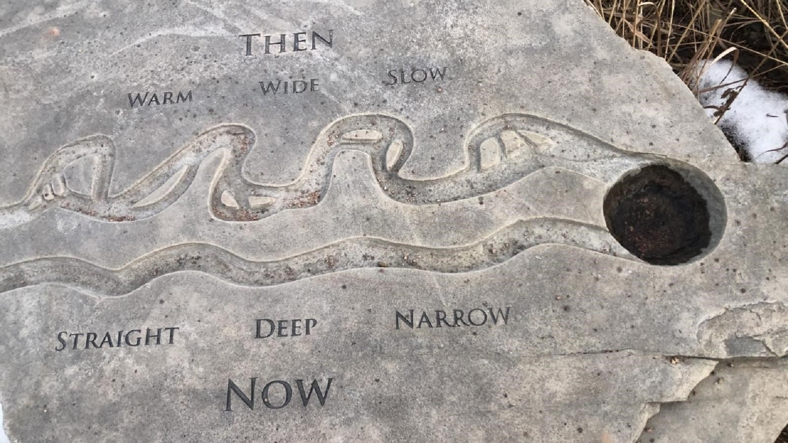
Lewis and Clark National Historic Trail Visitor Center - Missouri River Then and Now
NPS Photo
Quick Facts
Location:
Omaha, NE
Amenities
4 listed
Historical/Interpretive Information/Exhibits, Information, Information - Ranger/Staff Member Present, Information Kiosk/Bulletin Board
Lewis and Clark NHT Visitor Centers and Museums
This map shows a range of features associated with the Lewis and Clark National Historic Trail, which commemorates the 1803-1806 Lewis and Clark Expedition. The trail spans a large portion of the North American continent, from the Ohio River in Pittsburgh, Pennsylvania, to the mouth of the Columbia River in Oregon. The trail is comprised of the historic route of the Lewis and Clark Expedition, an auto tour route, high potential historic sites (shown in black), visitor centers (shown in orange), and pivotal places (shown in green). These features can be selected on the map to reveal additional information. Also shown is a base map displaying state boundaries, cities, rivers, and highways. The map conveys how a significant area of the North American continent was traversed by the Lewis and Clark Expedition and indicates the many places where visitors can learn about their journey and experience the landscape through which they traveled.
The Interpretive Garden at the Lewis and Clark National Historic Trail commemorates the journey that Captains Meriwether Lewis and William Clark, along with the rest of the expedition, took met traveled, camped, hunted, fished, and met with the native peoples in this area of middle Missouri. Visitors walking through the garden will find interpretive panels on the expedition, the local wildlife, and native plants.