Last updated: November 27, 2020
Place
Hat Rock
Quick Facts
MANAGED BY:
Lewis and Clark NHT Visitor Centers and Museums
This map shows a range of features associated with the Lewis and Clark National Historic Trail, which commemorates the 1803-1806 Lewis and Clark Expedition. The trail spans a large portion of the North American continent, from the Ohio River in Pittsburgh, Pennsylvania, to the mouth of the Columbia River in Oregon and Washington. The trail is comprised of the historic route of the Lewis and Clark Expedition, an auto tour route, high potential historic sites (shown in black), visitor centers (shown in orange), and pivotal places (shown in green). These features can be selected on the map to reveal additional information. Also shown is a base map displaying state boundaries, cities, rivers, and highways. The map conveys how a significant area of the North American continent was traversed by the Lewis and Clark Expedition and indicates the many places where visitors can learn about their journey and experience the landscape through which they traveled.
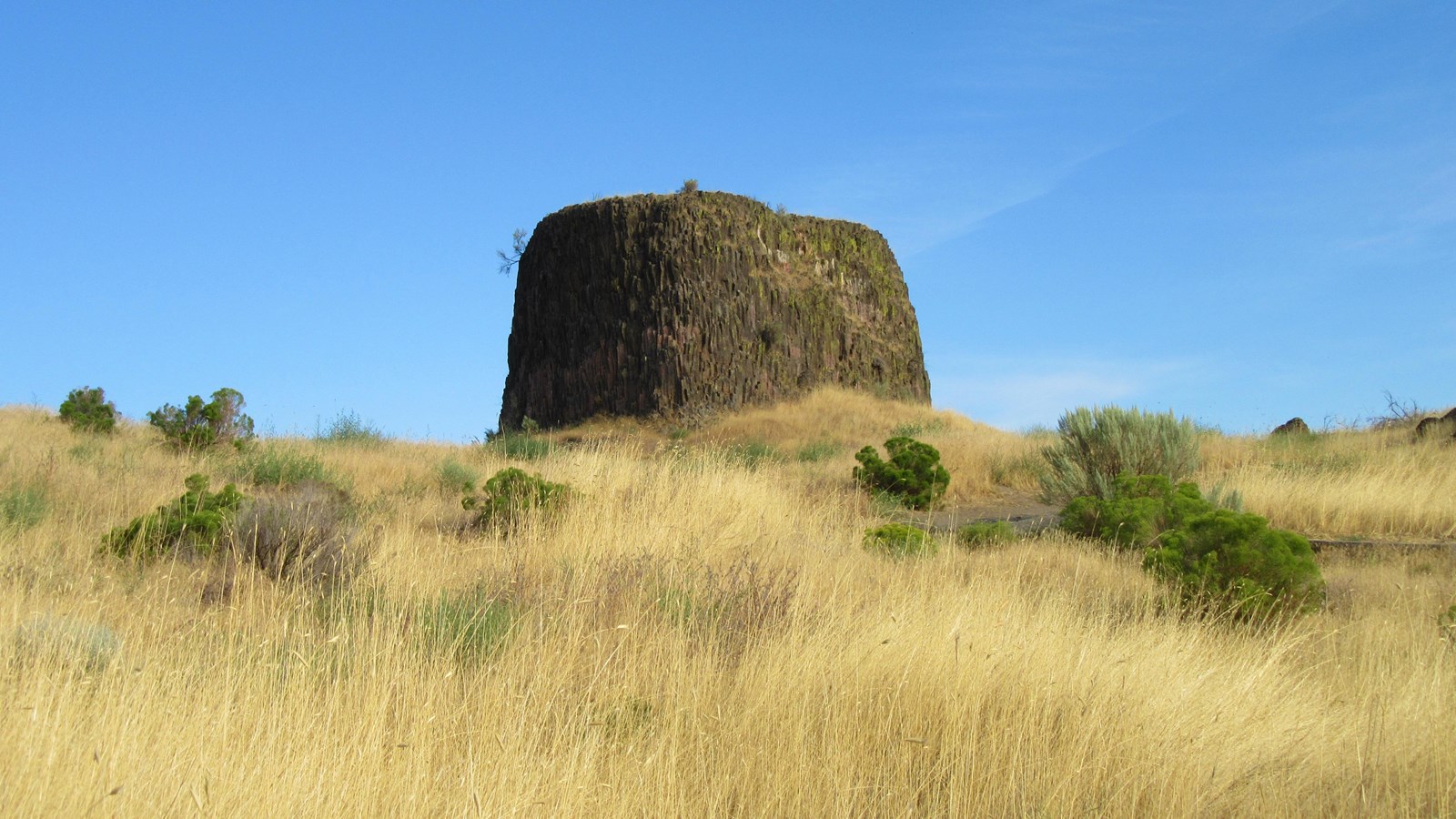
On October 19, 1805, as the expedition canoed down the Columbia River, Clark noted “a rock on the Lard. Shore resembling a hat at a rapid at the lower point of an Island in the middle of the river on which there is 7 Lodges of nativs drying fish, and opposit the head of an Isld. near the Std. side on which is 5 Lodges of nativs drying fish.” During the 1805-1806 winter at Fort Clatsop, Clark prepared a list of “Estimated Distances in Miles” from Fort Mandan to the Pacific Coast, using “remarkable places” such as distinctive landmarks, confluences, and villages as reference points. Included in that list is “the hat rock.”
Located about nine miles east of Umatilla off of Highway 730, Hat Rock is a formation of exposed basalt that rises approximately 70 feet to a plateau. It is located within the 719-acre Hat Rock State Park, which was established during the construction of the McNary Dam circa 1951-1953. On-site wayside exhibits and signage interpret the Lewis and Clark Expedition. Day-use recreation opportunities include activities such as boating, swimming, fishing, picnicking, horseback riding, and hiking. The park also provides an access point for the Lewis and Clark Commemorative Trail- a footpath along the Columbia River that extends west to the McNary Beach Recreation Area.