Last updated: January 26, 2023
Place
South Pass

Scenic View/Photo Spot
A map of Passport and Places to Go locations for National Historic Trails.
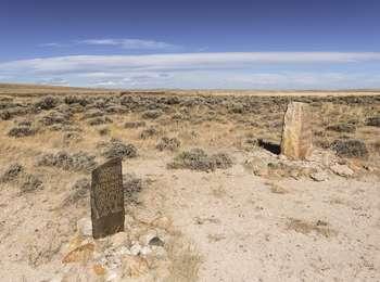
South Pass, a 20 mile wide, gently sloping gap in the Rocky Mountains, was perhaps the most important landform along the emigrant trails. It opened the West to settlement by providing a route over the Continental Divide that wagons could negotiate. Everyone who followed the Oregon Trail through Wyoming used this sagebrush and grass covered saddle. A wide and deep path was created as thousands of wagon wheels and livestock hooves steadily eroded the ground. The Oregon, California, Mormon Pioneer, and Pony Express National Historic Trails passed through here.
Emigrant Remarks
On July 12, 1846, Edwin Bryant made his way
"up a very gentle ascent to the south pass of the Rocky Mountains, or the dividing ridge separating the waters of the Atlantic and the Pacific. The ascent to the Pass is so gradual, that but for our geographical knowledge . . . we should not have been conscious that we had ascended to, and were standing upon the summit of the Rocky Mountains-the backbone . . . of the North American Continent."
Site Information
Location (From South Pass Rest Area, go south on Wyoming Highway 28 for 0.9 miles to reach Oregon Buttes Road (Fremont County 445). Turn left (southeast) onto this well-maintained dirt road. Drive 2.8 miles, slowing where the road begins curving to the right. Turn right (west) onto the two-track road that begins near the curve and drive 0.8 miles.)
South Pass National Historic Landmark, which is managed by the Bureau of Land Management, preserves these still visible ruts. The landmark is free and open to the public. Amenities are scarce; only a few monuments and signs mark the South Pass crossing. Roads in the landmark are all unpaved, but the main ones are maintained, gravel roads suitable for most vehicles when dry.
