
While almost all of the Parashant has no cell service, it was recently discovered that Verizon customers can get service (data and voice calls) at the a few places along the Twin Point road by the canyon rim with a line of sight view to the south. There are two cell towers on the south rim at Peach Springs, AZ and the Grand Canyon West Skywalk, both on the Hualapai Reservation. This guide starts in St. George. You will need a full tank of gas for this drive. There is no gas available on the Arizona Strip. Mileages listed below are approximate. Be aware that some trucks and SUVs have minor differences in odometer readings if tire size differs from the factory setting. All turns should be well marked by road signage. Rangers recommend you bring the free National Park Service Parashant Map with you before starting out as the roads to Twin Point are all shown on this map. The drive to Twin Point utilizes the same roads in and out. The NPS map can be picked up at the address at the bottom of the page or mailed to you. If you plan to travel other roads near Twin Point you will need the 2016 BLM Arizona Strip Visitor Map that shows every road. Vehicle Recommendations: • High Clearance 4x4 Trucks or SUVs are needed. Passenger cars, crossovers, minivans, and RVs will not make it to Twin Point. The road is too rough and has very sharp turns. • Four Wheel Drive • All-Terrain Tires 
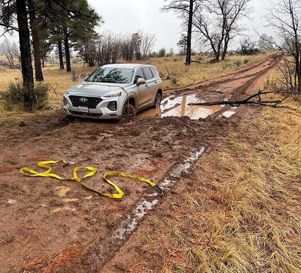
Mohave County Sheriff's Office Search and Rescue From Interstate 15, take Exit 2 east onto the Southern Parkway (Hwy 7) toward the airport. Take Exit 3 (River Road) and turn south. Set your vehicle trip odometer to 0 where the pavement ends at the state line. BLM Road 1069 You have now crossed into Arizona and are on BLM road #1069. The road is well maintained gravel. For the first 4 miles you will be on Arizona State Trust Land. At mile 4.4 you will pass the BLM Arizona Strip sign. You are now on BLM land. BLM1069 winds its way up to Quail Hill Pass, at 5,082 ft elevation. At mile 20.6 you will reach the BLM1004 junction in Wolf Hole Valley. Mohave County Road 5 to CR103 to BLM1019 At the BLM1004 junction in Wolf Hole Valley continue straight. Here BLM1069 ends and becomes CR5. At Mile 39.1 you will reach a Y intersection with a sign to Mt. Dellenbaugh and Twin Point. Turn right onto CR103. You are now headed southwest. Reset your odometer to 0. After a few miles Poverty Mountain will be on the south side of the road. You will travel 25.2 miles on CR103. Shortly after you begin to see tall ponderosa pine trees you will reach the junction with BLM1019. From Wolf Hole Valley on CR5 to Poverty Mountain on CR103 the road is usually in very good condition when dry. Between Poverty Mountain and Twin Point the road is primarily clay and will be impassible after heavy rain for at least a few hours. In winter travel is not advised to Twin Point due to snow and ice. Contact us at the bottom of this page to get current road conditions. 
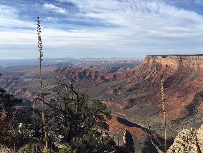
NPS - J. Axel BLM1019 turns off CR103 in an area called Oak Grove. You will pass the ruin of a small ranch house. The road then enters the ponderosa forest. This area can be impassible after heavy rain as water pools in the clay ruts. Shade from the trees keeps the road from drying quickly, especially in winter when the road may be impassible. Continue on BLM1019 to the National Park Service boundary sign. You are still in Parashant but are now in the NPS portion of the monument. The road becomes NPS1219 and winds through pinyon and juniper trees. Long wheelbase pickups may have trouble navigating a few of the tight turns. You will see two trailheads as you head south. The first, on the east side of the road into Twin Creek Canyon, is one area for hikers who want to access the Sanup bench. Overnight trips into Grand Canyon National Park (all lands below the Grand Canyon rim) need a backcountry permit from Grand Canyon National Park. The next trail, on the west side of the road, is the Burnt Canyon Overlook Trail. This easy 3-mile round trip trail follows an old level road bed to a scenic view (pictured). It is approximately 15 miles on BLM1019/NPS1219 from the CR103 junction to Twin Point. There are numerous camp sites along the rim. Rangers ask campers to use existing campsites and fire rings rather than establish new ones. |
Last updated: January 11, 2023
