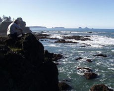
Olympic National Park protects over 73 miles of the some of the most primitive natural coastline in the 48 contiguous United States. The views of ocean, cliffs, headlands, islands and seastacks, coupled with the dramatic changing sea, provide a unique wilderness experience. Most of the coast can only be accessed by foot. Rialto Beach and Kalaloch beaches are accessible by road. Wilderness Camping Permits are required for all overnight hikes on the Olympic Wilderness Coast year-round.
Permits are limited and reservations are required for all areas between Point of the Arches and Yellow Banks. Coastal Camping Permits are limited for camping between Yellow Banks and Point of the Arches Only a limited number of traditional forested campsites are located adjacent to the beach. Many visitors choose to camp on the beach itself, which can be done in some areas above the high tide line. These sites offer less shelter from wind, sun, and precipitation than the forested sites, but reduce resource damage. Building driftwood shelters or furniture is discouraged, as it diminishes the coast's wilderness character. On the coast, all food, garbage and scented items must be stored in bear canisters. See Wilderness Food Storage for more information. Water Purification 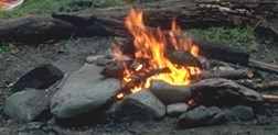
Campfires Always build your fires on the beach and keep them at least ten feet from beach logs and below the high tide line. Remove any evidence of the fire before you leave. Leave No Trace Because of tree and vegetation damage from campers campfires are not permitted north of Yellow Banks to the headland at Wedding Rocks. This includes the Sand Point area. General Information When traveling to Cape Alava or Sand Point from the Ozette trailhead, you walk on three miles of boardwalk, which can be extremely slick. It is important to take your time and walk carefully. Soft-soled shoes, such as tennis shoes or lightweight hikers, grip the boardwalk better than stiff hiking boots with lug soles. Hiking on the wilderness coast includes both beach hiking and hiking on trails over forested headlands. On the beach, the hiking surface varies from soft to hard sand, gravel, cobble stones, boulders, and large drift logs. Algae-covered rocks and wet logs can be slippery and unstable, often tipping or rolling. Hard lug-soled boots do not give traction on slick rocks. Wear lightweight hiking boots with flexible soles. It is best to stay low, take short steps, and keep your hands free for balancing. The variable hiking surfaces of the beach, combined with headland trails and tides, usually limit even strong hikers to between five and ten miles per day. Avoid walking on or picking up tidepool animals. Human handling can be harmful and sometimes fatal to the animal. 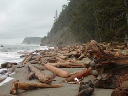
Hike by the Tide! Along the ocean, rising water can corner you below cliffs. People have died along the Olympic wilderness coast trying to beat the tide. Some headlands require low tides for passage. Some can NEVER be rounded safely even at the lowest tides, so overland routes must be taken. Before traveling along the coast, obtain a detailed topographic map. Your map should indicate areas where tides may be a problem, and the tidal height at which headlands become hazardous or impossible to round. Carry a tide chart. Strong winds or off-coast storms make tides higher than tide charts indicate (see "How to Use a Tide Chart" below), sometimes making normally passable routes impassable. Winter storms can significantly elevate tides and create seriously hazardous conditions. Never underestimate the Pacific Ocean. Always keep in mind that waves can move beach logs, which can crush and kill. Strong currents, cold water, and hidden rocks make swimming hazardous. Be vigilant for large swells. How to Use a Tide Chart Headland Trails 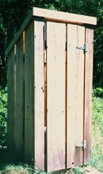
Toilets and Sanitation Toilets are located at each of the main concentrations of campsites at Cape Alava and Sand Point, and at various other high-use camp areas along the beach. In the absence of a toilet, dig a cat hole 6-8" deep and 200 feet from any campsite or water source in the forest to dispose of human waste. Beach Combing and Beach Debris Garbage and plastic, debris cast from ocean vessels, accumulates on coastal beaches. Do not decorate campsites with beach debris as this detracts from the wilderness character of the area. Help keep your wilderness beaches clean by carrying out marine debris. Do not touch metal cylinders or other containers that have washed up onshore. They may contain hazardous or explosive materials. If you see a suspicious object, note the type of container, any markings and its exact location. Report this information to a ranger. Subtidal and Offshore Area 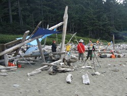
Sarah Bouska, NPS The Coast can be Crowded! If you are planning a trip to the coast, keep in mind that it is very popular during the spring, summer, and early fall months. It is not uncommon to arrive at a location like Shi Shi Beach or Third Beach and not be able to find a place to put your tent. 
Sarah Bouska, NPS |
Last updated: April 16, 2025
