|
I do not own an inch of land, but all I see is mine.

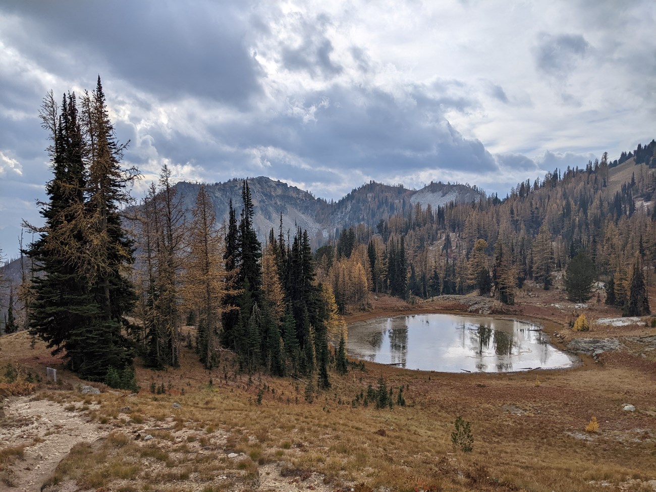
NPS / Rosemary Seifried Juanita Lake lies in a larch-dotted basin between Purple and War Creek Passes. At over 6,600' elevation (2010 m), it is not a casual hike by any approach route, but it offers days of highcountry exploring in several directions for backpackers, or a very strenuous day hike from Stehekin. The trail can also be combined with the Boulder Creek or Summit Trails to create multi-day backpacking loop options. The larchs and fall colors make this a spectacular fall destination. More information can be found in the detailed trail description below. Special Concerns:
Backcountry Camping: A backcountry permit is required for all overnight stays. Permits are limited. There are both hiker and stock camps near the lake. The party size limit is 12 persons, or a total of 12 pairs of eyes, including stock and people. Campfires are not allowed--please protect this fragile lake basin by bringing a cook stove. Access via Stehekin: From Stehekin Landing, find the trailhead for the Purple Creek Trail behind the Golden West Visitor Center. Access via Twisp River Road: From the town of Twisp on State Route 20, drive the Twisp River Road west, following signs to the War Creek trailhead. This trailhead requires a Northwest Forest Pass or federal recreation access pass, which is available at any ranger station. Follow the War Creek Trail 9.3 miles (15 km) to Juanita Lake. 
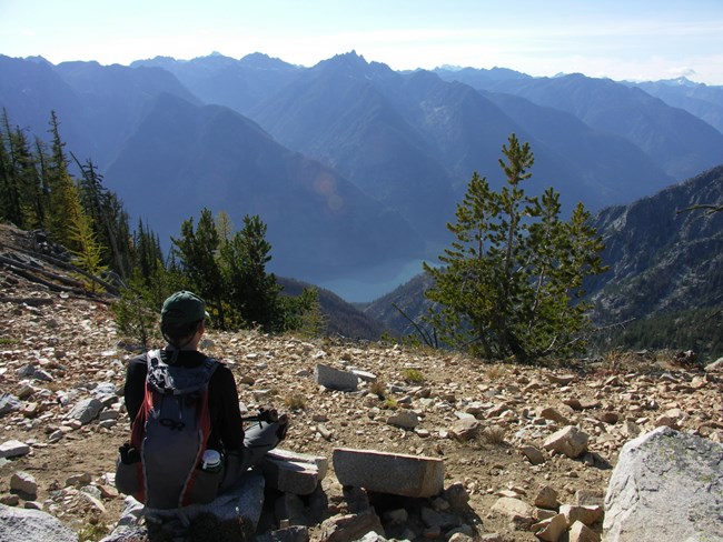
Detailed Trail Description Begin this hike on the Imus Creek Trail which starts behind the Golden West Visitor Center at Stehekin Landing. The junction for the Purple Creek Trail is on the right shortly after the first bridge crossing. Bring plenty of water for this hike, as there is lots of sun exposure and the only reliable water source along the way is at the crossing of Purple Creek two miles up the trail. The next water source is beyond Purple Pass at Juanita Lake. The lower flanks of this drainage burned in the Flick Creek Fire of 2006, so hikers on this trail can observe the process of re-growth after a wildfire. Fireweed now blooms in abundance on the hillsides, its purple flowers a stark contrast against blackened tree trunks. Notice the mosaic pattern of burned and unburned areas created by the fire. Many downy and hairy woodpeckers now make their homes in the snags created from the fire. The trail is mostly forested by ponderosa pine and Douglas fir trees with occasional views of the surrounding peaks such as Castle Rock. As the trail continues to climb, the forest begins to thin, and the lower elevation trees are replaced by subalpine fir and larch. This trail is spectacular during autumn as the needles of the larch trees turn bright yellow before falling off. This is a survival strategy which allows the tree to avoid desiccation at high elevation during the harsh winter months. Views from 6,900 foot (2100m) Purple Pass are spectacular, with the sparkling blue ribbon of Lake Chelan beckoning far below and a sea of ridges in the Glacier Peak Wilderness marching off to the west. From the pass it is well worth the effort to continue another 0.5 miles (0.8km) up the trail to Boulder Butte (7,350ft / 2240m), the site of an old fire lookout. A few scattered shards of broken glass are now the only remnants of the lookout structure that once resided here. The 360 degree views from this point are breath-taking, and include excellent views up the Stehekin River Valley as far as Cascade Pass, as well as the highest peak in the park, Mt. Goode! To reach Boulder Butte, take the marked trail leading to the north shortly after descending from Purple Pass. The main trail continues on a gentle descent to the basin of Juanita Lake, a shallow reedy lake surrounded by meadows and clumps of larch and subalpine fir. Separate hiker and stock camps are found on opposite sides of the lake, with views from the hiker camp looking down the Fourmile Creek drainage. Neither campfires nor grazing are allowed in this high elevation lake basin—please help protect the area by bringing a cookstove. Grazing permits can be obtained with your backcountry permit for grazing at least ¼ mile from the lake. The best water source is found at the outlet of the lake. Hunters use this area, especially for high buck hunt, so hikers should wear bright colors during hunting season. The junction for the Chelan Summit Trail and the War Creek Trail lies just beyond the lake. The Summit Trail makes a gradual traverse south from the Juanita Lake basin, traveling mostly through open meadows, stands of larch, and some whitebark pine, before rising more steeply to a pass at 7,300 feet (2225m) and heading into the Lake Chelan Sawtooth Wilderness. Views are excellent. Total mileage from the lake to the NPS boundary is 2.4 miles (3.9km). Backpackers have several options at this point, including looping back to Stehekin via the Fish Creek or Prince Creek Trails. More information on these USFS trails can be found on the Okanogon-Wenatchee National Forest website. Juanita Lake via War Creek Trail: Hikers and stock parties can also approach this area from the east, via the USFS War Creek Trail. This more moderate approach gains 3,600 feet (1097m) over 9.3 miles (15 km) and is popular with stock parties. Most of the hike is a gradual, forested route, with steeper elevation gain coming toward the end as the trail reaches the subalpine. The junction for the Boulder Creek Trail is just before War Creek Pass. 
|
Last updated: October 17, 2022
