|
Return to River of History. Transforming the River I: Commerce and Navigation Improvements, 1823-1906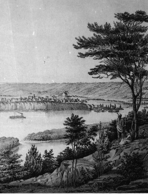
the Upper and Lower Landings. Artist: Thompson Ritchie. American Memory Project, Library of Congress. The Mississippi River gave birth to most cities along its banks, and those cities did all they could to ensure that the river would nurture their growth. From their pioneer days on, they insisted that the federal government should “improve” the river for navigation. St. Paul and Minneapolis pushed especially hard. Lying at the head of navigation, they demanded a river capable of delivering the immigrants needed to populate the land (not considering that they had taken it from Native Americans) and the tools and provisions needed to fully use it. They also demanded a navigable river so they could deliver the bounty of their labor and their new land to the country and the world. All this, they believed, was part of their manifest destiny. To fulfill that destiny, they would help transform the entire upper Mississippi River and make the reach between Hastings and St. Anthony Falls one of the river’s most engineered. (Figure 1) The Twin Cities had to see that the entire Mississippi River was remade. They needed local navigation projects, but these did little good without a navigable river downstream. So they actively participated in local, regional and national campaigns for navigation improvement. In response to their lobbying, Congress authorized four broad projects to improve navigation on the upper river and a number of site-specific projects in the Twin Cities metropolitan area since 1866. The four broad projects are known as the 4-, 41/2-, 6- and 9-foot channel projects. Key local projects included Locks and Dams 1 (Ford Dam) and 2 (Hastings), Lower and Upper St. Anthony Falls Locks and Dams, and the little known Meeker Island Lock and Dam, which was the river’s first and shortest-lived lock and dam (Figure 2). In less than 100 years, these projects would radically transform the river that nature had created over millions of years and that Native Americans had hunted along, canoed on, and fished in for thousands of years. 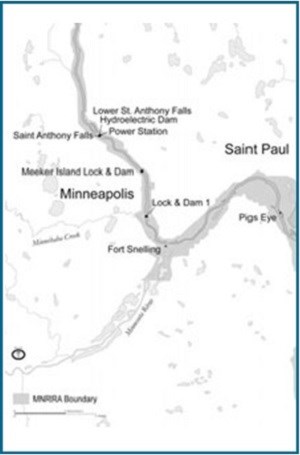
Navigation on the Natural River: 1823-1866Early Navigation • Paddling upstream from St. Louis to St. Paul in 1823, the Virginia became the first steamboat to navigate the upper Mississippi River. It did so twice that year. Other boats had been plying the upper river–Indian canoes, piroques, flatboats and keelboats–but the Virginia announced a new era. Under steam power, people and goods could be transported upstream far more quickly and in greater numbers and quantities than on boats with sails or oars or poles. As steamboats evolved and as the region's population and production grew, the river's limitations as a navigation route would become unacceptable and Midwesterners would repeatedly call for its improvement as a commercial artery.
Steamboat traffic grew quickly after 1823. Between 1823 and 1847, most boats carried lead and worked around Galena, Illinois. Few boats plied the river above Galena. After 1847, as miners depleted the lead supply, the trade quickly declined.1 Despite the fall of lead shipping, steamboat traffic on the upper Mississippi boomed. One measure of this was the number of times steamboats docked at the upper river's port cities. Some steamboats might land only once, while others returned many times. St. Paul recorded 41 steamboat arrivals in 1844, and 95 in 1849. During the 1850s, traffic soared. By 1857, St. Paul had become a bustling port, with over 1,000 steamboat arrivals each year by some 62 to 99 boats.2 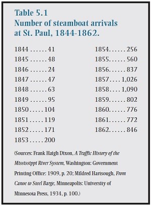
As rapidly as the number of steamboats increased, they could not keep pace with demand. In 1854 the Minnesota Pioneer,a St. Paul newspaper, reported that passengers and freight overflowed from every steamboat that arrived and that “the present tonnage on the river is by no means sufficient to handle one-half the business of the trade.”3 While two steamboats often left St. Paul each day, they could not carry goods away as quickly as merchants and farmers deposited it, and many upper river cities mirrored St. Paul.4 Each steamboat that docked created new business and a greater backlog, as more immigrants disembarked to establish farms and businesses.5 Spurred by Indian land cessions that opened much of the Midwest between 1820 and 1860, by Iowa's statehood in 1846 and Wisconsin's in 1848 and by the creation of the Minnesota Territory in 1849, passenger traffic on the upper river boomed. Many passengers came from the East; others came from Europe, fleeing famine in Ireland and political unrest on the continent. While some arrived by way of the Great Lakes, many settlers entering Iowa, Minnesota and western Wisconsin made part of their journey on the upper river.6 Historian Roald Tweet contends that, “The number of immigrants boarding boats at St. Louis and traveling upriver to St. Paul dwarfed the 1849 gold rush to California and Oregon.”7 More than one million passengers arrived at or left from St. Louis in 1855 alone.8 As a result, the population of the four upper river states above Missouri ballooned between 1850 and 1860. Minnesota's population jumped from 6,077 to 172,023, Iowa's from 192,000 to 674,913, Wisconsin's from 305,391 to 775,881 and Illinois' from 851,470 to 1,711,951.9 Passenger traffic became so important to the steamboat trade that by 1850 passenger receipts exceeded freight receipts.10 
Minnesota Historical Society. The Natural RiverBefore 1866, during the heyday of steamboats, the upper Mississippi River still possessed most of its natural character. Trees filled and enshrouded it. Where steamboat pilots followed the deepest channel, as it hugged one shore or the other, leaning trees might sweep poorly placed cargo or an unwary passenger from a steamboat's deck. Many trees fell into the water to become snags. Snags skewered the careless and even the cautious steamboat. Snags were such frequent and treacherous hazards that steamboat pilots named them (Figure 3). Those that swayed back and forth with the current they called sawyers. Those that bowed in and out of the water they labeled preachers. Planters were those that became lodged in the river's bottom, and sleepers hid beneath the water's surface. Snags could, in an instant, impale a steamboat or tear it apart.11 The natural river became surprisingly narrow in places. Zebulon Pike and Stephen Long both not only commented on how confined the river became above Hastings, they rowed its width to see how few strokes they needed. Pike took 40 strokes in his bateau and Long only 16 in his skiff.12 Hundreds of islands, some forming and others being cut away, divided the natural river, dispersing its waters into innumerable side channels and backwaters. By dividing the river, islands limited the water available to the navigation channel and thereby its depth. Islands created dangerous currents.13 From just below Hastings to St. Anthony Falls roughly 40 islands broke the river’s flow. The number of islands, of course, varied with the season and the year, as many islands were temporary. Sandbars posed the most persistent and frequent problem. They divided the upper Mississippi into a series of deep pools separated by wide shallows that sometimes stranded even the lightest steamboats. Sandbars determined the river's overall navigability. A bad bar could sever St. Paul’s and Hastings’ connection with St. Louis, the Gulf of Mexico and the world.14 Normally, during the late summer or early fall, the river began falling and would enter the stage steamboat pilots and Corps engineers called low water. During low water, no continuous channel existed. Deep pools might run near one bank for a short reach and then jump to the other. Or a series of deeper pools separated by shallow sandbars could be scattered across the main channel. Deep was anything over three feet. Sandbars determined the river's controlling depth–the minimum depth for navigation at low water. From St. Paul to the St. Croix River, the controlling depth at low water was 16 inches. From the St. Croix to the Illinois River it varied from 18 to 24 inches.15 A few miles below St. Paul, the river sometimes became so shallow that boats would have to stop within sight of the city.16 The folklore that people once waded across the Mississippi is true. George Byron Merrick captures well the perils of sailing the natural river. Born in Niles, Michigan, on the St. Joseph River, Merrick watched steamboats go back and forth between South Bend, Indiana, and the town of St. Joseph on Lake Michigan.17 When Merrick was 12 years old, his family left Michigan and traveled to Rock Island, Illinois. There they took a steamboat upriver to Prescott, Wisconsin, some 30 miles below St. Paul, arriving in June 1854. Merrick's father bought a warehouse on the levee from which he ran a storage and transshipping business. He also sold “boat-stores” and groceries to the steamboats that stopped at the levee. The family lived in the upper two stories, George sharing the attic with his brother.18 From there the boys could see and hear every steamboat that stopped at or passed the levee. “And thus,” Merrick recalled, “we grew into the very life of the river as we grew in years.”19 When old enough, Merrick began working on a steamboat as a cabin boy and after one season became a cub engineer. Over the next nine years he worked his way up to become a cub pilot. But in 1862, he left the river to fight in the Civil War. After the war, he settled in New York. In 1876, he returned to Wisconsin to become–fittingly–a railway agent. Subsequently he turned to newspaper editing and publishing.20 In 1862, Nathan Daly, the son of a Minnesota pioneer family fleeing from the Dakota Conflict in Minnesota, recounts the effect bars could have on a steamboat's hull. Traveling down the Mississippi to Illinois, Daly's family camped for a night a few miles below St. Paul. Here, the Northern Light, one of the largest steamers on the upper river, passed them just after sundown. The young Daly recalled in his memoir that he could “distinctly hear the grinding of her bottom on the gravel bar over which she was passing.”23 Some boats ground to a halt on sandbars. To get off, pilots sometimes used spars, long wood poles on which the front and back of the boats would be alternately jacked up and pushed forward. In this way, pilots hoped to walk their boat over the bar. If lucky, they avoided “hogging” the boat; that is, warping or breaking its hull.24 Rocks and rapids were a greater problem for steamboats trying to ply the river above St. Paul. From St. Anthony Falls to downtown St. Paul, some 15 river miles, the river falls more than 100 feet. This steep slope, combined with a narrow gorge and limestone boulders left by the retreat of the falls, made the river through this reach too treacherous for steamboat navigation.25 Thus, St. Paul had become the head of navigation. 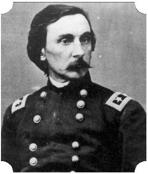
Corps of Engineers A Four-Foot Channel, 1866-1877To steamboat pilots the natural river was too perilous, and Midwesterners feared an unreliable river might limit their region's destiny. That destiny, they believed, was to become a commercial and industrial power as strong as the East, as well as the nation's breadbasket. Before the Civil War, Congress authorized minor improvements for the upper Mississippi River but no work for the river above Hastings. On June 23, 1866, Congress passed the first postwar River and Harbor Act. This act signaled a new era of internal improvements and the beginning of dramatic changes to the upper Mississippi River. Historians generally agree that with the Civil War's end the federal government took a very different position on internal improvements. Prior to the war, with a few exceptions, Congress and/or the President had opposed a federal role in internal improvements.26 The 1866 act provided for the first project to focus on the whole upper river.27 It directed the Corps to survey the Mississippi River between St. Anthony Falls and the Rock Island Rapids, “with a view to ascertain the feasible means, by economizing the water of the stream, of insuring the passage, at all navigable seasons, of boats drawing four feet of water. . . .” In other words, Congress asked the Corps to determine how to establish a continuous, 4-foot channel for the upper river at low water. Low water was based on the river’s elevation in 1864, when a severe drought occurred. By a 4-foot channel, Congress meant a channel at least 4 feet deep if the river fell as low as it did in 1864. (The 9-foot channel today is based on the same benchmark.) To create a 4-foot channel and deal with the Rock Island and Des Moines Rapids, the Corps established its first offices on the upper Mississippi River: one at St. Paul and one at Keokuk, Iowa (the latter would be moved to Rock Island in 1869).28 On July 31, 1866, A. A. Humphreys, the Chief of Engineers, ordered Brevet Major General and Major of Engineers Gouverneur K. Warren to St. Paul to begin the Corps' work on the upper Mississippi River (Figure 4). With Warren's arrival in St. Paul in August, the Corps established a permanent stake in how the upper Mississippi River would be managed and changed. From this time forward, the Corps' role in the river would become as deep and broad as the river itself. It came at the insistence of the states, farmers, business interests and the general public. All demanded the federal presence, the federal expertise and the federal dollars. Before he could develop a plan for achieving the 4-foot channel, Warren had to learn more about the upper Mississippi River and he had to complete his survey. After charging men under him to undertake the tributary surveys, Warren began the upper Mississippi survey from the Rock Island Rapids to Minneapolis himself. From this work, Warren contended that in its natural state the Mississippi River's navigation channel frequently changed and that the Corps would have to survey the river each year until they understood how it worked.29 In some reaches, Warren reported, sandbars moved in waves along the channel bottom, looking something like snowdrifts. A wave would start at the head of the reach and begin moving down, even when the current slowed. Another wave soon followed. As the river fell, each wave formed a bar that acted like a small dam. Behind the bar lay a deep pool of water. Just past the crest, the channel quickly became deeper.30 Normally, the river would begin cutting through the steep slope on the back side of the bar and another bar would eventually begin forming downstream of it. Without enough current, this happened too slowly for navigation. When a series of bars came in close succession, the river could become seriously obstructed. In these reaches, Warren found that “the river seems, as it were, lost, and indecisive which way to go and the pilot is scarcely able to find the line of deepest water even in daylight, and is unable to proceed at night with any confidence.”31 The small pools behind the bars would play an important part in Warren's strategy for navigation improvement on the upper river. Between 1866 and 1869, Warren completed 30 survey maps of the upper Mississippi River, at the scale of 2 inches to the mile. Ten sheets formed a continuous map of the river from St. Anthony Falls to the mouth of the St. Croix River. The remaining maps focused on problem reaches or detailed the river near a specific town.32 From these maps and from what he would learn about early navigation improvements, Warren began planning the 4-foot channel project. Warren asked private companies and local interests what work they had done to improve the river's navigability. He learned that Minneapolis and St. Anthony (the community on the river’s east bank that merged with Minneapolis in 1872) had funded the removal of boulders to encourage steamboats to travel above St. Paul. At Guttenberg, Iowa, an island split the river into two channels, one passing in front of the city and the other running along the Wisconsin side. Desiring to keep traffic flowing past their city, the citizens had attempted to close the Wisconsin channel but had been unsuccessful. Rafting companies and steamboat interests had employed wing dams to scour the channel at troublesome bars. These “slight dams,” Warren commented, had been somewhat successful, “indicating a way of deepening the low-water channel worthy of special attention.” But these measures had been only temporary; high water usually swept the dams away. Overall, Warren found that those who had been using the river “evince a shrewd knowledge of the action of running water and the means of temporarily controlling it, gained by their constant experience and observation.”33 Warren listened to these knowledgeable sources, but came to his own conclusions. Warren provided estimates for a variety of projects, in his first annual report in 1867. Responding in part to Minneapolis business and political interests, he requested $235,665 to construct a lock and dam at Meeker Island, which lay between Minneapolis and St. Paul. If built, this project would allow Minneapolis to become the head of navigation. Without a lock and dam, the river above St. Paul was too narrow, too shallow, too strewn with boulders and the current too fast for steamboat navigation.34 To create a safe and continuous 4-foot channel for the river between St. Paul and the Rock Island Rapids, Warren asked for $96,000 to acquire and operate two dredge and snag boats, $5,000 to construct an experimental closing dam at Prescott Island, about 26 miles below St. Paul, and $5,000 for another experimental closing dam for the Wacouta chute near Red Wing, Minnesota.35 Warren decided to deepen the upper Mississippi by dredging. It was a method that had proven successful in France and elsewhere.36 Mississippi River pilots had learned that by running their paddle wheels over the crest of a bar, they helped the river cut through it, allowing the flow from the pool to deepen the cut just enough for the boat to pass. As a result, Warren favored dredging. As long as the Corps ran the dredges, it could limit the depth of the cut on a bar and preserve much of the deeper pool behind it. “In view of the hold which this method has taken upon the minds of river men, and the difficulties, uncertainty, and expense which attend the use of dams,” Warren concluded, “I have determined to recommend the employment of these dredging machines.”37 In 1867 the Corps initiated a program of dredging sandbars, snagging, clearing overhanging trees and removing sunken vessels to create the 4-foot channel. The 4-foot project did not greatly alter the river's physical or ecological character and did not improve the river much for navigation, but it initiated a series of navigation projects that would do both. The Corps simply did not have the funding, equipment, personnel or authority to make significant and permanent changes. Midwesterners, however, needed to transform the river, if they hoped to make it a commercial thoroughfare. 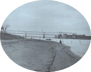
Henry P. Bosse. Rock Island District, Corps of Engineers Demanding a Deeper ChannelRailroad Monopolies • The Midwest’s need to receive and send out goods grew as rapidly as its population and agricultural production. Railroads, more than the river, would meet the region’s need, but not without a price, a price much too high for some. In 1854 the first two railroads reached the Mississippi River: the Chicago and Rock Island Railroad at Rock Island, Illinois, and the Chicago and Alton at Alton, Illinois. In 1855 a railroad entered Galena. Quincy and Cairo, Illinois, became railheads in 1856, and East St. Louis, Illinois, and Prairie du Chien, Wisconsin, in 1857. La Crosse, Wisconsin, joined these cities, becoming the terminus of the Milwaukee and La Crosse in 1858. At Rock Island in 1856, the Chicago and Rock Island became the first railroad to cross the Mississippi. But the economic panic of 1857 and the Civil War ended further railroad expansion across the Mississippi. Despite the growing menace of the railroads, river traffic remained strong.38 Railroad expansion following the Civil War accelerated the pace of the Midwest's unprecedented population and agricultural growth. Railroad trackage in the United States multiplied from 30,635 miles in 1860, to 52,914 in 1870, and 92,296 in 1880.39 Before the Civil War, only the Rock Island Railroad had bridged the upper Mississippi River from Illinois to Iowa. Between 1866 and 1869, three more railroads crossed the river to Iowa, and by 1877, thirteen railroad bridges spanned the upper river (Figure 5).40 Railroads greatly increased the country’s ability to move commodities, and, yet, railroads would provoke and inflame a shipping crisis. In doing so, they would contribute to the drive for navigation improvement at the same time they were throttling shipping on the river. While steamboat traffic had remained strong before the Civil War, steamboats had begun losing passengers and grain to railroads. Early railheads on the upper river's east bank fostered steamboat traffic, but they initiated its end as well. With each new rail connection, steamboats made shorter trips between ports. Instead of going to St. Louis or New Orleans, a steamboat from St. Paul might unload at La Crosse or Rock Island or at other railheads, and increasingly, most river commerce became local.41 While the river had been hauling grain since the birth of Midwestern agriculture, railroads held too many advantages over the undeveloped waterways. Railroads moved their freight quicker, giving their users greater flexibility in responding to market changes. Rail lines were generally shorter, more direct, and could reach deep into lands served by no navigable rivers. Compatibility between rail lines made transshipment unnecessary. Trains ran when the river was high or low; they ran when the cold of winter froze it; for the most part, they ran throughout the year.42 Those railroads that ran east to west–most importantly to Chicago–took advantage of complementary markets. Midwestern farmers sent grain to Chicago, and Chicago merchants and eastern manufacturers sent their goods back on the railroads. While railroads could send many cars in both directions with full cargoes, barges delivering their commodities at St. Louis or New Orleans or points in between too often returned empty.43 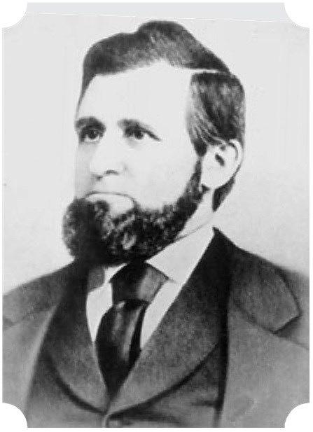
the Grange. Minnesota Historical Society. The Granger Movement • As railroads spread throughout the upper Mississippi River valley and the Midwest, they began monopolizing the shipping of bulk commodities, especially grain. With river traffic failing and railroads monopolizing the region’s transportation, many farmers and business interests believed they were facing a shipping crisis. In response, farmers in the Midwest and throughout the nation joined the first national farm movement, called the Grange or Patrons of Husbandry. Grangers sought to control railroad rates through state and federal regulation and through improved navigation on the nation's rivers. Formed in 1868 by Oliver Hudson Kelley, a Minnesota farmer who had moved to Washington, D.C., to work as a clerk in the Department of Agriculture, the Grange had established nearly 1,400 chapters in 25 states by 1873 (Figure 6).44 The number of chapters multiplied to more than 10,000 by the end of the year. Over the next year, the Grange founded nearly 12,000 chapters and claimed over 858,000 members. Solon J. Buck, who wrote the classic study of the Grange, observed that, although avowedly nonpolitical, “the phenomenal increase in the membership of the order during 1873 and 1874 awakened the liveliest interest, and sometimes apprehension, among politicians throughout the Union.”45 As a result, he says, “the New York Tribune, referring to the Grange, declared that “‘within a few weeks it has menaced the political equilibrium of the most steadfast states.’”46 While the Grange refused to form a political party or actively participate in the established parties, its members did not. Farmers created third parties in states throughout the country during the mid-1870s, winning significant elections and threatening the established order. Kelley and Grangers in the upper Mississippi River valley saw the river as an essential route to domestic and foreign markets. Demonstrating the Grange's early concern for improving the Mississippi River, the state Grange convention of 1869 featured the river. Printed in the Minnesota Monthly’s July edition, the convention's preamble to its resolutions declared: "The Mississippi River traverses for thousands of miles the noblest agricultural regions of the earth, running from North to South, . . . it is destined to become the most popular region of the world, and its waters should forever be kept free and untrammelled and open to the use of every citizen within the entire navigable length, and all obstructions, whether natural or of human device, are like impediments to the prosperity of the people who till the soil of the great valley." In August 1870, Kelley left Minnesota by steamboat for St. Louis to secure direct trade arrangements between Minnesota and Missouri. During his trip, he fed the St. Paul Pioneer Press articles condemning railroads and the Chicago Board of Trade and promoting waterway improvement. He hoped to restore the dying river connection between St. Paul and St. Louis. “The Mississippi and her tributaries are natural outlets for the west and northwest,” Kelley insisted, “but how little attention is given to their improvement.” Railroads, he charged, “control the river front in every town on the river; their boats can land freight without paying wharfage and people consider it all right.” While railroads had received huge land grants, steamboats had not. “Railroads have got enough for the present. . . .” he concluded, calling on Congress to appropriate funding “for every navigable stream in the West” and to “open the natural outlets free to all.”47 To restore river traffic, Kelley insisted that the Mississippi needed grants like those given to railroads, and the Grange had to establish an agent in St. Louis to buy and sell Minnesota's products. As with the drive for railroad legislation, the push for waterway improvement was not just a farmers' movement. St. Louis merchants were among the Mississippi River's greatest advocates. Reeling from Chicago's increasing dominance over the region's trade, they saw the river as their best counteroffensive. In 1867, they held, according to one historian, the most important navigation improvement convention before 1873. “The keynote of the meeting was a determined effort to obtain federal money for the improvement of western waterways so that they might be used as reliable routes for cheap transportation.”48 Cheap transportation, delegates argued, would allow the United States to “monopolize the markets of the world.”49 In May 1873, cheap transportation advocates held another convention in St. Louis–the Western Congressional Convention. It drew national Senators and Representatives from 22 states and the governors of Minnesota, Ohio, Kansas, Missouri, and Virginia. The conference organizers' goal was to impress upon these key political officials the depth of the shipping crisis. The solution, they insisted, lay in improving the nation's waterways, especially the Mississippi River and its tributaries. Such improvements were beyond the ability of the individual states and had to be undertaken by the federal government, they declared.50 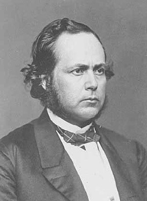
Photo by Brady. Minnesota Historical Society. The Windom Committee • Spurred by the Granger movement and navigation conventions–partly out of fear and partly out of a genuine concern to help farmers and businesses–Minnesota Senator William Windom asked the Senate to establish a committee to examine the transportation problem and recommend solutions to it. The threat of a railroad monopoly, the commercial decline of the Mississippi River and rising dissatisfaction with his Republican party were of particular concern to Senator Windom (Figure 7). Windom's hometown, Winona, lay on the Mississippi River in southeastern Minnesota.51 Windom first became a senator when Republican Daniel S. Norton died in office in 1870 and Minnesota's governor appointed Windom to fill the seat. Windom had already served in the House for a decade. While the Minnesota legislature appointed someone else to finish Norton's term, Windom won the seat in 1871. He would become one of the Senate's strongest advocates for railroad regulation and navigation improvement.52 The rapidly growing strength of the Granger movement in Minnesota and the threat of railroad monopolies spurred Windom to address the transportation issue with zeal. Led by Ignatius Donnelly, Grange supporters had organized the People's Anti-Monopoly party, “with a platform striking at monopolies, advocating state railroad controls, and denouncing postwar corruption. . . .”53 Recognizing the Granger movement's growing strength and its discontent with the Republican party's failure to deal with monopolies and the farm crisis, Donnelly joined the movement in 1872. As Anti-Monopoly parties threatened to undermine the Republican party's dominance in the state and nationally, Windom and other Republicans began working for railroad reform and began seeking ways to solve the farm crisis.54 As chairman of the Senate Select Committee on Transportation to the Seaboard, Windom was in an especially good position to help both farmers and his party. In December 1872, he had introduced a resolution to address the transportation problem. And in a speech before the Senate, he asserted that “it was ‘an admitted fact’ that present transportation facilities between the interior and the seaboard were ‘totally inadequate.’ These transportation networks,” he charged, “were controlled by ‘powerful monopolies who dictate their own terms to the people. The burdens they impose upon both consumer and producer are too grievous to be long endured.’”55 On March 26, 1873, responding to Windom, the Grange and the transportation crisis, the Senate directed Windom’s committee to study the problem.56 On April 24, 1874, Windom’s committee submitted its report to the Senate. After reviewing various proposals, the committee recommended that Congress regulate some railroad operations and that it authorize an intense program of waterway improvements. The “remarkable physical adaptation of our country for cheap and ample water communications,” the committee concluded, “point unerringly to the improvement of our great natural water-ways, and their connection by canals, or by short freight-railway portages under control of the government, as the obvious and certain solution of the problem of cheap transportation.”57 Relying on the reports the Corps of Engineers submitted, the committee noted that improvements on the Mississippi River had been sporadic. No general plan had been developed or implemented. The committee recommended that Congress authorize surveys and get cost estimates prepared as early as possible “in order to mature a plan for the radical improvement of the river, and of all its navigable tributaries.”58 The committee suggested that the Corps establish a channel of 41/2 to 6 feet for the upper Mississippi River.59 To create a channel of these depths, the committee acknowledged, would require constricting the river with wing dams and closing dams.60 Together, the Grange, shippers and merchants, boosters in river towns and the Windom committee persuaded Congress to authorize the 41/2-foot channel project. The works built under the 41/2-foot channel project embody these national movements and local efforts. 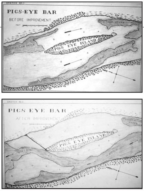
Corps of Engineers The Four and One-Half Foot Channel, 1878-1906By authorizing the 41/2-foot channel project, Congress directed the Corps to remake the upper Mississippi. The Engineers were to create a permanent, continuous navigation channel, 41/2-feet deep at low-water, for the entire river between St. Paul and the mouth of the Illinois River at Alton. To do this, they would have to change the Mississippi's landscape and environment. They would have to eliminate the wide shallows and sandbars and the thou- sands of little pools that Warren had once sought to preserve. They would have to alter the pattern by which sand and silt moved along the river bottom. They would have to focus the river's current into one main channel and block off the myriad side channels. The focus of Corps work between 1878 and 1906, the 41/2-foot channel became the first system-wide, intensive navigation improvement project for the upper Mississippi River. It would alter the navigable portion of the river through the MNRRA corridor dramatically. 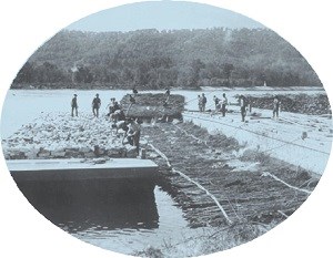
Photo by Henry P. Bosse. St. Paul District, Corps of Engineers. Alberta Kirchner Hill spent 19 summers (1898-1917) with her father's fleet as they built the dams for the government. Her father, Albert Kirchner, along with Jacob Richtman, both from Fountain City, Wisconsin, became the leading contractors for the Corps in wing dam construction. From the building boat, Alberta Kirchner recalled, “. . . I could even smell the delightfully blended odor of the willows and of the creosoted marline twine with which the bundles were held together. It came to me strongly every time the men hoisted a swishing bundle of brush to their gunny-sack-protected shoulders. . . .”65 Once the willow mats had been laid in the water, the workers would sink them with rock. “No sooner had a barge of rocks been pulled up to the dam,” Hill remembered, “than the symmetry of the load was destroyed as the men began the routine of sinking the mat. . . . From the quarterboats you could hear the big rocks hitting each other, like a rapid-fire rage. . . as the mat went down under the load . . . a splashing began. The sound grew in intensity as the mat sank lower and lower in the water.”66 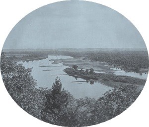
Photo by Henry P. Bosse. St. Paul District, Corps of Engineers. The wing dams' success depended upon the main channel's volume and velocity. During the late summer or early fall, when the Mississippi usually became a shallow, slow-moving stream, the wing dams could not direct enough water down the channel to scour it. Droughts had the same effect, but could last an entire season. The many islands dividing the river disbursed the little water available into side channels and sloughs. As the experiments with closing dams had shown, cutting off the side channels greatly increased the main channel's flow. The river passed over the closing dams when high, but for most of the year, the dams directed water into the main channel, denying flow to the river's side channels and backwaters (Figure 10). While the river naturally eroded its banks, closing dams and wing dams accelerated erosion by increasing the channel's velocity and volume. Wing dams especially caused bank erosion by forcing the river away from one shore and against the other. At Dibble’s Point, the shoreline had eroded 15 to 20 feet in one year due to a wing dam built at Prescott Island, near Prescott.67 To protect shores from naturally eroding or from being undercut by the constricted channel, the Corps protected hundreds of miles of shoreline with brush mats and rock. A 1903-1905 Corps navigation map shows the river ribbed with wing dams and closing dams and lined with hundreds of miles of riprap. Wing and closing dam construction began at Pike Island at the mouth of the Minnesota River. By 1905, the Engineers had built about 340 wing and closing dams from the Minnesota River to the southern end of the MNRRA corridor below Hastings. They had closed nearly all the side channels. The Engineers did not build all the works depicted in one area at the same time. They would build as many wing dams, close as many side channels, and protect as much shoreline as needed to establish a 41/2-foot channel. Then, they would move to the next troublesome reach. In newly constricted reaches, the channel might be good for a season or two and then become difficult again, due to the river's natural tendencies or as a result of the improvement works themselves. Where necessary, the Engineers would return and add more wing dams, closing dams and shore protection. The density of channel constriction works and the degree to which they physically and ecologically changed the river increased gradually over the project's history. Dams at the HeadwatersThe desire to improve navigation on the upper river affected the river above the Twin Cities, as well. To further increase the water available for navigation, Congress authorized the Corps to construct six dams at the headwaters of the Mississippi, in northern Minnesota, between 1880 and 1907. Warren had recommended that Congress fund a survey of the upper Mississippi River's headwaters and tributaries in his 1869 report. In his next report, Warren had suggested a system of 41 reservoirs for the St. Croix, Chippewa, Wisconsin and Mississippi River basins. Subsequent engineers reduced this number to six. Millers at St. Anthony Falls especially pushed for reservoirs above the falls. William Washburn went so far as to purchase land at one of the reservoir sites in anticipation of a private or federal project there and later gave the land to the government. The millers recognized that the release of water from the reservoirs for navigation in the later summer and fall would increase the flow of water to keep their mills turning longer and more consistently. Congress initially balked at the project’s pork-barrel appearance. In 1880, however, it finally authorized an experimental dam for Lake Winnibigoshish and authorized the remaining dams shortly afterwards. The Headwaters project provided for construction of the Winnibigoshish Dam in 1883-1884 and the completion of dams at Leech Lake (1884), Pokegama Falls (1884), Pine River (1886), Sandy Lake (1895), and Gull Lake (1912). In their 1895 Annual Report, the Engineers reported that releasing water from the Headwaters reservoirs had successfully raised the water level in the Twin Cities by 12 to 18 inches, helping navigation interests and the millers. Twenty-seven river miles downstream, at Hastings, they recorded a rise of about one foot and at Red Wing about one-half foot. To steamboats, even half a foot was important. Below Red Wing, water from the reservoirs had little effect.68 The Meeker Island Lock and DamFrom Minneapolis' perspective, the channel improvement works on the upper Mississippi River only benefitted its principal rival–St. Paul–until Congress did something about the rapids below St. Anthony Falls. Millers at St. Anthony were profiting from the release of water from the Headwaters Reservoirs, but Minneapolis civic and commercial boosters wanted more than milling. They yearned to make their city the head of navigation. So, commercial leaders in Minneapolis, supported by the State of Minnesota, sought federal support for navigation improvements in 1866. Their effort resulted in one of the most mysterious and ill-fated projects on the upper river. One dam would be blown up within 5 years of its completion and another would have to be redesigned and the completed part rebuilt. The project would permanently reshape the river between Lock and Dam 1 (the Ford Dam) and St. Anthony Falls. It is a story with local and national significance. As early as 1850, Minneapolis business and civic leaders had tried to convince shippers that steamboats could reach the falls. To prove their point, they paid the steamer Lamartine $200 to journey from St. Paul to the cataract. They also raised funds during the 1850s to remove boulders and other obstacles.69 Recognizing that the river's challenges required more than these futile measures, navigation boosters began discussing a lock and dam for the river above St. Paul as early as 1852. Over the next five years, the city's newspapers, civic leaders and the Territorial Legislature called for locks and dams to carry the booming steamboat trade to Minneapolis. In 1855, the St. Anthony Express proposed building two locks and dams. In 1858, when Minnesota became a state, the new legislature sent a petition to Congress requesting that the federal government improve the river for navigation above St. Paul.70 While Minneapolis navigation boosters focused on shipping, others recognized the river's hydropower potential between the falls and St. Paul. Bradley B. Meeker and Dorilus Morrison formed the Mississippi River Improvement and Manufacturing Company in 1857, with a group of Minneapolis businessmen, to develop this potential. Playing on the desire of Minneapolis navigation boosters, they proposed building a lock and dam between the two cities to aid navigation and to secure the hydropower for themselves.71 Meeker, a territorial judge and local entrepreneur, and Morrison, a St. Anthony Falls sawmill operator, lobbied for and obtained permission from the Minnesota Territorial Legislature to build their lock and dam near Meeker Island. Gone now, the island lay some three miles below the falls, in Minneapolis. Portending the coming conflict with Minneapolis, St. Paul citizens criticized the project, as it would steal from them their valuable position as the head of navigation. As with so many projects, the Economic Panic of 1857 and the Civil War stalled the Mississippi River Improvement and Manufacturing Company's plans, postponing the project and the intercity conflict.72 Holding to their dream through the depression and the war, Meeker and Morrison beseeched Congress for a land grant to fund their project in 1865. Focusing on navigation, the Minnesota Legislature, in 1866, petitioned Congress to authorize navigation improvements above St. Paul and requested the land grant on behalf of Meeker's company. The company needed the grant, the state contended, because the company's income from water power would be limited by the “inexhaustible resources in this respect above and on the falls” and because the company's state charter required it to lock boats through free.73 Anticipating opposition from the millers at St. Anthony, the state claimed that the petition’s principal purpose was to bring steamboats to Minneapolis and that hydropower was “incidental.”74 Meeker, himself, emphasized navigation. The miller's “fear,” he said, “"is another waterpower that might result incidentally from our effort to get Boats to the Falls of St. Anthony.”75 Minneapolis navigation boosters clearly saw that Meeker's project would extend navigation above St. Paul, which was their primary reason for supporting it. In its petition, the state stressed that boats had frequently landed within two and one-half miles of downtown Minneapolis, up until 1857. But, as a result of the economic panic beginning that year, a number of unprecedented droughts and the Civil War, navigation, they brashly claimed, “had receded some sixteen miles, to St. Paul, where all the freight destined to these cities, (Minneapolis and St. Anthony) and the vast regions north and west . . . must break bulk and be carried in wagons to their destination.” A lock and dam, the state contended, would extend navigation “to its natural and proper terminus.”76 Acknowledging the obvious local appearance of its request, the state touted the project’s interregional benefits. The best market for the Midwest's corn, flour, pork, and beef, it claimed, was the South. And the Midwest needed the South's cotton, rice, sugar, and molasses. Whatever products the Midwest came to manufacture, like woolen and cotton fabrics, would find their chief market in the South and Southwest. The Mississippi River, the state insisted, provided the natural link. Echoing the beliefs of their counterparts downstream, Minneapolis boosters pointed to the divine purpose of their project. “Direct communication,” they pleaded, “is both natural and necessary, and the all-beneficent Creator has graciously anticipated the wants and necessities of unborn millions in having given us exactly such a continuous means of supply and exchange from the Falls of St. Anthony to the Gulf of Mexico.” The petition even cited editorials from the St. Paul papers stressing the importance of Minneapolis to the region's economy. Finally, and recognizing the emerging power of railroads, the state asserted that the river “is now and ever will be and remain the great regulator and moderator of fares and freights among the rival carriers of the commerce of the west.” Referring to the Civil War, the state implored Congress to “recollect with what haste and facility the various railroad lines combined to increase the cost of travel, and double, and in some instances triple and quadruple, the cost of transporting the produce of the west during the late non-intercourse measures in the Lower Mississippi.” The river would bind the country together again.77 Navigation boosters in Minneapolis failed, however, to convince Congress of the importance of their project. Congress rejected Meeker's request and the Minnesota Legislature's petition for a land grant in support of a lock and dam in 1866. It did, however, authorize the Corps of Engineers to survey the reach between Fort Snelling and St. Anthony Falls, along with its general survey of the upper Mississippi River. Warren brought new hope for the project, when, in his 1867 annual report, he requested $235,665 to construct a lock and dam at Meeker Island.78 Warren engaged Franklin Cook, a former employee of the Minneapolis Mill Company, to undertake the survey. Cadwallader C. Washburn and his brother William D., the Minneapolis Mill Company's owners and two of the city's most powerful and prominent millers, adamantly opposed locks and dams. As Cook had worked for the Washburns, Meeker expected a negative report. Cook completed his survey between 1866 and 1867 and, to Meeker's surprise, recommended that a lock and dam be constructed at Meeker Island, with a 13-foot lift.79 Cook's report and lobbying by Representative Donnelly and Senator Alexander Ramsey finally convinced Congress to give the State of Minnesota a 200,000-acre land grant to finance the dam, rather than having the Corps build it. On June 7, 1868, the Minneapolis Daily Tribune claimed that the Meeker Island lock and dam would “transfer the commercial prestige of this upper country from St. Paul to the ‘Magnet.’”80 St. Paul industrial boosters also claimed victory. A day earlier, the St. Paul Daily Dispatch had declared that the dam had given St. Paul “a water power equal to St. Anthony,” and would provide enough power “to make St. Paul one of the largest manufacturing cities on the continent.”81 Through a deal between Meeker and a number of St. Paul businessmen, St. Paulites had gained control of Meeker's company and would get the waterpower created by the dam, even if Minneapolis and the state thought it overshadowed by St. Anthony Falls.82 On March 6, 1869, the state awarded the land grant to the Mississippi River Improvement and Manufacturing Company. It required the company to spend $25,000 on the project before February 1, 1871. If the company failed to do so, the state threatened to rescind the grant and issue it to another company. Having accomplished nothing as the deadline approached, the company spent $26,000 during late 1870 and early 1871. It did not begin building the project, focusing instead on a provision in the grant that limited the company to selling no more than one section of land within a township. As this requirement had proven cumbersome, the company asked Congress to modify it to allow for the sale of more sections within a single township. To secure their objective, the company needed support from businessmen in Minneapolis, and for that support, Minneapolis interests won back control of the company. At this point, Minneapolitans began fighting among themselves over the project.83 Millers feared a competing water power so close to St. Anthony Falls and believed that the project might jeopardize federal funding for repair work at the falls. Due to the milling operations at the falls, the cataract was in danger of deteriorating into a series of rapids. Sawmill owners also feared that they would not be able to continue dumping sawdust into the river, as it would obstruct navigation, and boom company operators did not want a dam obstructing the lumber rafts they sent downriver. Some opponents argued that it was the federal government's responsibility to improve the river, not private interests subsidized by the government. During its 1872 to 1873 session, Congress temporarily ended debate over the project, when it refused to amend the land grant.84 In 1873, Congress lost patience with the Mississippi River Improvement and Manufacturing Company and appropriated $25,000 for the Corps to begin the project.85 But Congress required the state to return the land grant before the Corps could start. Eager to begin the project, Major Francis Farquhar, the new St. Paul District commander, reported that he had initiated a survey of the river and of the dam site. Over the next year, he began developing plans, determining that the Engineers could build one lock and dam with a 17-foot lift. Further work on the project, he declared, had to wait until the Engineers could take borings, which they could not do until the state returned the grant. As the state failed to return it, the Corps did not begin work. Nevertheless, Farquhar optimistically asked for $300,000 for the fiscal year ending June 30, 1876.86 Disagreement over the grant and haggling over land for the project, including the purchase of Meeker Island, however, would delay the project for nearly 20 more years.87 St. Paul remained the head of navigation, and the Corps focused its efforts downstream. The lock and dam project hopelessly mired, the Corps, during its 1890 survey, evaluated removing boulders and rocks to encourage navigation.88 Major Alexander Mackenzie, the Rock Island District commander who had taken over this part of the river with the change in funding in 1888, suspected that Congress might authorize the Corps to remove the boulders in lieu of building locks and dams, even though it had authorized $25,000 to plan for a lock and dam in 1873. He questioned the value of removing boulders, believing that the steep grade and rapid current required locks and dams. As Mackenzie anticipated, Congress, under pressure from Minneapolis to do something, provided $50,000 to the Corps to remove boulders, which the Engineers did during the summer of 1890 and in 1891. In 1892, Mackenzie again insisted that only locks and dams could regularly entice steamboats above Meeker Island; any other efforts, he charged, wasted time and money.89 Signaling a possible break, the Chief of Engineers, on February 15, 1893, directed Mackenzie “to prepare new and exact estimates for locks and dams for this portion of the river . . . .” Mackenzie made the surveys, including borings, during the low-water season of 1893 and concluded that the Corps would have to build two locks and dams to bring navigation to the old steamboat landing below the Washington Avenue Bridge. Lock and Dam 1 would have to be placed above Minnehaha Creek and have a lift of 13.3 feet. Lock and Dam 2 (the Meeker Island Lock and Dam) could then be placed about 2.9 miles upstream, below Meeker Island, and would have a lift of 13.8 feet. Mackenzie added that the Corps would have to build a third lock and dam with a 10.1-foot lift to bring navigation to St. Anthony Falls and a fourth lock to bring navigation above it. He estimated that Lock and Dam 1 would cost $568,222 and that Lock and Dam 2 would cost $598,235. Extending navigation above St. Anthony Falls with the other two locks and dams would total $1,538,702.90 Accepting Mackenzie’s arguments and under continual pressure by navigation proponents in Minneapolis, Congress authorized the “Five-Foot Project in Aid of Navigation,” in the River and Harbor Act of August 18, 1894. In this act, Congress directed the Corps to extend navigation to the Washington Avenue Bridge by constructing Lock and Dam 2.91 While it did not mention Lock and Dam 1, Congress called for improving the river from near the mouth of the Minnesota River to the Washington Avenue Bridge, indicating that another lock and dam would be built below Meeker Island. Following through on the 1894 act, Congress provided for the construction of Lock and Dam 1 in the River and Harbor Act of March 3, 1899. By the fall of 1906 the Engineers had completed most of Lock and Dam 2, and on May 19, 1907, the Itura became the first steamboat to pass through the lock (Figure 11). At Lock and Dam 1, the Engineers had begun constructing the lock.92 Few, if any, spectators watching the Itura paddle through Lock 2 imagined that the new facility would be destroyed within 5 years. 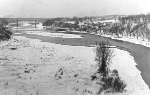
Minnesota Historical Society St. Paul suffered a double setback. Minneapolis had captured title to the head of navigation, but the low dams had eliminated St. Paul’s hope for securing hydropower. Why Congress authorized two low dams, instead of one high dam that could have generated hydropower, is unknown. The St. Paul District commander, Major Francis R. Shunk, tried to explain the matter to Minneapolis Mayor J. C. Haynes on February 17, 1909. “Now as to the duplication of locks and dams; two instead of one. Connected with this matter is a secret history, upon which I proceed as discreetly as may be to cast a little light. There is the city of St. Paul, and there is the city of Minneapolis. For physical reasons, a single lock and dam must lie entirely within the limits of Minneapolis, or entirely within the limits of St. Paul. . . . Enough said. There are two locks.”93 Minneapolis had somehow won the debate over building one or two dams. While intense local issues had resulted in two dams, an equally intense national debate would lead to a new project for one. SummaryBy 1907, Minneapolis, St. Paul, Hastings and other river cities, through their successful lobbying and through the Corps, had changed the upper Mississippi River dramatically. Hundreds of wing dams and closing dams studded the river’s banks from St. Paul to St. Louis. Hundreds of miles of riverbank had been secured with riprap. Five dams at the Headwaters stored the winter’s snow, holding it for the summer and fall, when the millers at St. Anthony and the steamboats below would need it. And Congress had authorized, that year, a sixth dam for the Headwaters, the one at Gull Lake. A newly completed lock and dam and another one under construction promised to make Minneapolis the head of navigation. The river pioneers once forded with their wagons and livestock no longer existed. Maybe, at a few places, especially between St. Paul and Hastings, settlers could have waded across on some persistent bar during extremely low water. Congress, however, would soon authorize new projects for the upper Mississippi River that would make this impossible. Endnotes
|
Last updated: November 22, 2019
