- Rock Creek Park (342)
- Grand Canyon National Park (202)
- Yellowstone National Park (194)
- Mount Rainier National Park (121)
- Lewis & Clark National Historic Trail (115)
- Bryce Canyon National Park (108)
- Golden Gate National Recreation Area (106)
- Chesapeake & Ohio Canal National Historical Park (103)
- Prince William Forest Park (94)
- Show More ...
- Geologic Resources Division (168)
- Inventory and Monitoring Division (28)
- Northeast Coastal and Barrier Inventory & Monitoring Network (27)
- National Register of Historic Places Program (22)
- National Center for Preservation Technology and Training (21)
- Natural Resource Stewardship and Science Directorate (20)
- San Francisco Bay Area Inventory & Monitoring Network (15)
- Wildland Fire Program (12)
- Harpers Ferry Center (11)
- Show More ...
Showing 4,410 results for Rim Rock Drive ...
Sleeping Bear Inn Garages
- Type: Place

Six years after Day's death, his daughter Marion and her husband Louis Warnes began running Dunesmobile rides out of Glen Haven. It started with a 1934 Ford which took four people out to the crest of the dunes and back. It was a thrilling 35-minute ride that took passengers to the crest of the dunes and back for 25 cents each. By the time the rides ended in 1978, there were 13 dunes wagons each carrying 14 passengers on a 12 mile, 35-minute excursion.
Philip A. Hart Visitor Center
Ledges Overlook
Oak Ridge Alphabet Housing
- Type: Place

Alphabet housing in Oak Ridge ran the gamut of style, space, and function. From Type A through H Cemesto homes- Cemesto being a mix of cement and asbestos- to Types A, B, C, S, and V Flat-Top designs, Oak Ridge’s architectural style was unique in its simplicity, form, function, and space. There are several examples still standing in Oak Ridge as private residences.
Visitor Contact Station Kaloko Honokohau
Pine Lane Trailhead Information
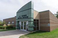
A. E. Seaman Mineral Museum
Geography of Oak Ridge
Coppertown Mining Museum
Painesdale Mine and Shaft
Adventure Mining Company
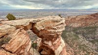
Rim Rock Drive (Colorado National Monument)
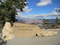
Bright Angel Trailhead
- Type: Place

Bright Angel Trailhead is located just west of Bright Angel Lodge, Lookout Studio, and Kolb Studio. At 6,840 feet (2,085 m), it provides access for hikers and mules to many inner canyon destinations. From the Hermit Road Interchange shuttle bus stops, it is a short walk to the east, and up a hill, on a paved footpath to the trailhead. This winter, a number of trail closures (on parts of Bright Angel Trail) are in effect. Click on the link for details.
Bright Angel Trail
- Type: Place

Bright Angel Trail lets hikers walk in the footsteps of the canyon's Indigenous Peoples, miners, and early tourists, as they descend into the canyon's depths. Offering big views, morning and afternoon shade, resthouses, vault toilets, and water stations during the summer. The water is OFF at 1.5- and 3-mile resthouses. Portions of Bright Angel Trail are closed for waterline construction, Visit the link for a list of trail closures.
South Kaibab Trail
- Type: Place

This well-maintained dirt trail offering wonderful expansive views. This is a great trail for short day hiking trips into the canyon of half a day or less. During winter months foot traction and hiking poles are advised when trail surfaces are icy. There is no public parking at the South Kaibab Trailhead. Please park at the Visitor Center, then take the Kaibab (Orange) Route shuttle bus to the trailhead. It is a 9-minute ride from the Visitor Center to the Trailhead.
Backcountry Information Center
- Type: Place

The Backcountry Info Center is open daily from 8 am–noon; and 1 pm–5 pm, and provides information, permits, and trip planning assistance about day and overnight hikes into the canyon. The building is located in the village by Parking Lot D, and across the railroad tracks from Maswik Lodge. Park in Lot D, then take the free, early morning Hikers' Express bus from Backcountry Info Center to South Kaibab Trailhead.
Canyon Rim Trail (Colorado National Monument)
Window Rock Trail (Colorado National Monument)
Ute Canyon Trail (Colorado National Monument)
- Type: Place

Ute Canyon Trail can be accessed from above or below. The upper trailhead is on Rim Rock Drive and begins with a half-mile steep descent on switchbacks down to the canyon bottom. The lower access is from Wildwood Trailhead outside the Monument. Follow Liberty Cap or Corkscrew Trails up to the connection with Ute Canyon.


