Filter Your Results
- Acadia National Park (440)
- Golden Gate National Recreation Area (363)
- Yellowstone National Park (360)
- Lewis & Clark National Historic Trail (355)
- Grand Canyon National Park (306)
- Denali National Park & Preserve (305)
- Point Reyes National Seashore (259)
- Rock Creek Park (227)
- Mount Rainier National Park (205)
- Show More ...
- Geologic Resources Division (552)
- Inventory and Monitoring Division (203)
- Wildland Fire Program (196)
- National Register of Historic Places Program (194)
- Natural Resource Stewardship and Science Directorate (157)
- Harpers Ferry Center (125)
- National Center for Preservation Technology and Training (119)
- National Heritage Areas Program (102)
- Fire and Aviation Management (101)
- Show More ...
Showing 13,214 results for Hawaiʻi Volcanoes National Park ...
Fort Vancouver National Historic Site
Finishing Touches and the Future of Vancouver Barracks
- Type: Article

With much of the rehabilitation complete – utilities replaced, buildings upgraded, parking and walkways enhanced, and overhead electrical lighting removed – the team at Vancouver Barracks can continue to focus on the details that bring history to life.
California National Historic Trail
Jim Beckwourth Cabin Museum
- Type: Place
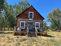
Jim Beckwourth, the African-American mountain man, scion of British nobility, great medicine and warrior chief in the Crow Indian Nation, US Army scout and courier, and discoverer of Beckwourth Pass and trail, settled here on his road for 7 years. He created several things we still have: Beckwourth Pass and Trail, located by Trails West markers, this cabin, and a national best seller biography, The Life and Adventures of James P. Beckwourth, 1856.
Fort Vancouver National Historic Site
Visiting Vancouver Barracks
- Type: Article

From the beginning of the National Park Service’s custody of Vancouver Barracks, Fort Vancouver National Historic Site staff envisioned a place of recreation and learning for the public. After years of work, and with improved, accessible routes and programming, they finally welcomed visitors to parts of the site that were previously difficult to reach.
- Type: Article
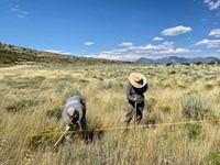
At Black Canyon of the Gunnison National Park and Curecanti National Recreation Area, long-term vegetation monitoring provides park managers with useful information for decision making on topics including changes in climate, grazing, and fire management. A recent report summarizes monitoring from 2011 to 2022 of vegetation and soil conditions provides management recommendations for their conservation.
Fort Vancouver National Historic Site
Beneath the Barracks: Archeology Considerations for Utilities Upgrades
- Type: Article

When Fort Vancouver National Historic Site took over the U.S. Army’s Vancouver Barracks in 2012, many of the utilities systems were decades old – some had not been updated since they were built in the first half of the 20th century. Bringing those systems up to standard was a top priority for creating a sustainable, historic campus for public service.
Fort Vancouver National Historic Site
Post to Park Transfer
- Type: Article

In 2012, the US Army transferred the east and south portions of Vancouver Barracks to the National Park Service.
Fort Vancouver National Historic Site
Developing the Master Plan
- Type: Article

The Post-to-Park transfer of the East and South Barracks to the National Park Service didn’t take place overnight – planning began over a decade earlier with thorough public involvement and community input. In 2012, Fort Vancouver National Historic Site released its Draft Master Plan for the site, with the goal of establishing a vision for public use and providing guidance for park managers for the next 20 years.
Fort Vancouver National Historic Site
Partnerships for a Public Service Campus
- Type: Article

The goal of Fort Vancouver National Historic Site’s 2012 Master Plan is to create a public service campus for the local community and for visitors. To accomplish this, Fort Vancouver NHS partnered with local agencies and organizations to find creative ways to adapt and reuse barracks buildings.
Assateague Island National Seashore
Outside Science (inside parks): Bird Health at Assateague Island
- Type: Article

Assateague Island, way out on the Maryland coast, may be famous for its wild horses, but it’s also a great spot for birds. In this episode of Outside Science (inside parks), park scientists and interns are giving birds a health check-up to make sure they’re doing okay.
- Type: Article

Invasive exotic plants are one of the most significant threats to natural resources in the national parks today. To provide early warning of weed invasions, the Northern Colorado Plateau Network monitors target plants in park areas where they are likely to first establish: along roads, trails, and waterways. Find out what we've learned at Curecanti National Recreation Area.
Hampton National Historic Site
Ann's story at Hampton
- Type: Article

Ann is with our friend's group Historic Hampton Inc (HHI). She has played a role in supporting and helping Hampton for decades! It all started when her friend invited her to a meeting. She told us all about her experience with Hampton, click to learn more!
- Type: Place

At Little Rock Central High School National Historic Site in Arkansas, exhibits tell the story of those times, and interactive oral history stations give you a chance to hear the people who were there tell the story in their own words.
Valles Caldera National Preserve
Valles Caldera Announces 2025 Artists in Residence
- Type: Article

Valles Caldera National Preserve has selected five artists to take part in its inaugural Artist in Residence (AiR) program during the 2025 summer season. Through the AiR program, selected artists will immerse themselves in the park’s natural and cultural landscapes to create original artistic works inspired by the setting. During their residencies, they will also share their work with the public through presentations and interactive workshops. Meet this year's artists!
Hawaiʻi Volcanoes National Park
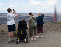
Eruption Viewing from Wahinekapu
- Type: Place

Experience the heat from nearby steam vents as you take in the breathtaking views of the eruption, with unobstructed, panoramic views of the entire cinder cone. Located on Crater Rim Drive West, 1 mile (4 minutes) from entrance station. A popular, but congested spot due to being the first overlook you encounter upon entering the park.
- Type: Article

The National Park Service (NPS) is on a mission to deepen its understanding of the bees living in parks. Traditional survey methods require significant time, specialized expertise, and the collection of specimens from their natural habitats for species-level identification. With limited bee specialists available and a growing need for efficient, cost-effective methods, the NPS sought an alternative approach.
- Type: Article

Forest regeneration in the National Capital Region continues to slowly improve, especially in parks that manage their deer populations. A look at forest regeneration capacity based on monitoring data from 2024.
- Type: Article
Cape Cod is a large glacial moraine peninsula that extends 96.5 km into the Atlantic Ocean from the coast of Massachusetts. Cape Cod National Seashore (CACO) is located on the outer portion of Cape Cod. Almost all the estuarine habitat at CACO is associated with two large coastal lagoon systems, Pleasant Bay (PB) and Nauset Harbor/Marsh (NH). Due to restricted flushing with the ocean and residential development pressures outside the seashore boundary...
Hawaiʻi Volcanoes National Park
Eruption Viewing from Uēkahuna
- Type: Place
The overlook at Uēkahuna offers great views into Halemaʻumaʻu crater and surrounding areas from the summit of Kīlauea volcano. Located at the end of Crater Rim Drive West, a 2.8 mile (7 minute) drive from the entrance station. Family-friendly location with ranger's on-site for information. More available parking compared to other locations.
Hawaiʻi Volcanoes National Park
Eruption Viewing from Kūpinaʻi Pali
- Type: Place

Escape the crowds and experience the eruption in solitude. This vantage point offers stunning wide-angle views of the caldera, being the furthest overlook from the eruption. Located at the end of Crater Rim Drive West, a 0.3 miles (2 minute) drive from the entrance station. Parking available near the closed Kīlauea Visitor Center. Hike 0.5 miles (20 minutes) towards Volcano House hotel and southeast on Crater Rim Trail.
Hawaiʻi Volcanoes National Park
Eruption Viewing from Kīlauea Overlook (Kapalikapuokamohoaliʻi)
- Type: Place

Kīlauea Overlook offers unobstructed views of the bottom of the Halemaʻumaʻu crater during an eruption. Located 2.5 miles (7 minutes) from the entrance station. Family-friendly location with great views. A short 0.4 miles walk from the overlook at Uēkahuna.