
NPS Photo/ Tracie Irvin Young Over 30 miles of the Green and Nolin Rivers trace through the Mammoth Cave National Park and offer a wealth of recreational opportunities. Angle for muskellunge, bluegill, catfish, bass, perch, crappie, and other game fish. Canoe or kayak the rivers looking for wildlife, springs and river bluffs. Camp on islands, in the floodplain, or by the river at the Houchin Ferry Campground. These rivers offer something for everyone. About the RiversThe Green River is one of the most biodiverse rivers in the country. It is home to more than 150 fish species, more than 70 species of mussel including many threatened or endangered species. The river spans 25 miles (40.2 km) through the park and is dotted with sandbars, islands, and subsurface springs. The river averages 200 feet ( 61 m) wide and 10 feet (3 m) deep, though its depth may be much greater in places.
While considered a flat-water river, the current can still be very swift and prior paddling experience is recommended. Regardless of water level, always be alert to hazards such as submerged trees and rocks, drifting debris, and the park's ferry. 7.5 miles (12 km) of the Nolin River span from the Tailwater Recreation Area, part of the US Army Corps of Engineers Nolin River Lake and Dam Area, to the confluence with the Green River in the park.
In 2016 there was a failure of Lock and Dam No. 6 on the Green River, downstream of the confluence with the Nolin River, and the dam was ultimately removed. The removal of the dam has resulted in lower water levels and swifter river currents. Water levels can change rapidly due to weather (i.e. rise 20-50 feet in the hours and days after a rain event) or due to water release schedules from the Nolin River Dam. Serious hazards such as fallen or submerged trees and rocks, drifting debris and swift currents can exist. Paddlers on the river should be familiar with operating paddle craft on moving water as part of a dynamic river system. 
Kentucky's First National Water TrailThe rivers inside of the park are part of the Green and Nolin Rivers Blueway, a National Water Trail encompassing 36 miles of navigable waterway and 7 public access sites. This designation actively supports public access for safe river recreational use, promotes stewardship, and connects communities and visitors to enjoyment and appreciation of the overall health of the river system and surrounding lands. Planning Your River Trip
River Access PointsWithin the park there are three river access points accessible by car: Dennison Ferry, Green River Ferry, and Houchin Ferry. All of these sites are located on the south side of the Green River. Outside of the park on the Nolin River is the Tailwater Recreation Area.
Trip IdeasTrip Distance: 7.6 miles (12.2 km)
Approximate Travel Time: 2.5 to 4 hours This popular river trip takes paddlers from the Dennison Ferry Day Use Area to the Green River Ferry, a short distance from the visitor center area. Paddlers are treated to scenic flat waters with gravel bars, islands, and back channels to explore while spending the day on the river. Riverside caves are accessible by paddle craft at lower water levels and wildlife is abundant in this section of river. The Green River is a dynamic river system with gravel bars, islands, and river channels that change each year. Use caution while recreating on the rivers and steer clear of downed trees and logjams. Trip Distance: 12.4 miles (19.9 km)
Approximate Travel Time: 4 to 6 hours This longer section of the Green River is less traveled then the popular Dennison Ferry to Green River Ferry trip, but offers beautiful and scenic flat waters with gravel bars, islands, and back channels. Several riverside caves and springs are accessible. At lower water levels, numerous gravel bars and low riverbanks offer camping destinations for paddlers with a valid riverside camping permit. The Green River is a dynamic river system with gravel bars, islands, and river channels that change each year. Use caution while recreating on the rivers and steer clear of downed trees and logjams. Trip Distance: 11.1 miles (17.8 km)
Approximate Travel Time: 4 to 6 hours This trip starts at the Tailwater Recreation Area below the Nolin River Dam north of the park. The trip will take paddlers below tall cliffs and steep river banks. Paddlers will continue down the Nolin River approximately 7.5 miles (12 km) to the confluence with the Green River. Once at the confluence with the Green River, turn left onto the Green River and paddle upstream 1.7 miles (2.7 km) to Houchin Ferry. An alternate take out spot is the former site of Lock and Dam #6 or the boat ramp in the town on Brownsville, 3.2 miles (5.1 km) downstream from the confluence of the Nolin and Green Rivers. The Nolin River is a dynamic river system with a narrow river channel that changes each year. Use caution while recreating on the rivers and steer clear of downed trees and logjams. Trip Distance: 3.6 miles (5.7 km)
Approximate Travel Time: 1.5 to 2 hours This short trip travels along the Green River from Houchin Ferry inside Mammoth Cave National Park to the former site of Lock and Dam #6 or the Brownsville boat ramp. The first half of the trip follows the river inside the park, once outside of the park boundary the river channel is surrounded by private land. Be mindful of private property boundaries when stopping along the river. Riverside camping permits are only valid inside the park boundary. The Green River is a dynamic river system with gravel bars, islands, and river channels that change each year. Use caution while recreating on the rivers and steer clear of downed trees and log jams. NOTICE: Class 2 rapids have developed on the Green River at the former site of Lock and Dam 6 at Mile Marker 182. The rapid area is just past the park's western boundary and before you reach the Brownsville Boat Ramp. Please adjust your plans accordingly. More Trip IdeasPaddling in the area is not limited to the rivers in the park. Visit Cave Country Trails for more information on paddling options in the greater Mammoth Cave area. 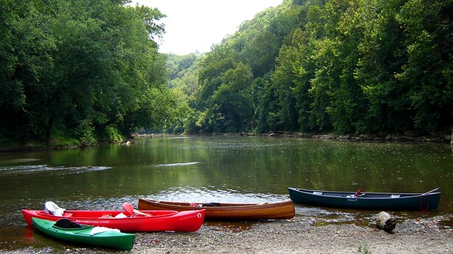
River Safety and Regulations
Learn your responsibilities when recreating on the river. 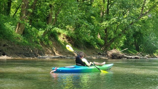
Canoe and Kayak Outfitters
Rent a boat for a day on the river. 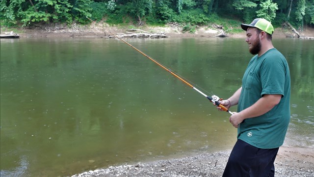
Fishing
Fishing regulations and more. 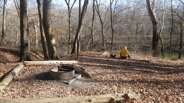
Backcountry and Riverside Camping
Learn more about backcountry camping in the park. 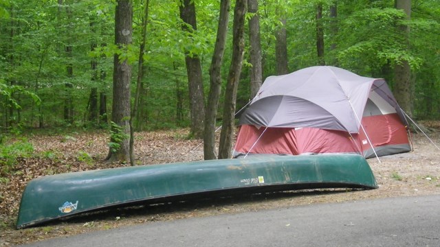
Houchin Ferry Campground
Camp along the Green River in a campground. Current and Forecasted Water Levels on the Green RiverIn cooperation with the US Geological Survey, the park maintains a water level monitoring station on the Green River inside the park boundary.
Lock and Dam 6 RapidsClass 2 rapids have developed on the Green River at the former site of Lock and Dam 6 at Mile Marker 182. The rapids area starts just past the park's western boundary and before you reach the Brownsville Boat Ramp. Please adjust your plans accordingly. SwimmingSwimming in park waters is not recommended. At normal stage, the Green River flows at a relatively brisk 4.3 knots, about 5 miles per hour, which is too strong to swim against. There is no designated swimming area in the park and no lifeguards on duty.
|
Last updated: February 2, 2026