Did you know that more fires occurred within Noatak National Preserve during the summer of 2010 than in any other National Park units in Alaska? The following is an introduction to the history, ecology, and importance of fire in the Western Arctic National Parklands by Jennifer Barnes, NPS Fire Ecologist.
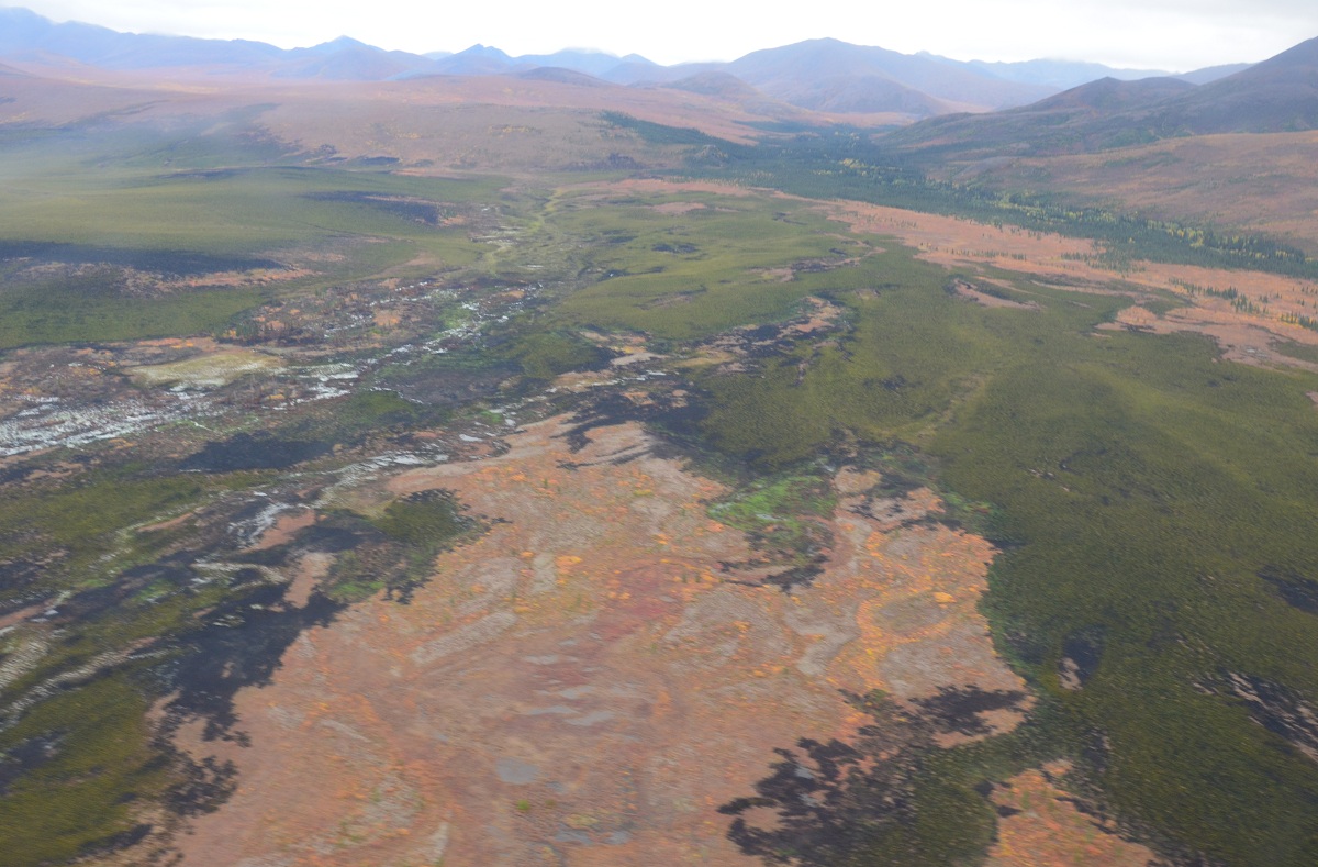
HISTORIC ROLE OF FIRE IN THE WESTERN ARCTIC NATIONAL PARKLANDS
Fire is the dominant disturbance regime in the boreal forests and tundra ecosystems in Alaska. Over 19 million acres have burned in Alaska over the last 10 years. The primary objective for managing wildland fires within the Western Arctic National Parklands is to maintain the area's bio-diversity and natural process through the use of fire (including the naturally occurring spectrum of fire intensities and effects) while also ensuring the safety of life, property, and sensitive resources (Western Arctic Parklands FMP, 2011). The National Park Service Fire Management Program and the Arctic Network Inventory and Monitoring Program monitor the number of fires each year and changes that occur after fires.
Weather, terrain, and vegetation strongly influence the occurrence and extent of fires within WEAR. The subarctic boreal forests and low arctic tundra biomes are subject to periodic fires. Over the last 60 years, greater than 1,248,506 acres have burned within and around the WEAR park units. An annual average of 13,397 acres burn per year just on NPS lands, 97% of which are caused by lightning (data from 1950-2010). The frequency and extent of the fires are variable within the park units (Table 1). Fires can exert landscape-scale controls on vegetation structure and composition, permafrost dynamics, nutrient cycling, carbon loss/gain, primary productivity, and biodiversity (Racine et al. 2004).
Table 1. Fire statistics for fires that have burned in and around WEAR from 1956-2010. Data is shown for both 1) fires that occurred only within park boundaries ("In Park") and 2) fires that have burned in the park boundaries, although not all acres are contained within the administrative boundary of the units ("Affecting Park"). Most fire data provided in the table is based on NPS fire records from 1950 - 2010 fires (Fire-NPS Alaska 2010, AKRO GIS permanent data set). Area burned within park boundaries are based on fire perimeter data. Lightning strike data is from AICC ARCIMS web page.
|
Statistic |
BELA |
CAKR |
KOVA |
NOAT |
Total: WEAR |
|
Number of Fires Affecting Parks (Fire-NPS Alaska 2010) |
45 |
4 |
63 |
189 |
301 |
|
Number of Fires Started in Park (Fire-NPS Alaska 2010) |
42 |
3 |
58 |
186 |
289 |
|
Total Acres Burned - Affecting Parks (Fire-NPS Alaska 2010) |
292,387 |
4,277 |
418,780 |
533,061 |
1,248,506 |
|
Total NPS Acres Burned* |
136,573 |
673 |
110,103 |
476,087 |
723,435 |
|
Average Area Burned/Year Affecting Park (1956-2010) |
5,415 |
79 |
7,755 |
9,872 |
23,120 |
|
Average Area Burned/Year NPS acres in Parks* (1956-2010) |
2,529 |
12 |
2,039 |
8,816 |
13,397 |
|
Average Fire Size Affecting Park |
6,497 |
1,069 |
3,735 |
2,820 |
4,148 |
|
Average number of lightning strikes/year (1986-2010) |
50 |
12 |
138 |
412 |
|
|
Park Acreage |
2,785,901 |
660,043 |
1,751,646 |
6,568,645 |
11,766,236 |
* Data based on acres from fire perimeter data set 1950-2010 clipped to park boundaries.
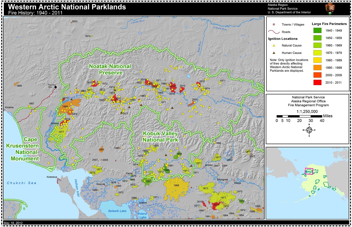
Within Noatak National Preserve the lowlands of the Noatak Valley are subject to periodic large fires and frequent small fires from late May until early August. Fires commonly occur in shrub-tussock tundra, sedge/graminoid lowlands, and shrub thickets of dwarf birch/ericaceous, alder or willow. Of all the parks in WEAR, Noatak has burned the most acreage and greatest number of fires over the last 55 years (Table 1). Recent studies indicate that over the past 2000 years in Noatak, the fire return interval has ranged from a median of 150 years down valley to 195 years up valley in the Noatak drainage (https://www.nps.gov/akso/nature/science/ak_park_science/PDF/2011Vol10-1/the-burning-tundra-Higuera.pdf). More than 95% of Noatak's fires are caused by lightning. Thunderstorm development in the valley can result from synoptic widespread storms or localized air-mass storms controlled by local topography. Warm dry air masses within the Noatak Valley can encounter coastal low pressure systems from the west, leading to significant thunder cell development and lightning. Noatak has the highest frequency of lightning strikes per year over the 15 year record. When ignitions are accompanied by dry windy conditions, fires in the shrub-tussock tundra and low shrub birch/ericaceous can spread rapidly and burn thousands of acres in a few days.
Kobuk Valley National Park (KOVA) is in the transition zone between the interior Alaska forests and northern and western tundra. Of the WEAR parks, KOVA has the greatest amount of forested lands, with a majority of the needleleaf forest mapped as white spruce (Table 1). Fires are most frequent in lower elevation forests south of the Baird Mountains within open and woodland spruce forests. Ninety two percent of starts occur between June and July. As is typical of boreal forest fires, the fires tend to have longer duration than tundra fires. No studies have been completed on the fire return intervals within KOVA. Fire cycles based on fire perimeters from 1950-2007 indicate that the fire cycle for Kobuk Valley is 840 years (Joly et. al. 2010). Fire cycle is defined as the length of time for an area equal to the entire area of interest (i.e. total park acres) to burn (McPherson et. al. 1990).
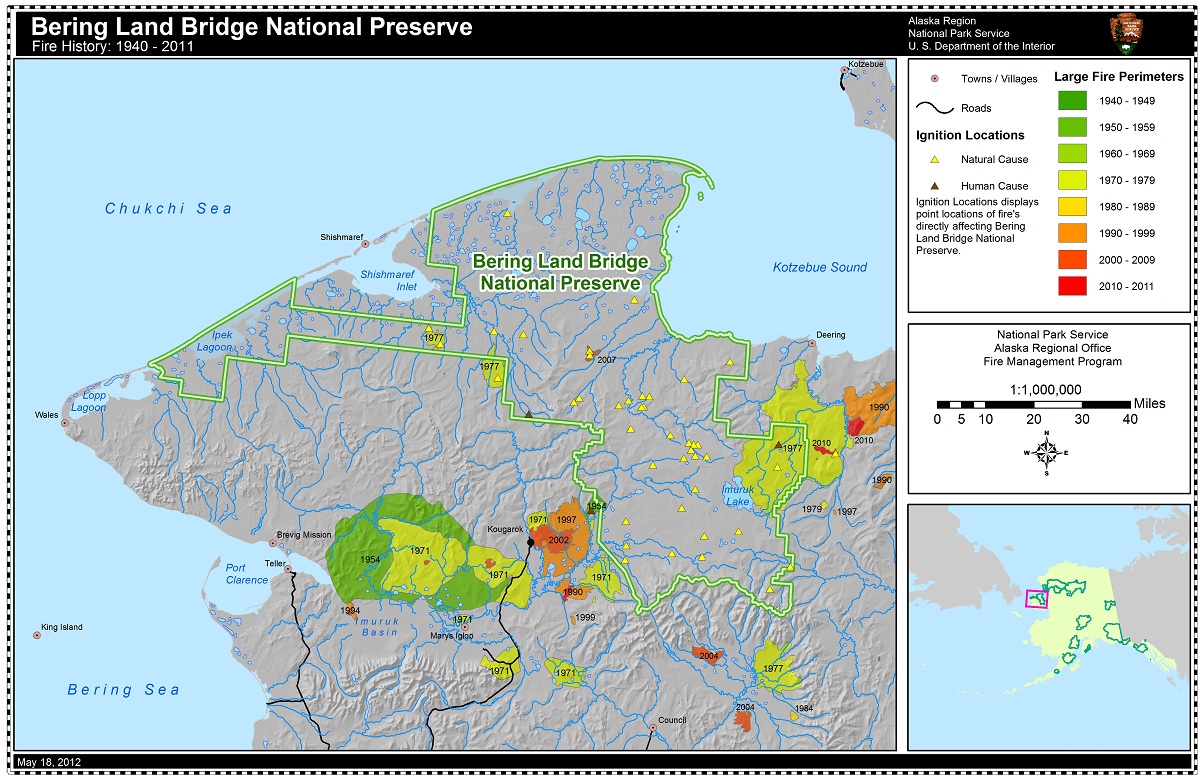
Bering Land Bridge National Preserve is located on the northern part of the Seward Peninsula. This area is a cold, wind-swept landmass jutting out into the Bering Sea. Vegetation is primarily tundra, with moist sedge-tussock shrub tundra communities at lower elevations and alpine Dryas-lichen tundra communities in the high mountains. Vegetation is primarily composed of sedge tussocks interspersed with scattered stringers of willows and dwarf birch. Patches of low-growing ericaceous and willow-birch shrubs occur on better-drained areas. Isolated pockets of balsam poplar occur within the region. These vegetation communities are susceptible to fire, but low frequency of lightning (Dissing and Verbyla 2003) and/or higher precipitation near coastal areas reduce the number of fires within BELA. The majority of acres burned within the preserve occurred during 1977, in which several large fires burned within and around the Preserve. Fire return intervals are not known for the preserve, however fire cycles based on fire perimeters from 1950-2007 indicate that the fire cycle for Bering Land Bridge is approximately 1,188 years (Joly et. al. 2010).
Cape Krusenstern National Monument (CAKR) is dominated by moist dwarf shrub-tussock tundra. The forest reaches its northwestern most limit in North America in the vicinity of the eastern border of Cape Krusenstern National Monument. The number of fires in CAKR is much lower than the other park units due to the wet maritime conditions and lack of ignition sources. Only four fires have been detected in CAKR over the past 50 years. Likewise, Joly and others found that the fire cycle for Cape Krusenstern was estimated at 53,349 years. No studies have been completed on the fire return intervals within CAKR.
RECENT FIRE HISTORY
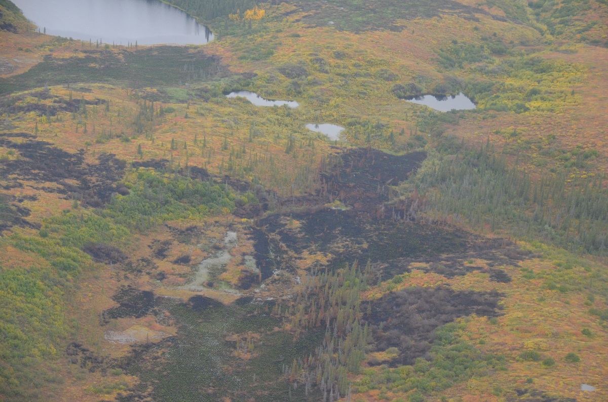
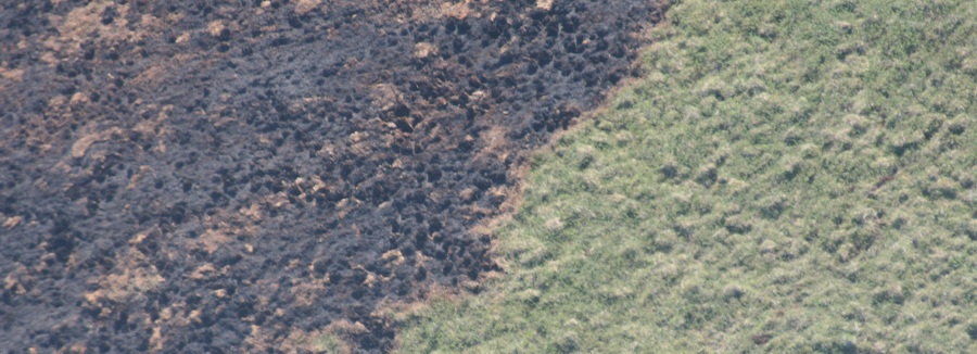
A total of47 fires occurred within the Arctic Network of Parks during 2010. This is the largest number of fires to have occurred in the last 60 years of records (1950-2010). Noatak National Preserve had a record breaking 37 fires with at least 106,000 acres burned within the preserve. The largest fire to occur in the preserve that year was the Kaluktavik River fire which burned 23,269 acres. Although many of the fires were small (17 of the 37 fires were less than 1 acre in size), the average fire size was 2,905 acres. After this large fire year, NPS fire ecologist and crew assessed burn severity and vegetation composition at 5 of the 37 fires that occurred in Noatak in 2010. In most areas monitored, the burn severity was low to moderate and vegetation was rapidly recovering just one year after the fire.
During the summer of 2011, a total of 15 fires occurred within the Arctic Network of Parks. Most of the fires occurred in Noatak National Preserve, 13 fires occurred and records indicate that 3,456 acres burned in the park. Most of the area burned resulted from a few fires, while 8 of the 13 fires burned 10 acres or less. Gates of the Arctic had 2 fires with a total of 184 acres burned. Overall for the state of Alaska the fire season was below the 10-year average for acres burned with a reported total of 293,017 acres burned and a total of 517 fires recorded.
During the summer of 2012, an additional15 fires occurred within the Arctic Network of Parks. Again most of the fires occurred in Noatak National Preserve, 7 fires occurred and records indicate that 55,024 acres burned in the park. Most of the area burned resulted from 3 fires near the Uvgoon Cr and Kungiakrok Cr that burned together for a total 43,880 acres. Kobuk Valley had 5 fires recorded with a total of 6,713 acres burned. Gates of the Arctic had 3 fires with a total of 834 acres burned on park lands, but including the area outside the park a total of 4,613 acres burned. Overall for the state of Alaska the fire season was below the 10-year average for acres burned with a reported total of 260,417 acres burned and a total of 389 fires recorded.
For more information about the National Park Service Inventory & Monitoring program's work on fire extent and severity, click here. To read more about the history of fires in Noatak National Preserve over the last six millenia, click here. If you don't believe lightning strikes often in northern Alaska, click here and enter dates that span up to two weeks during the months of June or July.
