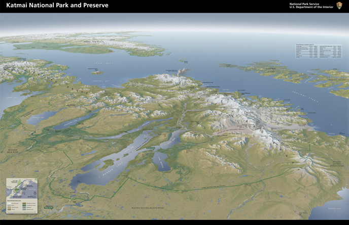
Katmai’s boundaries and the reasons for protecting the area have changed significantly over time. Presidential decisions can help explain why. Download a high resolution PDF of this map.
Presidents’ Day is a time to reflect on the office, role, and influence of the president of the United States. Throughout Katmai’s 97 years, several presidents have influenced Katmai’s purpose and evolution. Which U.S. presidents established, expanded, or adjusted Katmai’s boundaries and why did they do so?
Woodrow Wilson
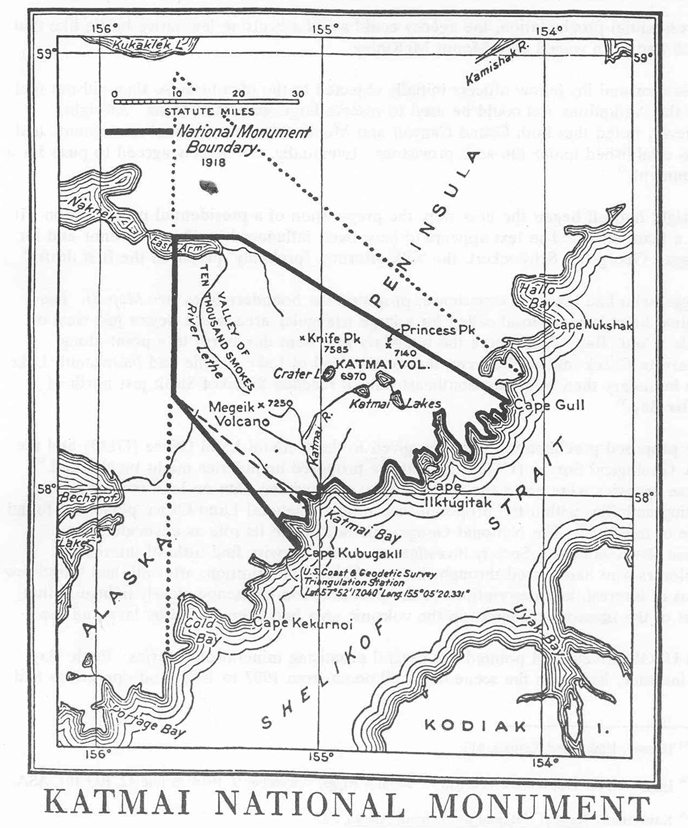
In 1918, President Wilson created Katmai National Monument by presidential proclamation to protect the Valley of Ten Thousand Smokes and surrounding area for “scenic, as well as scientific, interest for generations to come.” The original monument was over one million acres in size.

The area within the solid line represents the original Katmai National Monument, which was established to protect the volcanically devastated region surrounding the Valley of Ten Thousand Smokes.
Calvin Coolidge
In 1923, President Coolidge issued an executive order eliminating 10 acres of land from the monument to allow for coal mining on the west side of Amalik Bay. There is no evidence a permit for the mine (which was required at the time) was ever obtained and no mine was established there.
Herbert Hoover
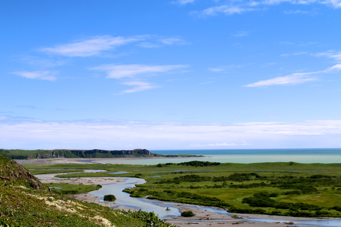
In 1931, President Hoover added 1.6 million acres to Katmai National Monument through a presidential proclamation for the “protection of brown bear, moose, and other wild animals.” This was the first, but not the last, time wildlife was cited as a primary reason for protecting Katmai. This presidential proclamation expanded Katmai’s boundaries west over the Brooks River area and much of Naknek Lake as well as north to include nearly all of Katmai’s modern coastline.

Among other areas, a spectacularly rugged coastline was included within the 1931 monument expansion. NPS/K. Critz.
Franklin D. Roosevelt
President Roosevelt twice altered Katmai’s boundaries and purpose. In 1936, he modified the previous presidential proclamations “to make reservations contained therein subject to valid claims…existing when the proclamations were issued and since maintained.” This validated land claims made prior to the 1918 or 1931 proclamations, like that of a cannery in Kukak Bay, so the business could gain a patent and continue operating.
In 1942, FDR issued another presidential proclamation which altered Katmai’s boundary to include “all islands in Cook Inlet and Shelikof Strait in front of and within five miles of Katmai National Monument.” Administrative reports at the time suggest these islands were not protected for their resources, but to to stop poachers from using them as a base to trap on mainland Katmai.
Lyndon Johnson
President Johnson, through presidential proclamation, expanded Katmai’s western boundary by 95,000 acres in 1969 to include all of Naknek Lake “for the protection of ecological and scientific values of this lake and the existing monument.”
Jimmy Carter
In 1978, through presidential proclamation, President Carter expanded Katmai National Monument by 1.3 million acres to protect “a viable gene pool population of the Alaska brown bear…headwaters of the drainages which provide the spawning grounds for red salmon…and the unique subsistence culture of the local residents. Subsistence hunting is a value to be protected and will continue under the administration of the area added to Katmai National Monument.” This was the first mention of subsistence in any of the Katmai proclamations.
On December 2, 1980, he signed the Alaska National Interest Lands Conservation Act (ANILCA) into law. ANILCA redesignated the monument as Katmai National Park “to protect habitats for, and populations of, fish and wildlife including, but not limited to, high concentrations of brown/grizzly bears and their denning areas; maintain unimpaired the water habitat for significant salmon populations; and to protect scenic, geologic, cultural, and recreational features.” It created an area called Katmai National Preserve and stated that “hunting shall be permitted in areas designated as national preserves under the provisions of this Act.” It also designated 3.4 million acres of Katmai as official wilderness.

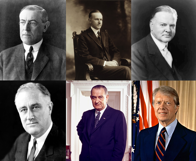
The presidents who have altered Katmai. Top row, left to right: Woodrow Wilson, Calvin Coolidge, Herbert Hoover. Bottom row, left to right: Franklin D. Roosevelt, Lyndon Johnson, Jimmy Carter.
Many presidents influenced Katmai’s history, some for the same reasons and some for different reasons. While some of the boundary changes attracted little attention, many were controversial. Katmai’s history will not remain static. How will future presidential decisions influence Katmai and national parks?
You can find more detailed information about the monument expansions and the reasons for them in Isolated Paradise: An Administrative History of the Katmai and Aniakchak National Park Units. You can also read the presidential proclamations and pertinent ANILCA sections in the appendix of Katmai’s Foundation Statement.
