As many of you know, recently the Brooks Camp Developed Area was temporarily shut down to give the park staff a chance to quarantine, after multiple positive cases of coronavirus were detected. It was definitely a difficult time, not only for the staff here, but for visitors as well. Katmai National Park and Preserve is a once-in-a-lifetime trip for many, and to have it shut down disrupted many people’s plans.
Most people come here for the fishing, or for the bears. If you google “Katmai,” ninety percent of the images will be bears at the falls, with a few photos of salmon from the same location. When people think of Katmai, they are usually thinking of the Brooks Camp Developed Area, so the closure was understandably devastating. Even for those intrepid few who are looking to hike to the Valley of Ten Thousand Smokes or Novarupta usually start from the Brooks Camp Developed Area.
Most people come here for the fishing, or for the bears. If you google “Katmai,” ninety percent of the images will be bears at the falls, with a few photos of salmon from the same location. When people think of Katmai, they are usually thinking of the Brooks Camp Developed Area, so the closure was understandably devastating. Even for those intrepid few who are looking to hike to the Valley of Ten Thousand Smokes or Novarupta usually start from the Brooks Camp Developed Area.
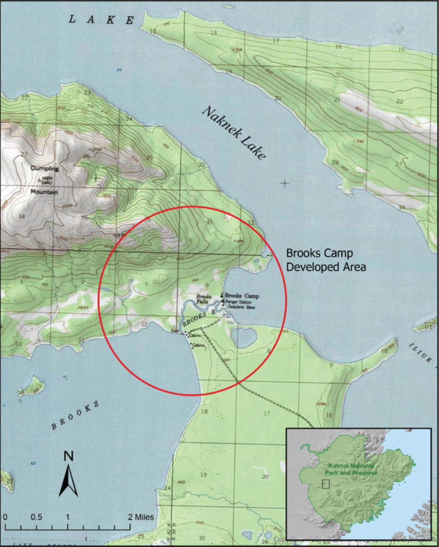 Brooks Camp Developed Area NPS
But Katmai National Park and Preserve is over 6,000 square miles. The Developed Area is just a dot on the map; a tiny speck barely two miles in diameter. If you can get out here, there is so much more to see than just the Falls, spectacular though they are. For example, the Iliuk Arm of Nanek Lake: accessible by boat or plane, just as Brooks Camp Developed Area is, but outside that temporarily-closed bubble.
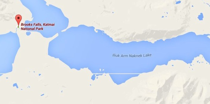 Iliuk Arm in relation to Brooks Camp Developed Area NPS
That’s where I went when I found myself with a bright, sunshiny day, and a perfect opportunity. The Law Enforcement Rangers were about to go out and patrol some of those other areas, and since things were pretty quiet, I was allowed to tag along; a rare opportunity for me, since usually I would be busy with Bear Orientations and monitoring the Falls, and the usual things that keep many of us squarely within that two-mile block. One of the boats needed to be run for general maintenance anyways, so we took it out into the Iliuk Arm. To begin with, there was the usual safety briefing (even Rangers have to go through them, as well as give them), and some fiddling was required to get the motor running, but then we were off.
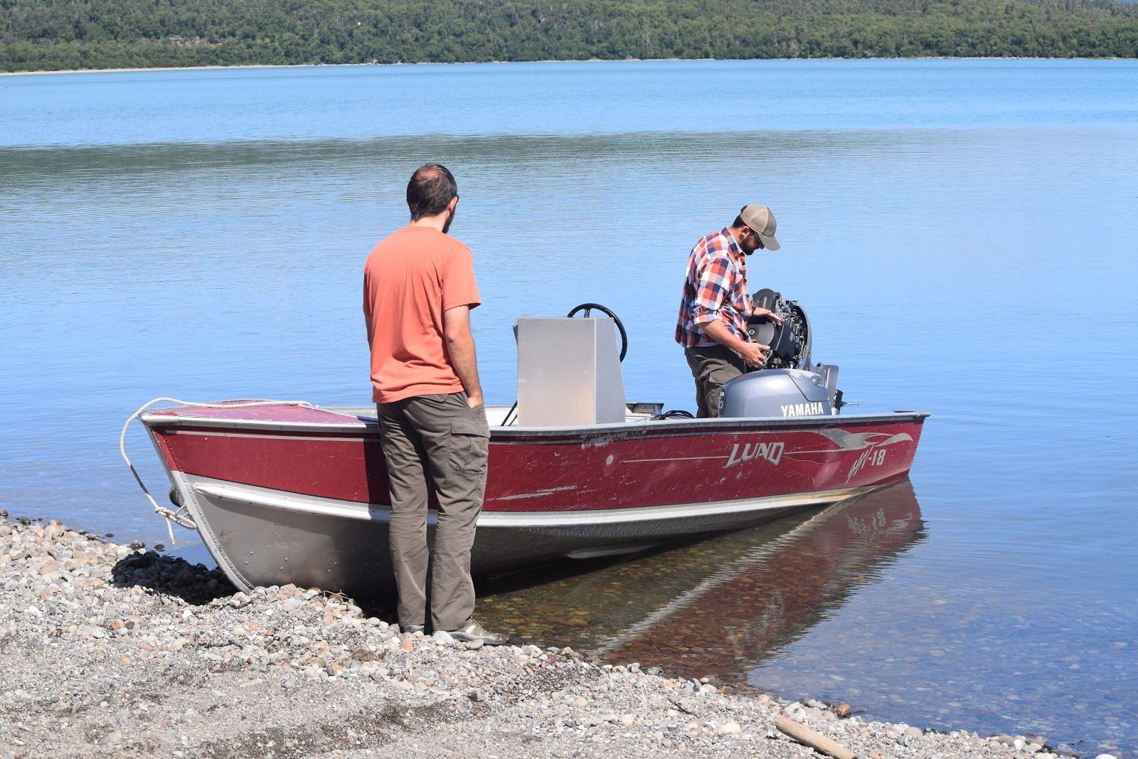 Law Enforcement Rangers checking the boat before setting out
NPS photo/C. Rohdenburg
We buzzed along shorelines for a bit, looking for signs of visitors. We found no people, but did find the remnants of a campsite on one of the islands (please make sure to follow Leave No Trace guidelines when camping). After a quick walkabout, it was back into the boat and on to the next likely spot.
Another island, uninhabited except for some seagulls, gave us the opportunity for a bit of rock climbing and some spectacular views of where the waters mix: clear, gorgeous, sea-green on one side, swirling together with a murky, silt-filled brown on the other. It is both mesmerizing and deceptive: the sand banks and mudflats beneath shift and are obscured from sight. To make it even harder to judge depth, there are whole clusters of floating pebbles milling about.
Usually when out boating, if you see rocks on the surface, that means there’s land. Here, it’s often just pumice bouncing along on the waves, courtesy of the volcanic activity this park is famous for. We found one of these sandbars just below the surface “by feel” which is a fancy way of saying “by accident,” meaning “we ran the boat up on it.” What’s to be done? Hop out, of course, enjoy the sandbar and the fun of appearing to walk on water, and then give the boat a shove back into deeper water and clamber back on board.
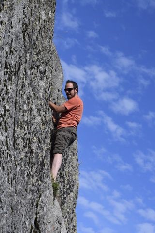
I think rock climbing counts as PT for Law Enforcement
NPS photo/C. Rohdenburg
NPS photo/C. Rohdenburg
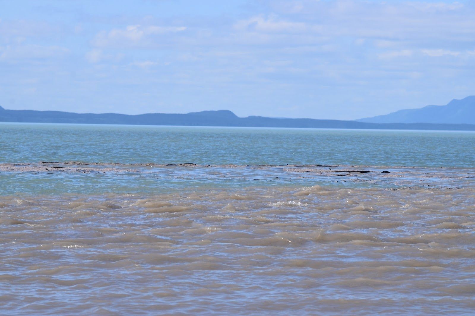 The swirl where the waters meet
NPS photo/C. Rohdenburg
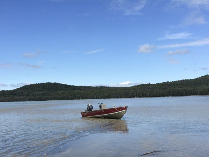 Oops. Beached boat
NPS photo/C. Rohdenburg
The highlight of the afternoon, at least for me, was the stop at Margot Creek. Bears aren’t confined to the Falls over at Brooks. One was peeking out from a bush on the far bank as we approached, and then another, and another, and another. We sat on a bank across from them (more than 50 yards away, and ready to retreat to the boat if they approached) and marveled. Although there are approximately 2000 bears living in Katmai National Park and Preserve (an estimate based on a 2004 study, and observations by our wonderful Resource Management team in the years since), these bears happened to be ones we recognized: #94 and her three two-and-a-half-year-old cubs. You can read more about #94 in the Bears of Brooks River booklet. They are regulars around the Brooks Camp Developed Area, but like so many of our familiar and favorite bears, had moved on to other feeding grounds as the season progressed.
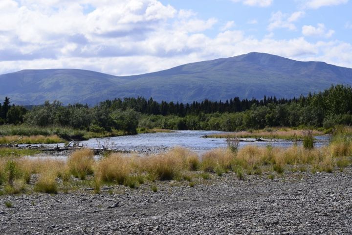 Margot Creek
NPS photo/C. Rohdenburg
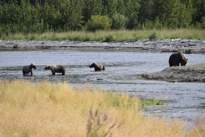 #94 and her cubs
NPS photo/C. Rohdenburg
The salmon aren’t exclusive to the Developed Area either: in fact, at Margot they were brighter and larger than I’d seen all season so far. According to Alaska’s Department of Fish and Game (and to anyone who happened to tear their gaze away from the bears this year) we had another incredible run of salmon this year: Over four million salmon came up the Naknek River, of which about 20% come up Brooks River. The rest go to other places in the Naknek watershed; like Margot Creek for example.
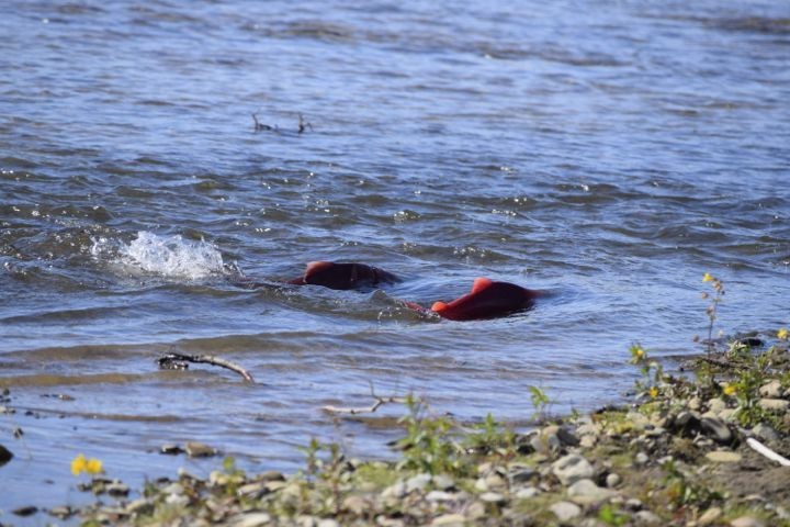 Salmon swimming up Margot Creek
NPS photo/C. Rohdenburg
Every Ranger has their own interests and areas of expertise, aside from the bears, salmon, and general knowledge required for the job. As we explored, turning up fossil after fossil, one of the Law Enforcement Rangers gave us an in-depth lesson in the geology of the area. Another off-duty park employee was spotted out kayaking, and yet another spent the day hiking, looking for mushrooms.
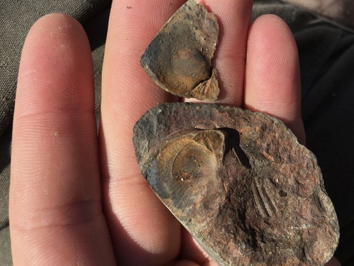 Fossils
NPS photo/C. Rohdenburg
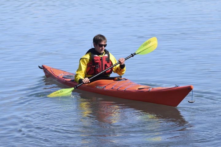 Kayaking on Brooks Lake
NPS photo/C. Rohdenburg
There are so many things to see and do out here in the Park, away from the Falls and the Camp. Even with the Developed Area open again, I hope some of you will take advantage of this wonderfully large, protected wilderness, and explore outside the famous two-mile diameter blip on the map. Let us know in the comments where you’d like to go!
