News Release
You are viewing ARCHIVED content published online before January 20, 2025.
Please note that this content is NOT UPDATED, and links may not work. For current information,
visit https://www.nps.gov/aboutus/news/index.htm.

NPS Photo
|
Subscribe
|
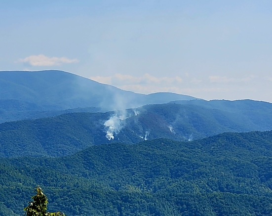
The fire is estimated to be roughly 28 acres and is not contained. The fire has grown minimally over the last several days due to weather conditions (high humidity and lack of strong winds) and shaded terrain. Increased smoke has been visible this week due to an inversion lifting and the relative humidity decreasing. Some rain is expected this weekend which will likely slow, but not extinguish the fire due the dense tree canopy and thick layer of duff (buildup of leaves and plant material) in this area.
While there has been minimal growth on the fire to date, the acreage may increase as weather conditions change with the coming of fall. Park management and the fire incident management team are implementing a strategy to safely and effectively suppress the fire, given that it is burning in very steep, backcountry terrain with dense tree cover. It currently takes firefighters more than two hours on foot to reach the fire from either Parsons Branch Road or from Abrams Creek and there are no options to create a helispot or options that would allow for quickly evacuating firefighters in case of injury. Park management is developing options to mitigate these safety concerns and to help transport firefighters and equipment more efficiently to the backcountry.
Resources on the fire include ground crews and a Type 3 helicopter. Park management is ordering more resources; however, many resources are currently in use given the number of active wildfires, particularly out west.
The park received a report of the fire near Hannah Mountain, south of Abrams Creek, the evening of Aug. 26. No structures are threatened at this time. An investigation revealed several days later that the fire was started by lightning.
Parson Branch Road as well as some park trails and backcountry campsites are currently closed due to fire activity. Check the park website for road closures and other updates before visiting.
-NPS-
Last updated: September 11, 2024
