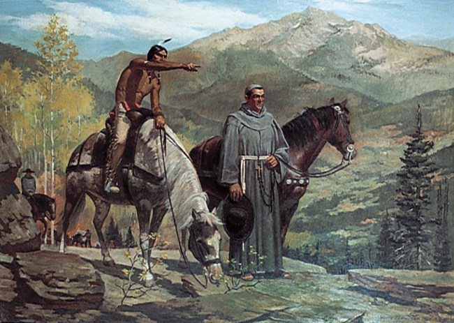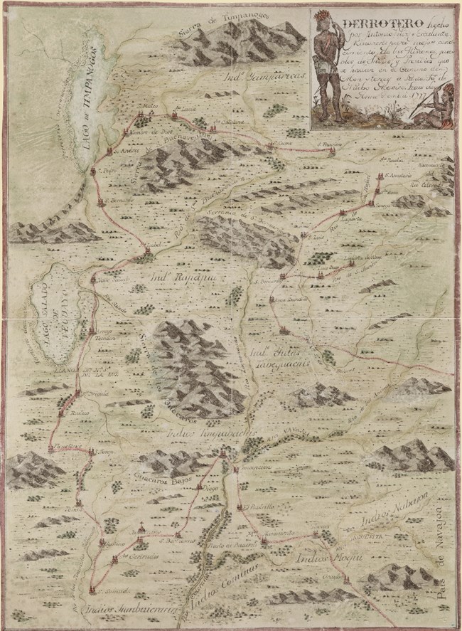
The expedition was organized in Santa Fe, NM with the goal to find a northern route to the newly established missions in Monterrey, CA. A Franciscan friar named Atanasio Domínguez was placed in charge and set about organizing the party. To aid him in this endeavor, Dominguez enlisted the help of fellow friar Silvestre Vélez de Escalante, who was familiar with the tribes on the northern frontier. Many give Escalante the credit for leading the expedition since he kept the journal that recorded daily events. However, Dominguez was the one who made most of the difficult decisions along the way and was ultimately the person to which everyone on the expedition answered. The two friars recruited a small group of men with the intention of securing guides from local tribes to lead them through unknown country. It was very small scale, and this made the journey all the more dangerous. They brought few weapons, and the Utes they encountered early in the expedition warned the friars that they would need them as they ventured further from settled areas. The expedition began in Santa Fe on July 29, 1776 and traveled through Colorado, observing and naming obvious landmarks. While many of the names given by the expedition are no longer in use, a few still retain the original mentioned in Escalante's journal. For example, Canon Pintado or “painted canyon” is just south of Rangely, CO and refers to the pictographs left on the canyon walls that can still be seen today. Along this route the group would encounter the Utes, whom they referred to as Yutas, several times and were able to convince two to join them as guides. They gave the two guides Spanish names: Silvetre and Joaquin, after members of the party. Silvetre and Joaquin were invaluable to the group’s success, guiding it from present day Colorado to Utah Valley. Remarkably, Joaquin was only twelve years old at the time of the journey.
In the middle of September 1776, the party arrived in the area around Dinosaur National Monument, killing a bison somewhere near the Yampa Plateau. From there they continued on a path following Cliff Creek, very close to the present route of US 40, observing Blue Mountain and Musketshot Springs, which they recorded as being “a musket shot apart from each other.” On September 13th, the expedition ventured inside the current Monument boundaries and described the area in great detail. The Friars were impressed by the Green River, which they named the San Buenaventura and wrote that the river flows “between two lofty stone hogbacks which, after forming a sort of corral, come so closely together that one can barely make out the gorge through which the river comes,” a very apt description of Split Mountain Canyon as seen from the south. They continued until they made camp on the bank of the river about a mile from where they intended to ford and camped by a big stand of cottonwoods where one of the members of the party carved “year of 1776.” Cottonwoods are fairly short-lived trees (under 100 years), so the exact tree is no longer present, but there are still several cottonwood stands in the area. On September 16th, the group managed to kill another bison and crossed the river within sight of the current Quarry Visitor Center. Escalante described the landscape where they forded the river as “a chain of small bluffs of loose dirt, some lead colored and others of yellow hue.” Now known as the Mancos shale, these bluffs at the river’s edge are among the first things visitors see when they approach the Quarry Entrance of Dinosaur National Monument. 
In order to survive, the expedition ate many of their horses, the only provisions left to them. Nevertheless, the two friars did return safely to Santa Fe thanks to supplies generously given to them by the Hopi, and they were able to present their journal to Spanish Authorities. Although they failed in their ultimate goal to make it to Monterrey, the Dominguez-Escalante expedition succeeded in describing and mapping huge areas of the American west, opening it up to future exploration and trade. |
Last updated: September 12, 2023
