An official website of the United States government
Here's how you know
Official websites use .gov A
.gov website belongs to an official government
organization in the United States.
Secure .gov websites use HTTPS A
lock (
) or https:// means you've safely connected to
the .gov website. Share sensitive information only on official,
secure websites.
The five trails in the park provide excellent views of Devils Tower and allow for adventures of all lengths and expertise. All park trails are connected and can be combined to fit your needs.Petsare not allowed on any park trail.
Essential Essentials
While we recommend carrying all of the 10 Essentials, during this time we emphasize having supplies to keep your hands clean, a first aid kit, extra water and a park map.
Practice Leave No Trace Ethics
You should follow all Leave No Trace practices, but we specifically enourage you to:
Plan ahead. Know which areas are open in the park, check the weather beforehand, wear proper clothing and bring everything you will need with you.
Be considerate of others. Maintain physical distancing, cover coughs and sneezes, and step off trail to maintain distancing while passing others.
Due to limited parking, hiking can be a great option to get to the visitor center area. The 1.5 miles 440ft elevation gain hike is moderate to strenuous and starts and the picnic area parking (first left after arriving to the park).
Hike to Avoid the Wait to Park at the Visitor Center.
Due to limited parking, hiking can be a great option to get to the visitor center area. The 1.5 miles 440ft elevation gain hike is moderate to strenuous. The fastest route from the picnic area parking is highlighted in the map below. It starts at the picnic area parking (first left after entering the park). Walk to the Sacred Circle of Smoke sculpture, then go behind it and hike the South Side Trail toward the road. Then connect to the Red Beds Trail going left and end at the visitor center.
Amphitheater Circuit:
This is a 1.5-mile (2.4 km), counter-clockwise loop of Valley View, Red Beds, and South Side trails. From the amphitheater, turn right to follow Valley View Trail until you reach the junction with Red Beds Trail (0.6 mi/1 km). Turn left and walk along Red Beds Trail until you reach the junction with South Side Trail (0.3 mi/0.5 km). Turn left again and follow South Side Trail back to amphitheater. In this direction, the steep elevation change is going downhill. Hike the loop clockwise, starting on South Side Trail, if you want to climb the steep portion up to Red Beds. Length: 1.5 miles (2.4 km) roundtrip Elevation Change: One section of steep elevation change (South Side Trail) Road Crossing: You will cross the road once on Valley View Trail and once on South Side Trail Features: Great views of prairie dog town, the Tower, and the Belle Fourche River valley
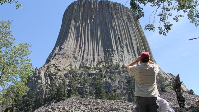
Tower Trail:
Due to the popularity of this trail and the limited parking capacity, we recommend hiking Tower Trail before 10 am / after 3 pm.
Amphitheater to Visitor Center Out-and-Back:
This is a 1.3-mile (2.1 km) hike up to the visitor center parking lot via South Side Trail and Red Beds Trail. Start at the amphitheater and hike up South Side Trail (0.6 mi/1km). At the junction with Red Beds Trail, turn left. Follow Red Beds Trail up to the visitor center parking lot (0.7 mi/1.1 km). From here, you can cross the parking lot and hike the Tower Trail , adding on a 1.3 mile (2 km) loop. To return, hike back down Red Beds Trail and turn right at the junction with South Side Trail. Walk along South Side Trail to the amphitheater. Length: 2.6 miles (4.2 km) roundtrip, 3.9 miles (6.2 km) with Tower Trail loop Elevation Change: Significant Road Crossing: You will cross the road on South Side Trail Features: Gorgeous views of the Belle Fourche River valley, up-close views of the geologic formations, and breath-taking views of the Tower
South Side to Red Beds Loop:
This is a 4-mile (6.5 km) hike using South Side Trail to access Red Beds Trail. Start at the amphitheater and hike South Side Trail (0.6 mi/1 km). At the junction with Red Beds, turn left or right and hike the entire Red Beds Trail, which will loop back to the junction. Then take South Side Trail back to amphitheater. Alternatively, you can use Valley View Trail to access Red Beds Trail; this will not affect the distance. Length: 4 miles (6.5 km) roundtrip Elevation Change: Significant Road Crossing: You will cross the road on South Side Trail (or Valley View Trail) Features: Gorgeous views of the Belle Fourche River valley, up-close views of the geologic formations, and breath-taking views of the Tower
or
Red Beds to Joyner Ridge:
This is a 4.9-mile (8 km) hike that takes you from Valley View Trail all the way up to Joyner Ridge via Red Beds Trail. Start at the amphitheater and turn right to follow Valley View Trail until you reach the junction with Red Beds Trail (0.6 mi/1 km). Turn right at the Red Beds junction and hike along Red Beds Trail until you reach the connector trail junction (0.5 mi/0.8 km). Turn right to get on the connector trail and hike until you reach the junction with Joyner Ridge Trail (0.6 mi/1 km). Turn right at the junction for a steep climb up to Joyner Ridge; for a slightly easier hike, turn left. Hike the entire Joyner Ridge Trail loop, and return to the connector trail junction. Follow the connector trail for 0.6 miles (1 km), and turn left at the junction with Red Beds Trail. Continue on Red Beds Trail to the junction with Valley View Trail (0.5 mi/0.8 km). Turn left to get on Valley View Trail and return to the amphitheater. Length: 4.9 miles (8 km) roundtrip Elevation Change: Moderate, sections of significant elevation change Road Crossing: You will cross the road on Valley View Trail Features: Sweeping views of Belle Fourche River valley and surrounding landscape, excellent views of the Tower, variety of landscapes (prairie, forest, red rock)
Pets are not allowed on park trails. We recommend taking leashed pets on a walk along the road to Joyner Ridge trailhead or through the campground. You can walk through the campground even when it is closed to overnight stays.
Less-Traveled Trails
These hikes offer solitude as well as spectacular views of the Tower.
Access the Joyner Ridge Trail from the Joyner Ridge trailhead parking lot or connect to it from the Red Beds Trail.
NPS photo
Joyner Ridge Trail
Along the north boundary of the park is a 1.5-mile (2.4 km) loop trail that follows Joyner Ridge and dips down into the draw below. Access the trailhead by taking the dirt road from the main park road as you head to or leave from the visitor center parking lot.
1.5 mile (2.4 km) loop
Trail Access: Joyner Ridge trailhead parking area or Red Beds Trail via 0.6-mile (1 km) connector trail
Significant elevation change along eastern portion, dropping from or climbing to the ridge
Offers scenic views of Tower, prairie, and surrounding landscape
Dirt road access to trailhead/small parking lot
Red Beds Trail offers diverse views of the Tower and the surrounding landscape.
NPS photo
Red Beds Trail
For those seeking a more traditional hiking experience, this 2.8-mile (4.5 km) loop will offer great views of the Tower and surrounding Belle Fourche River valley.
2.8 mile (4.5 km) loop
Trail access: visitor center parking lot or all other park trails
Parts of this trail are steep, as it climbs up and down between the river valley and visitor center
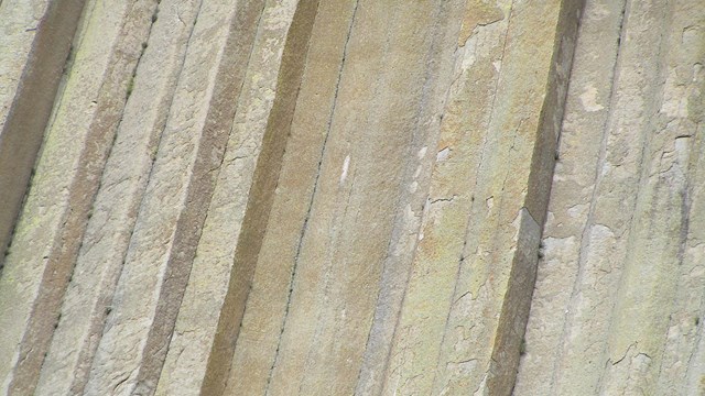
Offers stunning views of the Tower and surrounding geologic formations
Feeling watched? Prairie dogs like to keep an eye on passersby.
NPS photo
South Side Trail
This trail begins from the amphitheater and proceeds through the prairie dog town 0.6 miles (1 km) to link into Red Beds Trail. South Side Trail can be used with Red Beds to hike to the visitor center from the picnic area parking lot.
0.6 mile (1 km) trail
Trail Access: picnic area parking lot or Red Beds Trail
One road crossing
Walk through prairie dog town with slight/no elevation change
Moderate/steep elevation change once you cross the park road
Connects to Red Beds Trail
Valley View Trail is a nice stroll through prairie dog town with picturesque views of the river.
NPS photo
Valley View Trail
Beginning from the amphitheater, this trail winds through prairie dog town and offers picturesque views of the Belle Fourche River. With little/no change in elevation, this is a gentle trail for stretching your legs.
0.6 mile (1 km) trail
Trail Access: picnic area parking lot or Red Beds Trail
One road crossing
Slight/no elevation change
Walk through prairie dog town and see gorgeous views of the Belle Fourche River
Connects to Red Beds Trail
There are numerous benches to relax along the Tower Trail, as well as waysides which tell about the natural and cultural history of the park.
NPS photo
Tower Trail
This paved trail starts across the upper parking area from the visitor center. An accessible concrete path leads past the pavilion and up to the intersection of the loop. After the intersection, the trail is not ADA-accessible. We strongly advise not to take accessibility devices (wheelchairs or power scooters) past the intersection.
With the approach from the parking lot to the intersection and the 1.3 mile loop, you are looking at a total of 1.8 miles out at back.
As you walk the Tower Trail, you will notice cloths or small bundles attached to the trees. These are Native American prayer cloths and represent the spiritual connection many tribes have with the Tower. Please do not touch, disturb or remove these prayer cloths. Some consider it culturally insensitive to photograph these prayer cloths.
1.8 mile (2.9 km) out and back. This includes the 1.3-mile loop trail.
Paved
Trail Access: visitor center parking lot or Red Beds Trail
Stretches of moderate elevation change
Offers close-up views of the Tower and boulder field, as well as sweeping views of the surrounding landscape
Most popular hike in the park, can get very crowded
Last updated: April 24, 2025
Park footer
Contact Info
Mailing Address:
PO Box 10
Devils Tower,
WY
82714
Phone:
307 467-5283
x635
Devils Tower National Monument Information Line