One of the questions we have been fielding from climbers over the past year is whether Denali can be climbed or traversed from the north side, via the original Muldrow Route.
In early March of 2021, K2 Aviation Chris Palm flew over the Muldrow and noticed significant crevassing on this typically quiet stretch of glacier. It was determined that the glacier was surging, and this cyclical process has been very well documented and recorded by glaciologists. I encourage you to check out this excellent compilation of material that the NPS has put together for more information and some truly impressive before and after photos: www.nps.gov/articles/dena-muldrow.htm
The glaciologists’ work has focused mainly on the lower part of the glacier, so our team launched a scouting mission this August to take a look at the glacier with an eye towards the traditional climbing route. The short answer of what we found is that climbing the Muldrow in its present stage would be a formidable challenge with little guarantee of success.

The Muldrow from Anderson Pass, in June 2020 (top) and August 2022 (bottom). The once smooth moraine has changed into a complex jumble of crevassed ice.
The last time the Muldrow surged, in 1956, no one was able to successfully navigate the northern route up Denali until 1962. Howard Kantner, father of Alaskan writer Seth Kantner, was on the first team to make it through the post-surge icefall that had turned back other teams, a climb which Seth briefly details in his book Shopping for Porcupine.
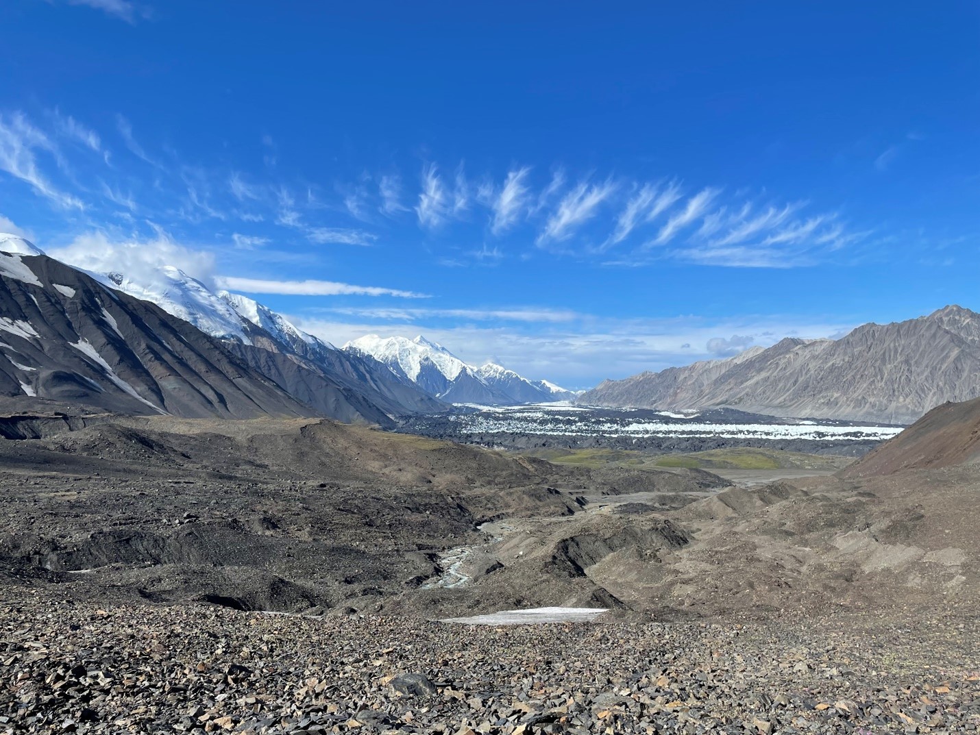
 View of Mount Brooks from McGonagall Pass, August 2022. Prior to the surge, this stretch of glacier was smooth and easy to navigate.
 Hiking to the base of Mount Brooks in June 2020.
 Given the current state of the glacier a year after the surge, we can probably assume a similar timeline this go around. Anyone hoping to take the first crack at the Muldrow, up or down, will also have to deal with the added logistical hurdle of the Park road being closed past the East Fork of the Toklat due to the Pretty Rocks slump. It is possible to fly into and out of Kantishna, but the road is not expected to be open until 2024.

There are several places a climber should expect difficult navigation and increased objective hazards. The surge has resulted in quite a lot of disruption along the sides of the glacier, so the typically straightforward access from McGonagall Pass may be more challenging. Additionally, what was once an easy walk on flat glacier from McGonagall Pass to the Lower ice fall now traverses a more complex glacier. Snow will most likely make this part of the route less challenging, but any parties trying this later in the climbing season, early June or later, may have more trouble.
 An expedition on the lower Muldrow, June 2019
  The lower Muldrow in August 2022
Gunsight Pass, a possible access to the Muldrow in the past, now does not look very feasible and would probably require some rappelling and ice climbing.
 Gunsight Pass in August 2022
Next, the Lower Icefall seems like it is the crux of this climb right now. Pre-surge, the route that entailed the least objective hazard exited the glacier climber’s right onto the moraine and by-passed the icefall by travelling on the moraine and rock off to the north. This move now looks to be quite challenging due to changes in the glacier at its edges.
 The edge of the Lower Icefall, climber’s right side, August 2022.
  Closeup of Lower Icefall terrain change, August 2022
 A healthy winter snowpack would make this move more feasible, but any climbers trying to pass this way into June should anticipate having to navigate complex terrain.
Climber’s left side also looks challenging, and as in the past requires travel underneath a formidable wall of seracs with limited options for decreasing exposure.
 Looking down on the Lower Icefall, August 2022
  Overhead hazard above the Lower Icefall, August 2022
 Above the Lower Icefall, the route looks similar to pre-surge conditions. However, the pictures we got in August 2022, probably the time of year with the lowest snow, reveal just how complex navigating the Hill of Cracks and Great Icefall can be even during a normal year if there is a poor or thin snowpack.
 The Hill of Cracks with low snow, August 2022
 Looking up at the Great Icefall from the Hill of Cracks area, August 2022.
 The Muldrow is a special place and we hope this historic route continues to attract mountaineers in the future. However, for the next few years, climbers should expect challenging route-finding and a high-probability of getting turned around.
 The map above details the places named in this article. You can visit this link for a more in-depth look at the topo map.