|
Did you know we have a hiker shuttle? Leave your vehicle at the visitor center and catch a ride up to Montezuma Pass to hike 3 miles back to your vehicle. Check out the hiker shuttle schedule on our Calendar. The shuttle typically operates a few days a week November - April. Trail Guide
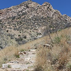
NPS Photo Coronado Cave Trail See the Coronado Cave page for more about the cave. The entrance to the cave is .5 mile from the trailhead and requires scrambling 25 feet down a rocky slope to the cave floor. The cave interior extends 600 feet in length, with 20 foot high ceilings. Those planning to explore the limestone cave should bring at least two sources of light per person. Please review regulations at cave entrance before entering the cave.
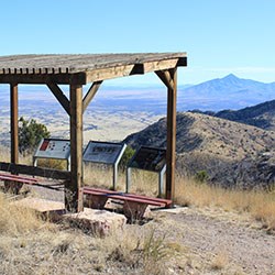
NPS Photo Coronado Peak Trail This interpretive trail climbs from the trailhead at Montezuma Pass to Coronado Peak. The sweeping views of Sonora, Mexico and the San Pedro River and San Rafael Valleys can be enjoyed while resting on the benches under a shade ramada. Learn more about the journey of the Coronado Expedition, the native peoples that lived in this area, and about the flora and fauna of this geographically unique area.
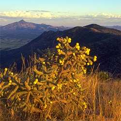
NPS Photo/D. Bly Joe's Canyon Trail From the trailhead near the picnic area turnoff, 500 ft/150 m from west of the visitor center, the trail climbs about 1000 ft/300 m in the first mile with scenic views of Montezuma Canyon and the San Pedro River Valley. After reaching the saddle at the top of Smuggler's Ridge, the trail continues westward with southerly views deep into the grasslands of Sonora, Mexico. Trail can also be done in reverse starting at Montezuma Pass via the Coronado Peak Trail. 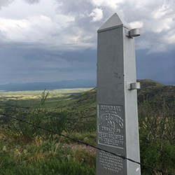
NPS Photo/C. Bentley Yaqui Ridge Trail A spur from the Joe’s Canyon Trail, the trail descends steeply to the US/Mexico border. One must hike 1 mile from Montezuma Pass along the Joe's Canyon Trail to reach the Yaqui Ridge spur, making the total length 4 miles round-trip from the Pass. Here you can view International Boundary Marker 102 located at the southwestern corner of the park as well as a short section of the border wall. This trail marks the southern terminus of the Arizona National Scenic Trail, an 800+ mile diverse and scenic trail that extends from Mexico to Utah. For your safety, please do not cross over fence into Mexico.
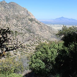
NPS Photo Crest Trail4 miles/6.4 km to Coronado NMem northern boundary, round-trip (5.3 miles one way to Miller Peak) The trailhead begins at the northeast end of the Montezuma Pass parking area and climbs for 2 miles to the northwestern boundary of the park where it enters Coronado National Forest. It continues along the crest of the Huachuca Mountains to the turnoff for Miller Peak, the highest peak in the range. 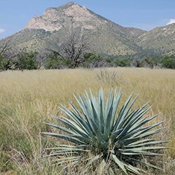
NPS Photo Windmill Trail2 miles / 3.2 km roundtrip 
Arizona Trail Association Arizona National Scenic TrailJoe's Canyon Trail and the Coronado Peak Trail are both part of the National Trails System and classified as National Recreational Trails. The Yaqui Ridge and Crest Trails are part of the larger Arizona National Scenic Trail (AZT) which stretches just over 800 miles from the Arizona-Mexico border at Coronado National Memorial to the Arizona-Utah border. Please do not harm or disturb any plants or animals, as all flora and fauna found in the park is protected by federal law. Wood gathering and hunting are not permitted within the park. 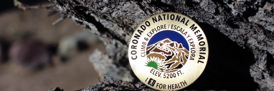
NPS Photo Climb & Explore / Escala y Explora: Hiking is a great way to exercise while exploring the lush oak woodlands and dramatic terrain of Coronado National Memorial. The I Hike for Health program is a hiking challenge you can attempt on your own or with your friends and family. Stop into the visitor center to learn about the challenge and to earn your reward - a Coronado National Memorial pin - while hiking some of the most beautiful trails in southeast Arizona. To qualify for the award, hikers must:
|
Last updated: July 25, 2025
