NPS Photo
Driving Directions From the Raton area
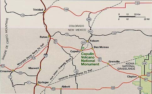
Follow US-64 E/Clayton Road toward Clayton for approximately 30 miles to the village of Capulin. Turn left on NM-325 and head north for approximately 3 miles. The park entrance will be on the right.
From the Clayton area
Follow US-64 W/US-87 N toward Raton for approximately 54 miles to the village of Capulin. Turn right on NM-325 and head north for approximately 3 miles. The park entrance will be on the right.
From the Branson, CO, area
Follow CO-389 S until it become NM-551 S continue for approximately 8 miles. Turn right at the fork on to NM-456 W. Follow for approximately an additional 8 miles to the village of Folsom. Turn right on to Grand Avenue for 1/4 mile and then left on to Bayley Street for 1/4 mile. Turn right on to NM-325 head southwest for approximately 6 miles. The park entrance will be on the left.
|
Last updated: April 24, 2025
