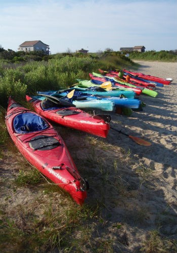
Paddle ResponsiblyCanoeists and kayakers should familiarize themselves with the safety hazards associated with Cape Lookout National Seashore before embarking on their trip. We highly recommend a sight visit before embarking on your kayak trip. Factors such as changing tides, wind speeds, and significant boat traffic present potential risks for paddlers. The dynamic nature of salt marshes can be challenging for kayakers and canoeists. We encourage you to review the safety tips outlined below prior to your visit. Float PlansWhen venturing out on the water it is always a good idea to leave a float plan with a family member, close friend or trusted neighbor. The float plan should include such things as Departure and Return dates and times, the trip route you intend to follow, the type (canoe, kayak, etc.) of boat, along with its brand, color and length of each boat that is being used in your excursion, and vehicle information such as license plate number, model and color as well as where you parked while you are out paddling. 
NPS Photo TidesKnowing the tides at the seashore will make or break a trip. Learning how to read and use a tide chart can make the difference between paddling with or against the current. The best bet for most people is to leave the mainland at high tide, so you are going out with the tide, and to return as the low tide rises. Most paddlers will want to avoid the rage tide, the time when the current flows the hardest, as ½ of the total water volume passes through inlets during the third and fourth hours of tide flow. During this time, flatwater will turn to whitecap waves and intermediate terrain can become expert. Look at the tide predications from NOAA, just remember the tides shown for Cape Lookout indicate levels on the oceanside and those shown for the Cape Lookout Bight indicate levels in the "hook" of the cape, not the lighthouse area (sound side) or on Harkers Island. 
NPS Photo WeatherBe prepared to adjust your schedule to the weather. A portable marine radio is recommended, but be advised of the range, which is typically only a few miles. The U.S. Coast Guard monitors Marine 16.In the event of trouble, one can often contact a power boat and have the boater broadcast a message through their marine radio for help. HypothermiaDress to protect yourself from cold water and weather extremes. Wear layered clothing under a windproof outer garment. Be aware of the dangers of hypothermia and how to treat it. Cold water reduces swimming ability. Be a competent swimmer. Know how to handle yourself fully clothed in cold water. CampingLooking to extend your paddle or your visit? Information on camping in the park can be found on the Beach Camping page. Before heading out to camp, we recomend filing a float plan with the Coast Guard. We also recommend sending your information to a friend or a loved one. Cape Lookout National Seashore does not actively check for submissions on our Optional Kayak and Canoe Registration Form. However, in the case of an emergency, the National Park Service will use this information to expedite an emergency response. In the case of an emergency, call 911. 
NPS Photo/S.Godin GearEvery canoeist and kayaker must have a U.S. Coast Guard approved personal flotation device (PFD). Wear it! It is extremely difficult to put on in the water, and your life may depend on it. Be sure it can be tied or zipped, and is the proper size, so it will not slip off in the water. Be sure your canoe or kayak is in good repair. If you using a nautical map, note that salt marshes are often shown as land when they are actually fully submerged. A suggested list of paddling specific gear includes, but is not limited to:
|
Last updated: March 20, 2025
