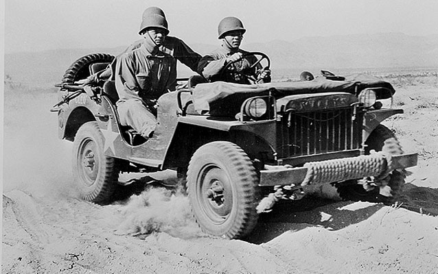
The Mojave Desert, a "wasteland" with easy railroad access, seemed to General George S. Patton to be an excellent place to train his troops during World War II. In early 1942, Patton established the Desert Training Center, and stationed troops throughout the Mojave.
Desert Military Training and a National Park Service Preserve

Farm Security Administration Office of War Information/Library of Congress
Much of the heaviest activity took place to the south of the current Mojave National Preserve boundaries, but some of these wartime camps and much of the maneuver areas were inside the present Preserve. A major division-size camp, Camp Clipper, was located north of Essex, with its northern boundary located inside the Preserve, north of I-40. A support division, including an ammunition dump, several large warehouses, and a military hospital, were located at Goffs, along with an emergency airfield a mile north of the hamlet. Later, the training grounds were expanded and renamed the California Arizona Maneuver Area, and remained in use until mid-1944. At least one million soldiers spent time in the area. Tanks and other military vehicles roamed throughout the desert, conducting exercises in the valleys of the Preserve and surrounding areas.
During World War II, many places in the greater Mojave desert received permanent designation as military training areas, but lack of such a status did not preclude the military from again using the eastern Mojave for practice. In May 1964, the Army staged a training exercise in the public lands west of Needles with 89,000 troops. Soldiers practiced amphibious landings on the banks of the Colorado River, troops constructed machine-gun emplacements at major crossroads, and heavy weaponry rolled across the sweeping valleys. The operation, known as "Desert Strike," caused significant impact to desert plants and animals. At least some locals attempted to halt the operation, but were unable to get support from the BLM or conservation groups. One author pointed out that the maneuver "laid environmental waste to sizable swaths of the East Mojave." Fortunately for the fragile lands of the east Mojave, Operation Desert Strike was the last major military use of the area now encompassed by the Preserve.
The army's training exercises left permanent scars on the desert. Tank tracks remain visible in many places inside and outside the Preserve. Rock alignments laying out huge tent camps dot the desert, especially in the southeast corner of the Preserve, and military debris still litters the desert floor in some places. Military use compacted the soil and changed the natural ecology of the desert.
Military use of the Mojave for training purposes had civilian ramifications as well. The military systematically mapped the entire Mojave desert in detail for the first time, utilizing aerial photography and traditional land-based methods to create maps for their training operations. After the war, many of the Army maps were sold to the public, and the U.S. Geological Survey utilized Army Map Service data to produce a series of 15 minute quads of the desert in the late 1940s and early 1950s. The experiences of soldiers at the wartime desert camps translated to increased recreational use of the desert after the war. War surplus jeeps and camping gear enabled former soldiers and their friends to explore the desert in four-wheel drive, as they had done during their training, with new maps of the Mojave to guide their travels. One U.S. Army photo, dated 1942, shows a soldier in full battle gear steering a huge military Harley-Davidson motorcycle down a Mojave sand dune - a stunning prelude of recreation to come.
More information available at the National Park Service's Mojave Administrative History.
Last updated: December 2, 2015
