Part of a series of articles titled History and Archeology of the District of Columbia Monumental Core.
Article
Archeology in the Monumental Core: Part 2
by Charles LeeDecker
Recent construction projects along 17th Street have revealed a few archeological sites associated with the landscapes that existed prior to creation of the Monumental Core park lands. The largest of these was the Potomac Park Levee. Archeological investigations focused on the 17th Street area, where a levee closure structure extends across 17th Street onto the adjacent areas of the Washington Monument Grounds and West Potomac Park. The archeological resource of primary interest here was the 17th Street Wharf, an important element of the city’s historic infrastructure, built by slave labor and later a predominantly African American workplace. Archeological investigation of this site would not have been practical under normal conditions, as it was beneath the pavement of a busy city street and flanked by some of the most heavily visited park land in the capital city. Archeological fieldwork was carried out during construction, when effective measures for traffic control and public safety were in place and when heavy equipment was available for deep excavations (LeeDecker 2013).

NPS

NPS
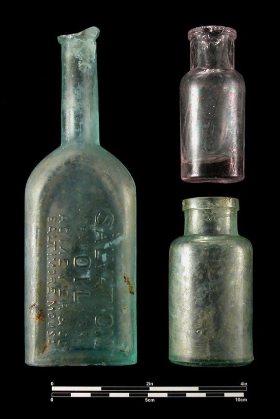
Test pits in other areas of the levee construction zone site contained highly varied fill deposits. Some areas contained late 19th-century domestic refuse and architectural debris, including whole beverage and medicine bottles. Ceramic vessel fragments were widespread throughout the construction area, giving the deposits the appearance of a domestic character. The highly variable soil columns reflect that a variety of sources were sought and used for fill in the late 19th century, not simply the sediments removed from the nearby shipping channels. The Chief of Engineers’ annual reports from the 1870s indicated that great quantities of street sweepings, household refuse, and construction debris were deposited in the public lands by local citizens and cartmen, along with material obtained by the grading of Pennsylvania Avenue and the excavations for major public buildings. Contractors supplied quantities on the order of tens of thousands of cubic yards, and anonymous citizens dumped individual cartloads of refuse from cellar excavations, furnace ash, and backyard trash dumps.

NPS
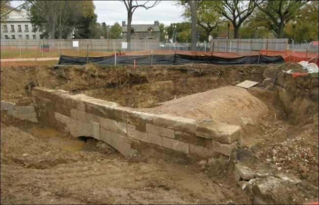
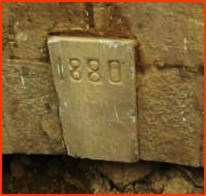
The most impressive feature at 17th Street was the headwall of the infamous sewer canal outlet, the outfall where the B Street sewer emptied into the Potomac, the embodiment of what Hains referred to as “a grave error in sewage disposal.” Partially exposed and dismantled during construction for the levee structure, the Tiber Creek Sewer Outlet was a massive structure in the form of brick shaft that was five courses thick. The headwall measured some 40 feet in length with two smaller flanking shorter wingwalls.

NPS

NPS
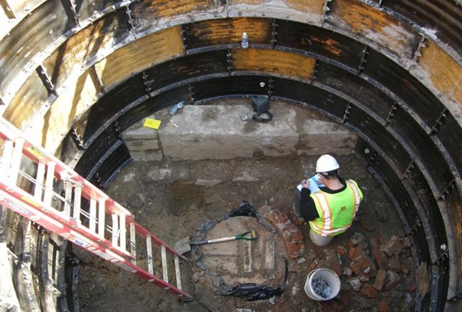
A short sewer replacement project along 17th Street allowed documentation of two archeological resources associated with the 1832 C&O Canal Extension. The land reclamation program for Potomac Flats required the deposition of millions of cubic yards of fill, a process that engulfed the wharf, the lock, and the lower portion of the lockkeeper’s house. When 17th Street was extended across the newly reclaimed land in 1902, it followed the alignment of the 17th Street Wharf and partially intruded on the footprint of the lockkeeper’s house, which by then had been abandoned. Lockhouse B was moved out of the street right-of-way to its present location in 1915. During the 2012 sewer replacement project, the original foundation of Lockhouse B was documented in an access shaft at a depth of more than 12 feet below grade. As the sewer replacement project continued, remains of Lock B were also documented, at a location beneath the pavement of present-day Constitution Avenue. Both sites illustrate the challenges and opportunities for archeology in modern urban environments, where resources from the city’s earliest history still survive but in settings where the logistical challenges of field documentation might sometimes seem overwhelming.
References
Bedell, John. 2003. Archeological Investigations, Southside Barrier Project, President’s Park, Washington, D.C. Prepared for the National Park Service, National Capital Region by The Louis Berger Group, Inc., Washington, D.C.
LeeDecker, Charles H. 2013. Archeological Monitoring of Construction Potomac Park Levee, National Mall and Memorial Parks, District of Columbia. Prepared for the Government of the District of Columbia, Department Of Transportation, Washington, D.C., by The Louis Berger Group, Inc., Washington, D.C.
Lusk, J.L. 1892. Statistical Map No. 5 Showing the Location of Sewers, City of Washington. On file, Geography and Map Division, Library of Congress, Washington, D.C.
Last updated: April 17, 2020
